Screw Up on Tornillo Creek: Banta Shut-in
The Banta Shut-in can be reached by hiking down Estufa Canyon, the subject of another virtual field trip, to Tornillo Creek ("tornillo" means "screw" in Spanish, named after the screw bean mesquite found there). My first trip through Estufa Canyon was with my brother, Randy, in late December of 2009, and a winter storm was brewing (but only dropped a few cold sprinkles on us during the night). This time I was going it alone in April, while my brother was birding in other parts of the park. Although I am known as a sort of "desert rat", I failed to take enough water on this trip. The weather turned out to be much hotter than I anticipated, and I went through the water faster than I had projected. Just because it was chilly in Austin doesn't mean the same would be true for Big Bend. I knew May was reputed to be the hottest month in Big Bend (and then the western monsoon should set in), and here it was, April, just one month earlier.
However, at the time I didn't think water would be much of a problem, because I was pretty sure there was water at the Banta Shut-in, through which Tornillo Creek flows (sometimes), and I have a filtering system I carry in my backpack. If not, I'd have to cut my visit short without getting to study the geology around the shut-in, which was a major reason for doing the hike in the first place. Fortunately, there was plenty of water despite it not having rained in the park for four months. I did learn one thing that I didn't know (but should have figured out). The dried, cracked mud around the pools of stagnant water at the shut-in has not-so-dry mud beneath it. In fact, it is as slick as a Louisiana used-car salesman. So I got an unexpected bath. The following photo shows the aftermath of that mistake. The water is surprisingly cool and refreshing. If only I had my swimming suit on. These pools are important for the wildlife, and I wonder if any were looking at me floundering around in the water and thinking, "Ugh! How disgusting! I'm not drinking that!"
The hike out was brutal. There were no clouds and hardly a breath of air. Despite starting out with all bottles full of shut-in water, I got dehydrated quickly. It was a matter of not having a sufficient number of bottles, and I had to pace the water use. The humidity must have been close to zero as your mouth would go completely dry with just a few breaths. I finally learned how the canyon got its name (Estufa means "stove" in Mexican Spanish.) It got so bad, I finally ditched my backpack for a small pack I use for day hikes from camp. Since I didn't show up at the time my brother, Randy, expected, he called the park rangers. Funny thing, I made it back in the dark just as Ranger Matt Graden, a paramedic, showed up at the trail head. Matt is an outstanding example of the kind of people working for the park system. He was joined later by another fine fellow, Ranger Michael Rodriguez. They checked me out and found me very dehydrated but otherwise OK. They told me it would be preferable for me to be checked out more thoroughly at a hospital, but I declined. Next day, a cooler day with some clouds, Randy and I hiked back down the canyon to retrieve the gear I had cast off. I either had to leave my heavy backpack or spend the night in the canyon, as I was not going to get back toting it. Here is a lesson for you desert rat backpackers. Don't get cocky, and don't skimp on water. OK, on to geology.
(First I'd like to acknowledge the significant help I obtained from new geologic work in Big Bend contained in the USGS publication Scientific Investigations Map 3142 in interpreting my observations.) The Banta Shut-in is a narrow gap in the Tornillo Creek drainage on the south end of the McKinney Hills igneous intrusion. It was once used to corral livestock. The sedimentary rocks in the vicinity of the shut-in have been baked and folded by the intrusion, which dates to about 32 million years ago during the early Oligocene epoch. The rock of the intrusion is an iron-rich syenite, a granitic-like rock containing little or no quartz. In this type of rock, the presence of abundant alkali metals results in the silica being used up to form feldspar as the magma crystallizes before much quartz can form. You see little, if any, of this rock between the confluence of the Estufa Canyon drainage with Tornillo Creek, but it forms both walls of the narrow shut-in, according to the afore-mentioned map. (Before that, I was of the impression the walls were baked sediment of the Pen Formation.)
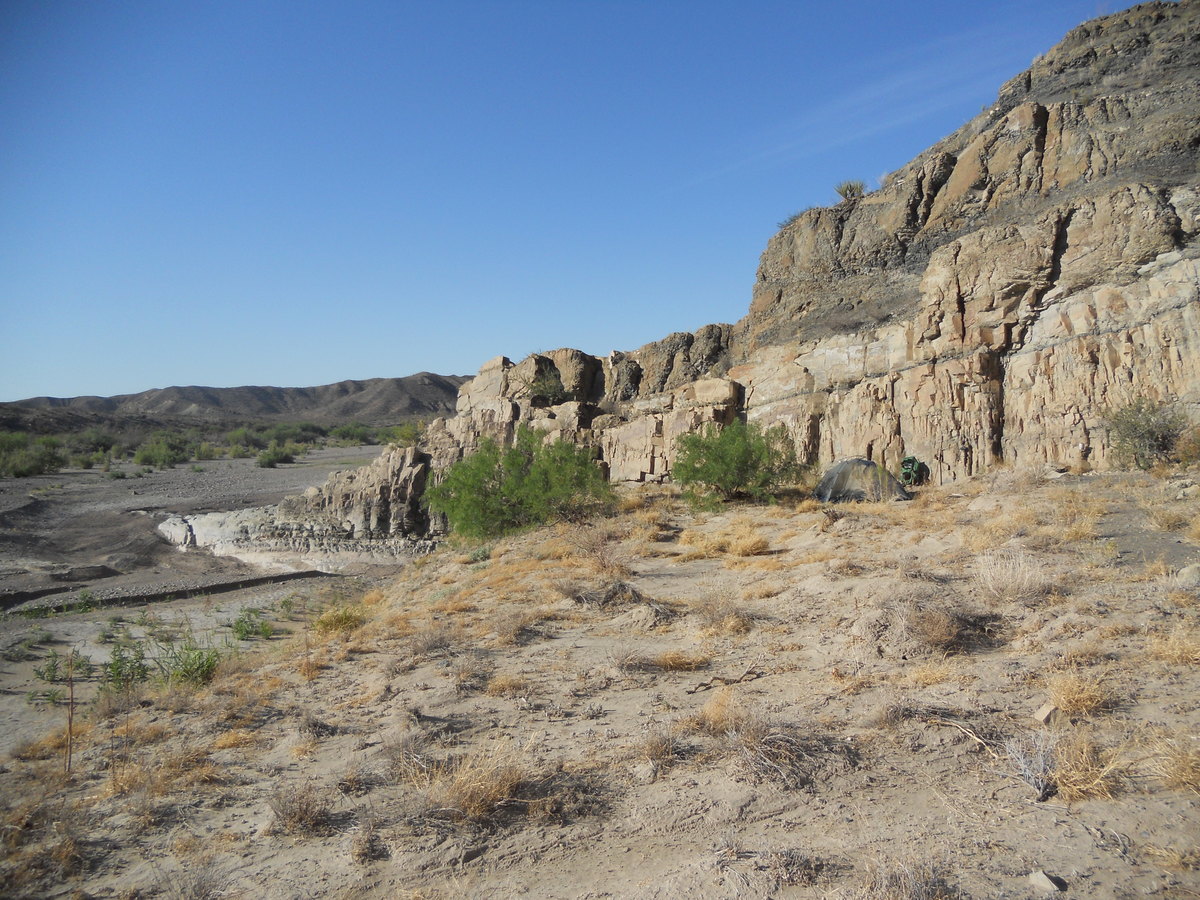
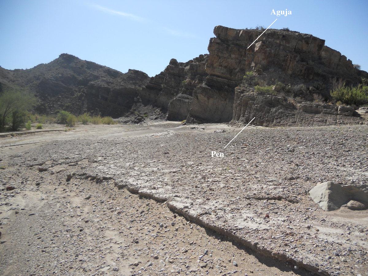
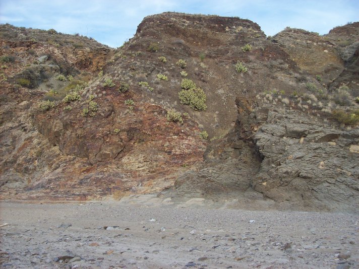
The following picture is my camp on a depositional fill terrace above the bed of Tornillo Creek. The light-colored rock forming the beds above the camp is apparently the basal sandstone member of the Aguja Formation. This formation is largely of terrestrial deposits of sandstone, shale, and mudstone, but some levels have marine fossils, and even ripple marks, indicating a very shallow marine environment at times. This formation marks the transition from sea to land in Big Bend. Note the thin bed of clay in the lowest Aguja sandstone bed. That might mark a hiatus in the deposition of sand or a influx of water carrying clay due to some unusual event. In the distance are hills composed of the Pen formation, on which the Aguja rests (although it may not look like it in this photo – recall the rocks have been folded by the intrusion). This is a marine deposit as it contains marine fossils such as ammonites, sea snails, and molluscs. Although it tends to be an easily eroded unit and often forms slopes as in this picture, that isn't always true in the shut-in area, where it has been hardened by metamorphism from the heat of the intrusion.
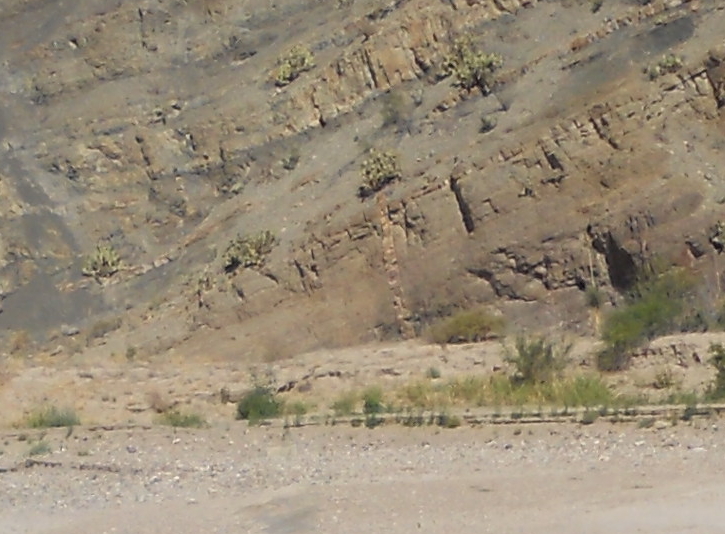
Beginning our virtual hike up to the Banta Shut-in, first we will take a look at the rock in the vicinity of my camp, which is to the left around the drainage bend. In the following photo, looking west, you see the general southwesterly dip of sedimentary beds in this area. I measured strike and dip at locations from my camp up to the shut-in. The strike varies between E-W and SE-NW, but a ESE-WNW strike is common. The dip is southwesterly ranging from 10°-30°. The intrusion is to the northeast, so it is reasonable to suppose that this dip is indicative of the doming effect on the preexisting rock due to the emplacement of the intrusion. Above the sandstone beds you see a carbon-rich shale of the Aguja formation. Although it contains some lignite coal, indicating low-lying land, it also is reported to contain some oyster fossils. Apparently the sea was occasionally making inroads onto the land, indicating a gradual change from marine to a mostly terrestrial environment. As you can see this unit erodes rather easily. Below the sandstone beds is the Pen formation.
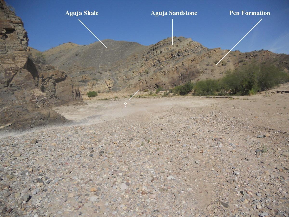
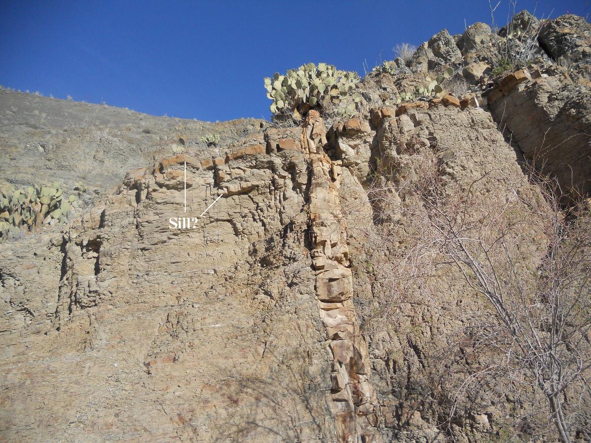
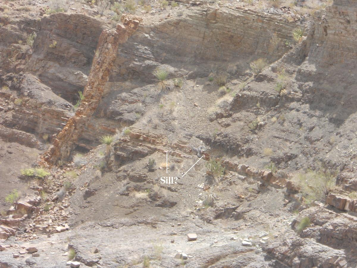
The question mark in the above photo indicates some sort of dike, a sheet-like intrusion into the pre-existing rock. I say "some sort of" because the rock it is made of does not closely resemble the McKinney Hills intrusive rock as you would expect. The following is a zoom of the dike from the same photo, and below that is a close picture of the dike. It may be what is called a clastic dike, or it may be an igneous dike, where a sheet of magma, most likely associated with the McKinney Hills intrusion, forced itself up toward the surface. This is not the only dike like this in this area. The third photo below is of another, very similar dike to the north, closer to the shut-in.
It is clear the second dike is entirely within the Pen formation, and it appears the first is also, depending on just where the Pen ends and the Aguja begins. Studies have shown that the contact between these two formations is gradational, meaning a gradual change from one to the other. In spots the two formations are interbedded, indicating a geologic facies change, an area where two different depositional environments existed side by side with one grading into the other.
In retrospect I don't think these are clastic dikes. There are a number of ways clastic dikes can be formed. Should they be clastic dikes, their presence in the vicinity of the intrusion suggests they are related to it. One possibility is that fractures were created during the intrusive event through which hot, liquified water-rich sediment was forced. More likely, the dikes are of magmatic origin, even though the rock of which they are composed does not look that much like that of the intrusion itself. There are magma differentiation processes such as fractional crystallization, partial melting, and assimilation that could produce an altered magma, and that is what I think the dikes consist of. Whether the dikes are clastic or magmatic, similar-looking rock forming beds extending laterally from the dikes could be sills, sheets of liquified sediment or magma inserting themselves between, in this case, preexisting sedimentary beds. The fact some of these sheets only extend so far from the dikes pretty much indicates this must be the case. It would make for an interesting investigation to analyze samples from these dikes.
In the next picture you are looking ESE toward the area from which the picture above was taken. The geologic map shows the Pen formation here, but when I looked at the outcrop, the sandstone beds are correlated with those on the west side of the creek, which belong to the Aguja formation, but the rock beneath is definitely the Pen formation. Although you might think this is an error in the new geologic map, you don't necessarily expect this degree of definition on a map with such a small scale. Rather, this appears to be an small isolated outcrop of the Aguja on the east side of the creek in this area. The Pen is a shaley-looking, friable unit at this location.
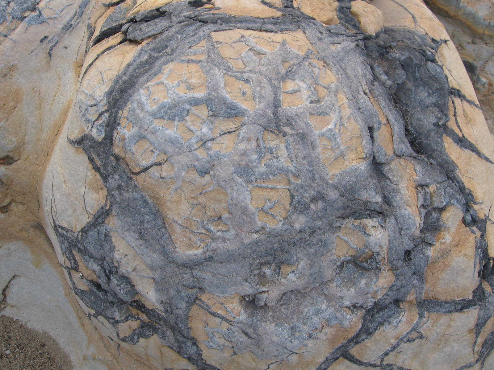
The Pen formation in this area is full of septarian concretions. A concretion forms when minerals precipitate to form a usually rounded mass in sedimentary rock. Septarian concretions have filled cracks, called septaria. Just how these concretions form these septaria is apparently still debated within the geology community. The following picture is of some of these concretions at a location farther north up Tornillo Creek. They range up to about a foot and a half across. A curious observation is that the jointing pattern (a joint in geology is a fracture where no movement parallel to the fracture has occurred – otherwise it would be a fault) does not penetrate the concretions. This would seem to imply the sediment was already turned to rock (lithified) and broken before the concretions formed, but contradicts the idea that concretions form while the sediment is being turned into rock, a process called diagenesis. More likely, to my mind, the jointing didn't affect the concretions. Perhaps the stresses that formed the joints only slightly deformed the concretions without breaking them.
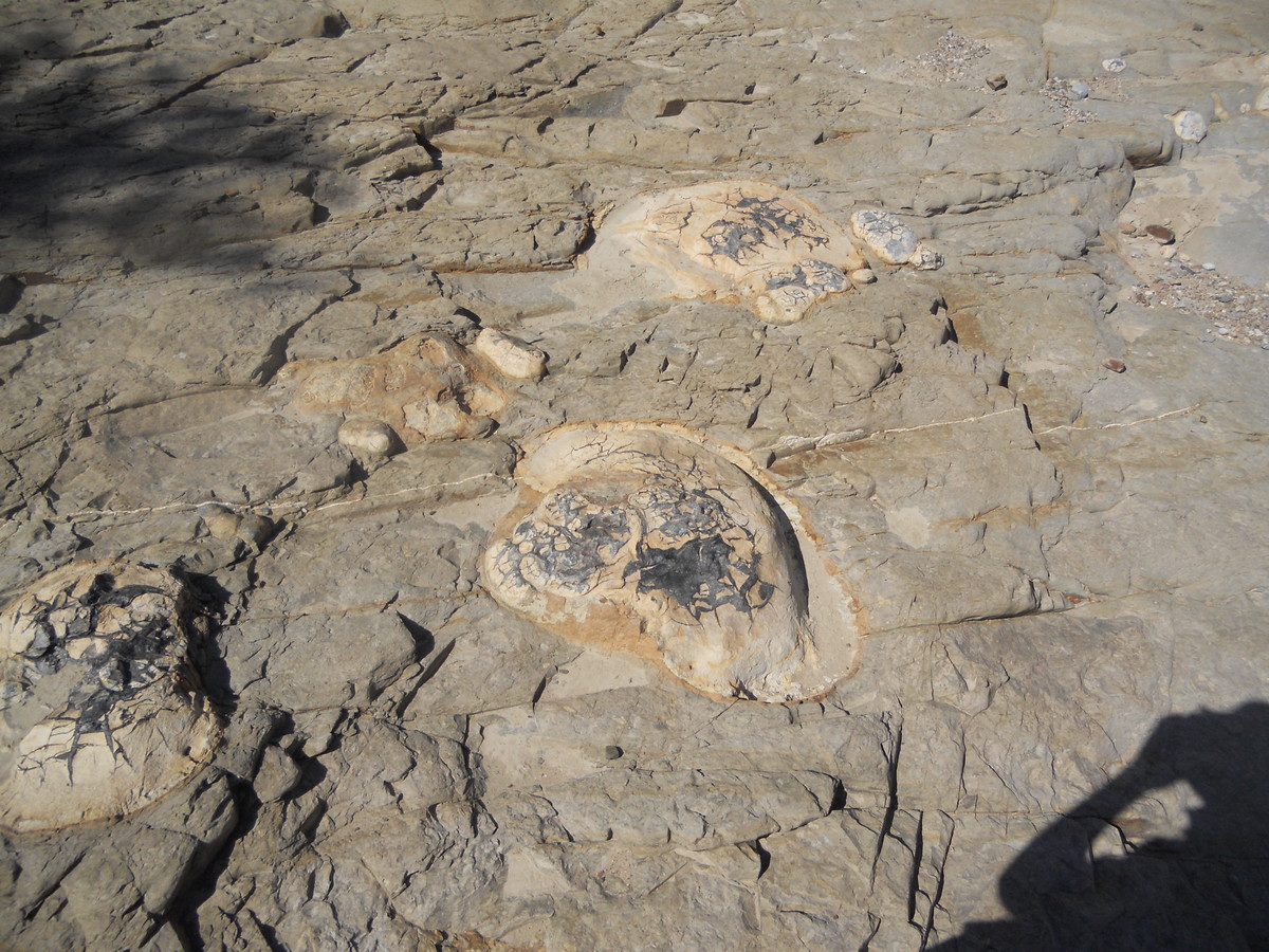
The concretions tend to form along "horizons", that is, lineations parallel to the sedimentary beds. Below you see an example of this. Below that you see the Pen Formation a bit farther up the drainage. I've changed my mind about the interpretation of this photo. Before I thought the discolored rock on the left belonged to the Pen Formation and had been altered by the heat of the McKinney Hills intrusion to the point of being metamorphosed, probably into hornfels, a fine-grained metamorphic rock formed by heat from the nearby presence off magma. This may yet be the case, but this rock looks a lot like that of the walls inside the shut-in, which, according to the USGS map, is intrusive rock. Furthermore, there are no concretions visible in the discolored rock as there are in the rock to the right.
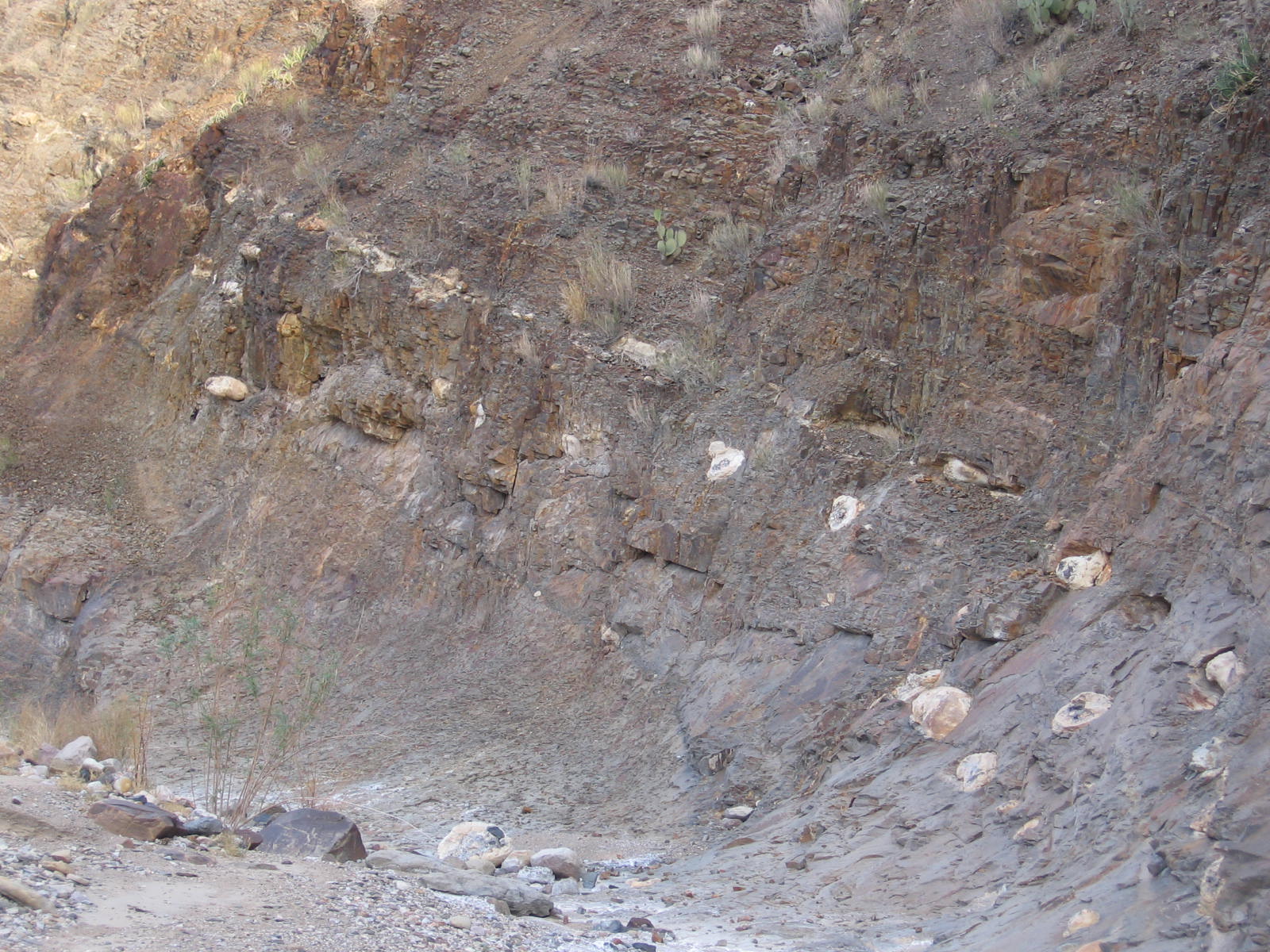
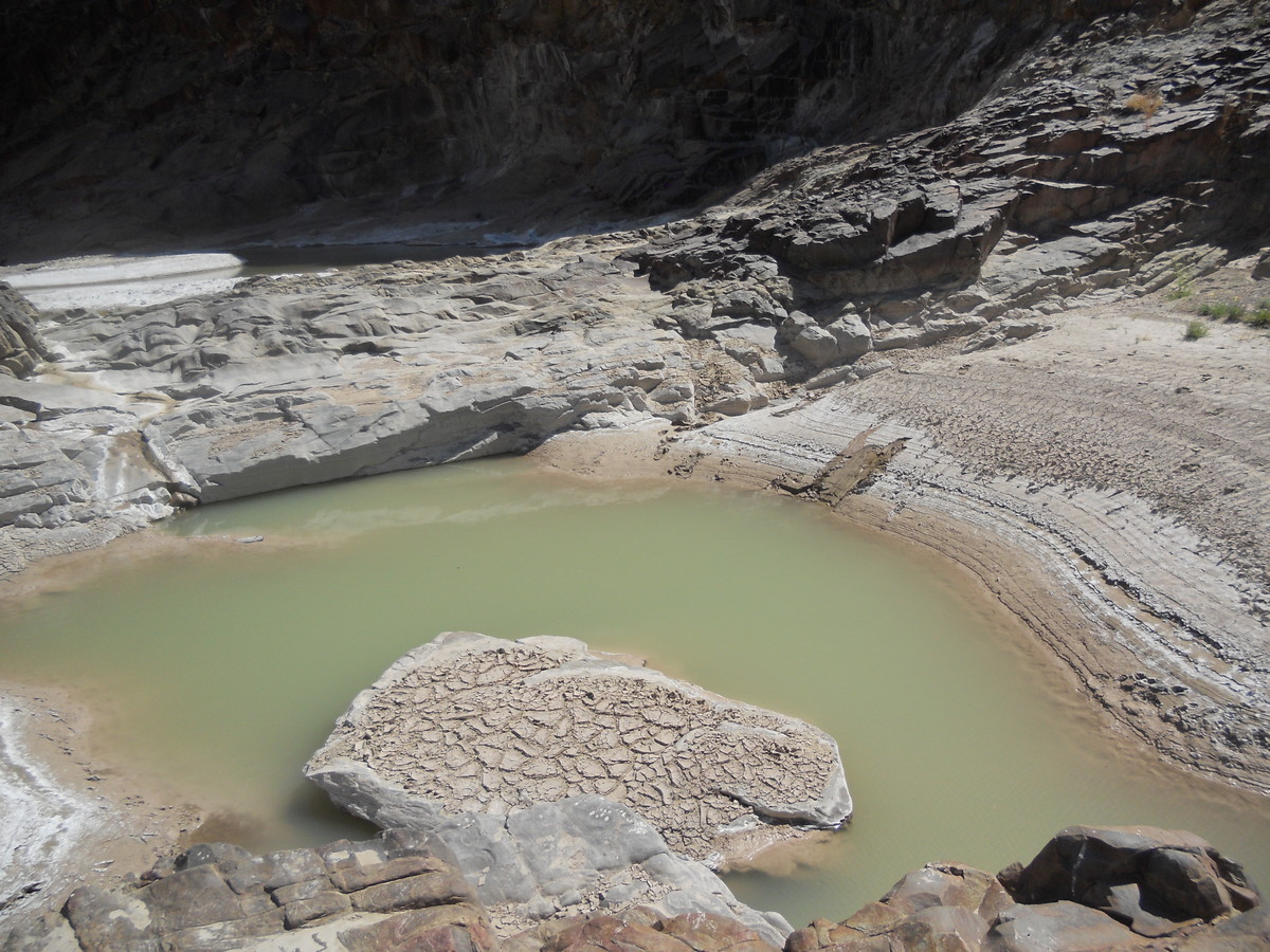
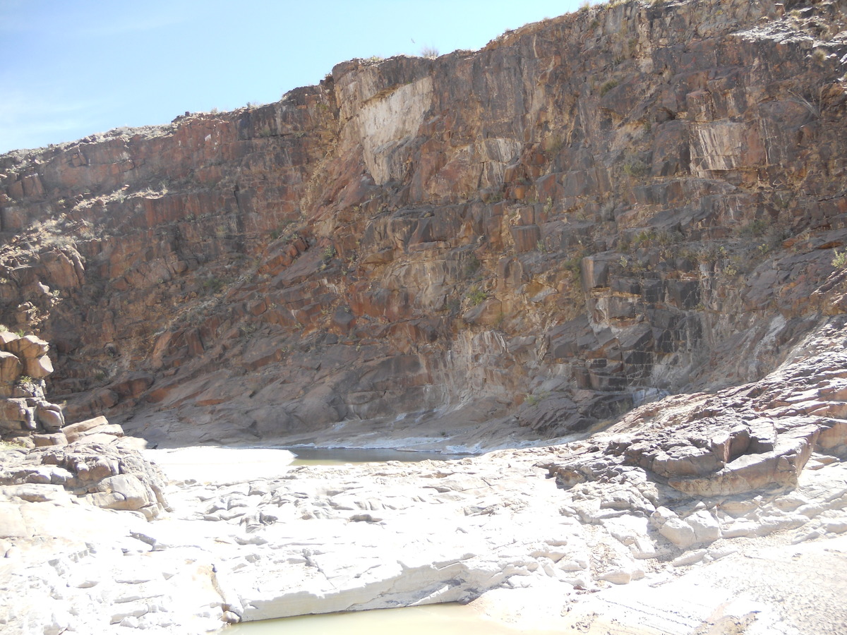
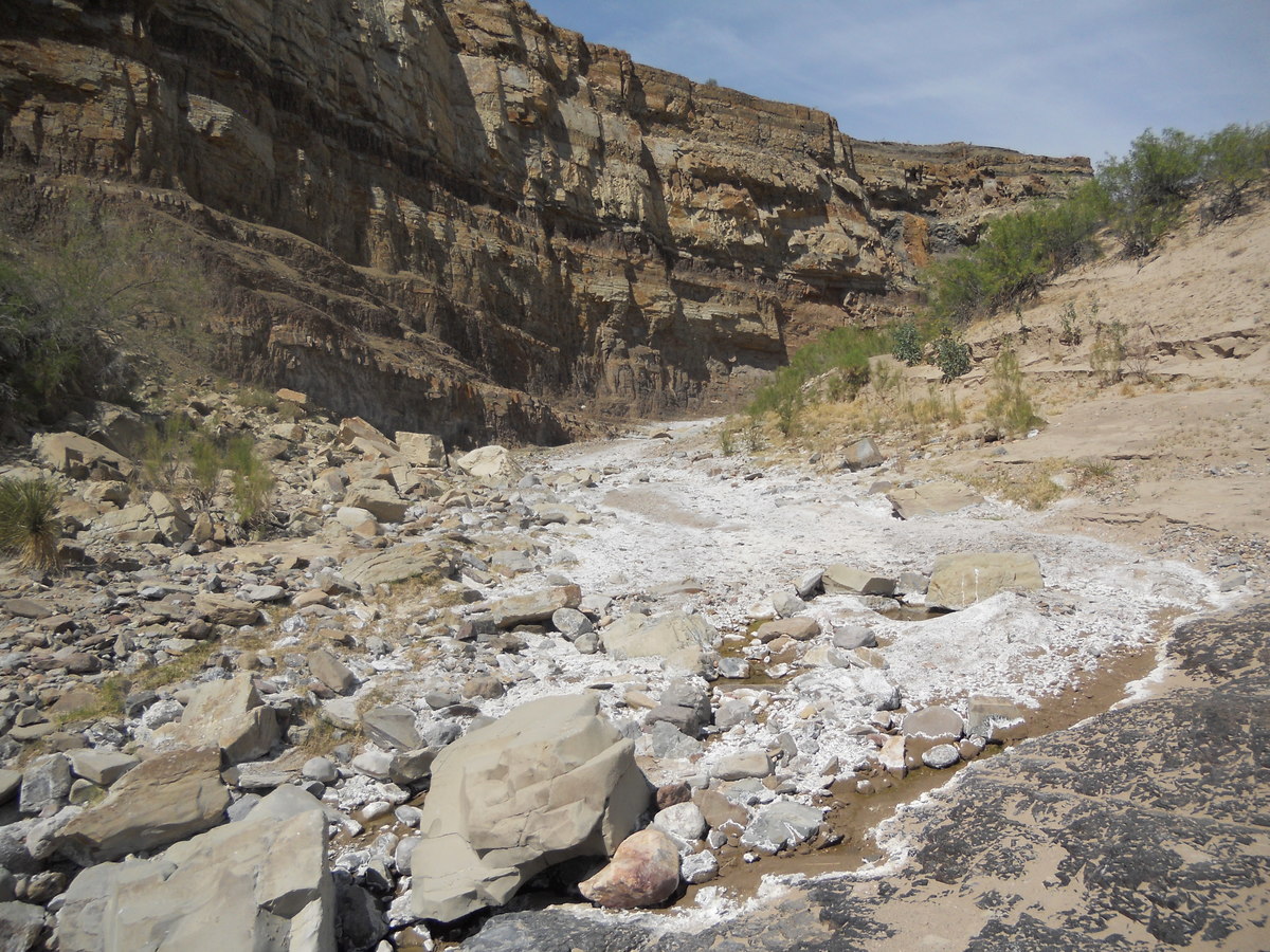
This is what you see when you are about to enter the narrow canyon of the shut-in. The rocks are of the Pen formation, as indicated by the concretions you find, but the rocks themselves are definitely not easily eroded. They have been metamorphosed, probably into hornfels. The water you see is less than you might encounter at other times. In my previous visit, you had to wade quite a distance to reach the end of the shut-in. This time it was dry except for these isolated pools. Note the white residue left by the evaporation of the water.
The walls of the shut-in probably do not consist of metamorphosed Pen formation, which is what I thought when I was there. The USGS map claims both sides of the shut-in are of igneous rock. Even the altered Pen has concretions in spots, and no concretions were present, at least in the area where the following photo was taken. This rock is the McKinney Hills Syenite. A radiometric date obtained at Roys Peak to the northeast gives an age of 32.2 million years for this intrusion.
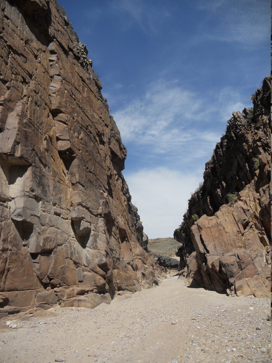
As you can see below, the gap which Tornillo Creek has carved in the syenite is narrow. This has made it easy for early ranchers to use it to handle livestock.
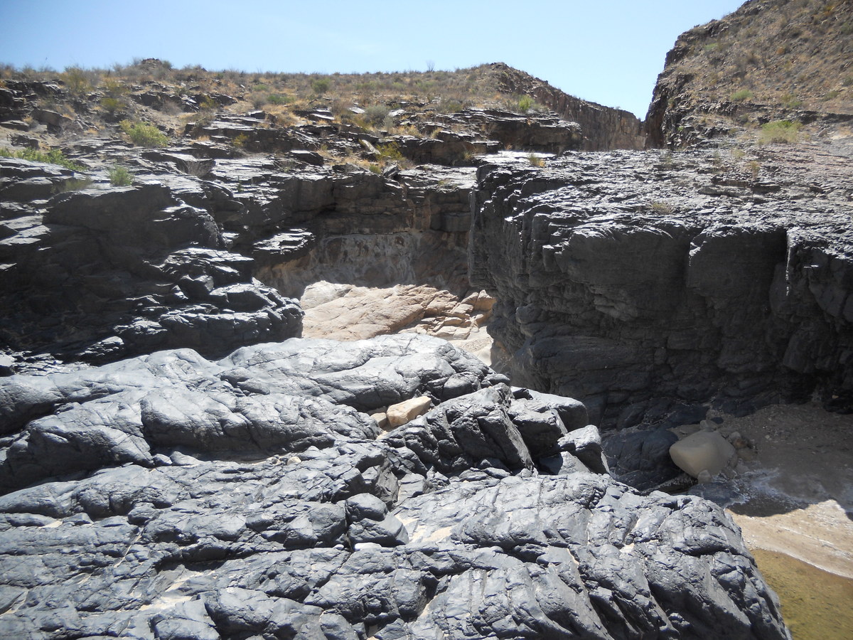
This is the north end of the shut-in. There are these exotic looking black rocks at this point. They appear to show bedding, so they were possibly originally of sedimentary origin. Perhaps they are metamorphosed versions of carbon-rich rocks of the Pen formation.
Here is another photo of these jet-black rocks.
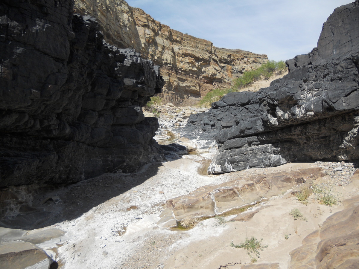
When you go beyond the gap, you see more of the altered Pen formation, competent enough to form cliffs due to it being baked by the magma that formed the McKinney Hills intrusion. It is now probably hornfels, a hard metamorphic rock not easily eroded. Tornillo Creek probably existed in some form when this rock was buried by later sediment. When the creek wore down through the sediment and encountered the harder rock, it continued to erode, dragging sediment across the bedrock like sandpaper, creating the gap seen today. Yet this is still an obstacle sufficient to obstruct the flow of both surface and subsurface water, such there are pools even during dry spells.
The image below was taken on the first trip. The wallet is for scale. Something was visiting the water hole.
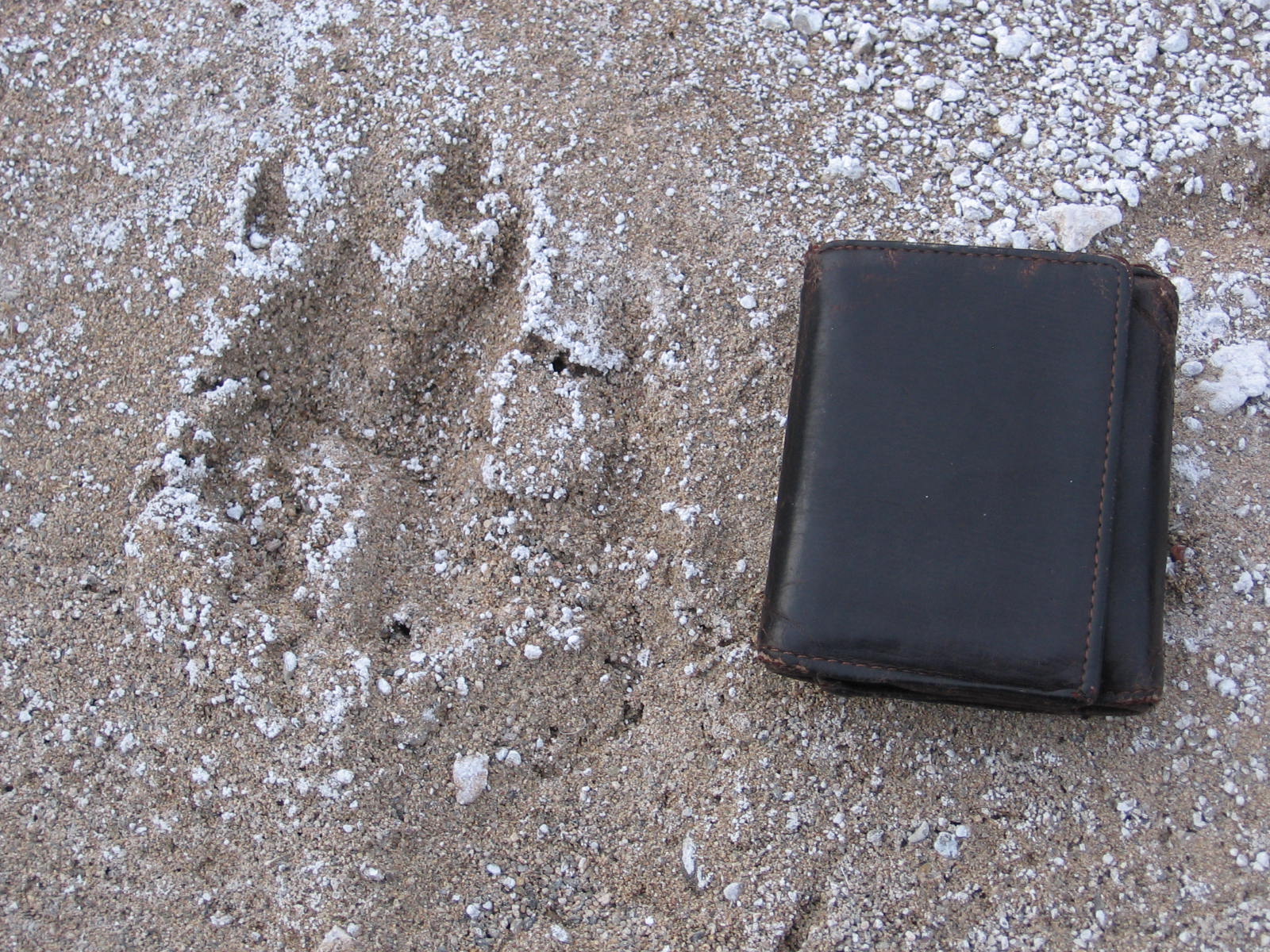
At night I could hear javelina in the creek bed. They would approach my tent but never got real close. However, worry about them trying to get into my tent after my food wasn't conducive to a good night's sleep. Chances are that wasn't going to happen. This brings up another point. You don't want to feed wild animals. Otherwise they will think it is perfectly OK to get into your tent. After all, don't they have a standing invitation? These javelina were well-behaved, however. The Banta Shut-in is a great place for geology buffs to visit. Please don't collect the septarian concretions. Leave them for future backpackers to enjoy. (Luckily, most of them are pretty heavy.)
BACKWARD to Telephone Canyon III
FORWARD to The Strawhouse Trail
ALL THE WAY BACK to the Contents