Deadly Beauty: Cattail Falls
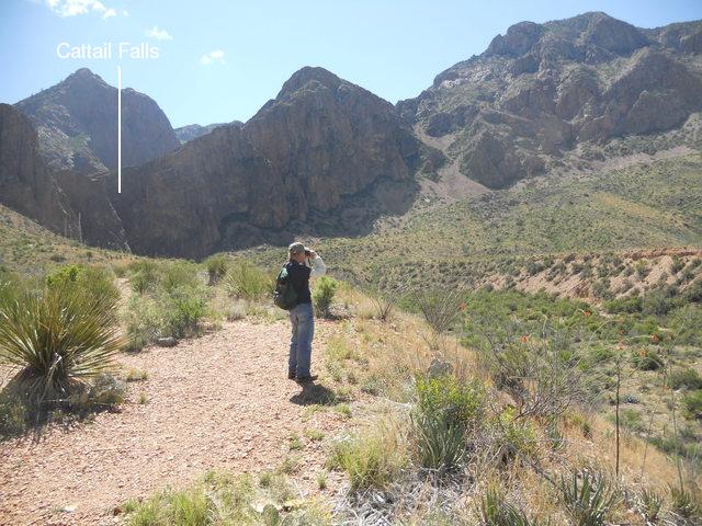
On our first day in Big Bend during a recent trip (April, 2015), my brother, Randy, and I decided to drive down the Maxwell Scenic Highway to check out the recent flooding along the Rio Grande we had heard about. But first, since I had never been to Cattail Falls, we turned off to enjoy this pleasant hike. However, I was haunted somewhat on the way there by the story of an unfortunate death at the falls, recorded in the book Death in Big Bend by Laurence Parent. Descending one of the drop-offs in Cattail Canyon by rope, a climber got stuck, hung up on his rope. His partner made a heroic effort to get to the Basin for help, but it was too late. The climber apparently died of exposure. What a gruesome story for a geologic feature with such a beautiful garden spot at the bottom!
The path to the falls winds through alluvial deposits of Quaternary age. These deposits were laid down during the last million years or so, up to an age of just a few thousand years, but the exact age of such deposits is difficult to determine. This isn't true for the occasional outcrops of the Chisos Formation that appear along the hike. Many of these rocks can be dated radiometrically such that it is known they range in age from 47 to 33 million years. This formation contains a variety of volcanic and sedimentary rock. Most likely these outcrops are chunks of rock that were caught up in the massive landslide deposit on the northwest side of the Chisos Mountians. The debris from this landslide borders either side of the alluvium. The southern end of the slide is just south of Cattail Falls.
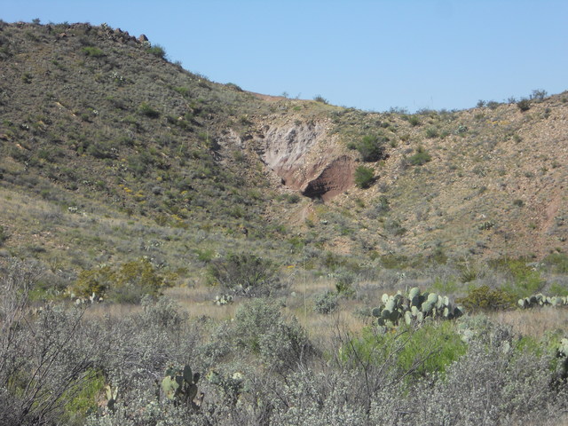
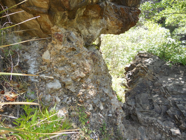
The next picture is a small outcrop of the Chisos Formation, too small to be on the new USGS map of the park (Scientific Investigations Map 3142, 2011) as it is likely contained in the landslide, but it may be a small part of the "sandstone, tuff, and rhyolite unit" (symbolized as Tcstr on the map), since this unit is mapped in other locations in this general area. Tuff is lithified ("turned into stone") volcanic ash, and rhyolite is a volcanic rock very rich in silica
.
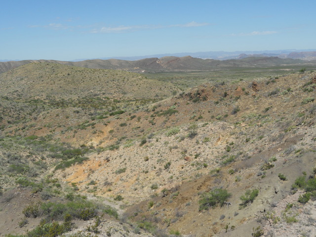
Below is a view back to the west toward Burro Mesa, the dark, hilly area on the other side of the plain. The rocks of the mesa include the 33 million year old Tule Mountain Trachyandesite member of the Chisos Formation and the 29 million year old Wasp Spring member of the Burro Mesa Formation. Trachyandesite is a volcanic rock of intermediate silica content but, unlike its otherwise close chemical "kin" andesite, contains little or no quartz, as the silica that would go to quartz is used up forming feldspar The Wasp Spring member records a violent eruption or eruptions of tuff, ash-flow tuff, rock fragments and blocks, and volcanic bombs: lava thrown into the air and cooled into rock during its flight. The multi-colored hummocky terrain in the foreground is probably debris from the landslide.
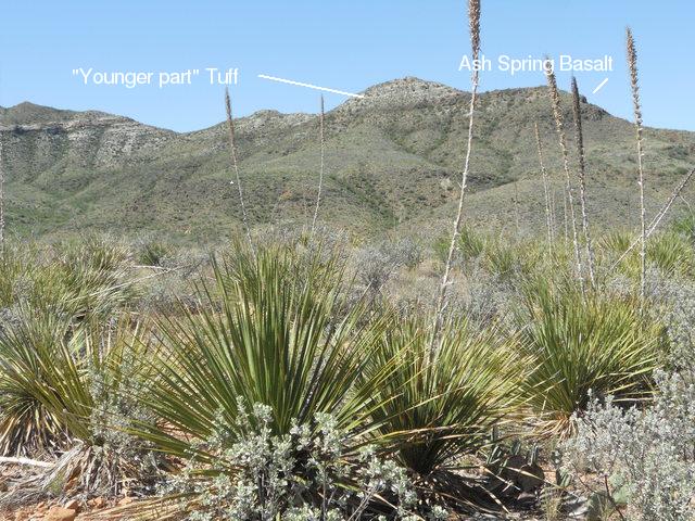
The final photo involving the Chisos Formation, below, looking in a northerly direction, apparently shows the so-called "Younger part" of the Chisos formation, in this case what appears to be volcanic ash. Below that, the USGS map indicates the presence of the Ash Spring basalt member of the Chisos. Basalt is a relatively silica poor and iron rich volcanic rock, which gives it its dark color. This unit is dated with an age of 41 million years. The hummocky deposits in the middle ground are of the landslide.
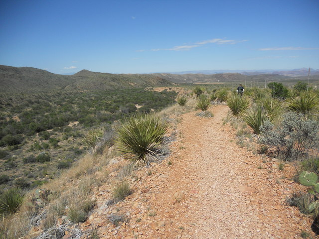
In the next picture my brother, the birder, is checking out a feathery guy on the other side of this impressive wash carved out by flash-flood water surging out of the falls. The picture after that is looking away from the falls down the wash. The wash cuts right through pediment, alluvium, and landslide debris that was deposited previously, as indicated by the steep, uniform, almost man-made looking banks of the wash. This could mean the falls is a geologically recent phenomenon, since the wash obviously is (certainly dating to a time after the landslide). Another possibility is that the channel dates back to the last glacial age when rainfall was heavier. The uneven terrain on either side of the wash is more landslide deposition.
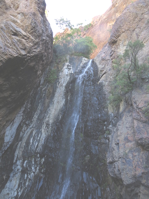
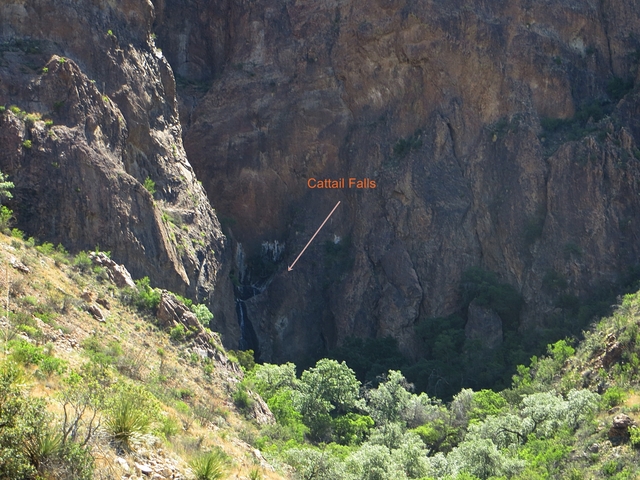
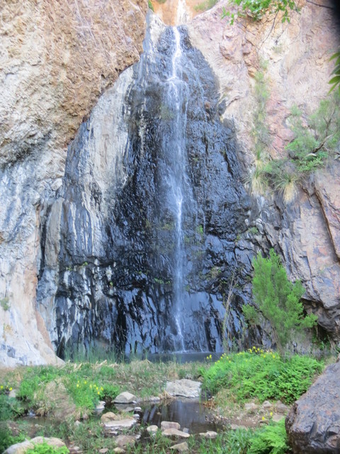
The falls are the last drop for water flowing down Cattail Canyon. Below is a photo taken while approaching the falls. The cliffs consist of the intrusive igneous rocks of Ward Mountain on the west side of the Basin. These rocks are high in silica and alkaline, meaning they are high in alkali metals like sodium and potassium. The radiometric age of the rocks at the falls has not been measured to my knowledge, but the pamphlet accompanying the USGS map records an age of 32 million years for a sample of this intrusive rock taken near the Window.
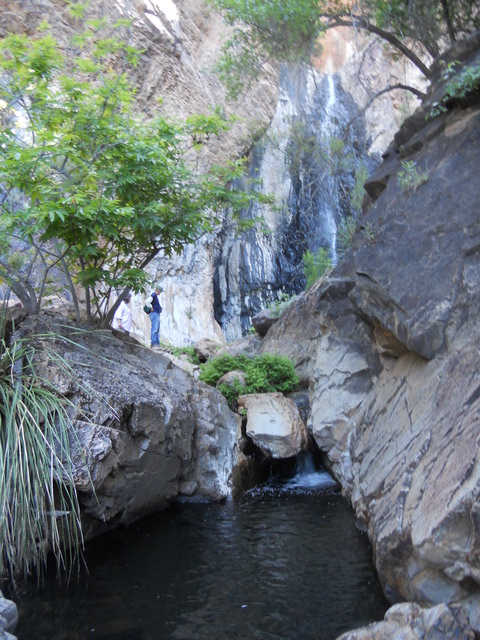
The base of the falls is truly a garden spot in the desert. The following pictures are, (1) looking toward the falls up the stream that flows from there, (2) a closer shot of the falls, and (3) a close-up of the yellow columbines that grow at the base of the falls. You may have noticed in the pictures of the wash that there did not seem to be any water flowing there. That's because the water flowing in the stream pictured below gradually disappears underground, out of sight. It may flow all the way to the Rio Grande; maybe some of it reappears in a spring down the drainage; or it gradually evaporates and the vapor rises and exits through the bed of the creek. Of course, during a flash flood, the water may make it to Cottonwood Creek on the east side of Burro Mesa and thence to Terlingua Creek, which empties into the Rio Grande at the mouth of Santa Elena Canyon. The headwaters of Cattail Canyon are on the west side of Emory Peak, the highest peak in the Chisos.
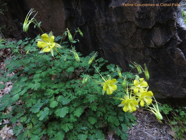
There are also some rare orchids that grow here. I wanted to get a picture of them, but you really have to be careful not to step on any of the fragile vegetation - especially the orchids. Unfortunately - NO, I did NOT step on an orchid! - my photo didn't come out for some reason. So, no orchid pictures, sorry! I just took one photo, because I was anxious to get away from any possible misstep. I even got to wondering if I was being irresponsible despite the care I was taking.
Here is a photo only a geologist could love. Erosive forces loosen rocks on the cliffs above the base of Cattail Falls, and they end up as rock-fall blocks. This particular block has served to preserve the material upon which it fell, the older landslide, alluvial, colluvial deposits of Quaternary age that generally have been eroded away at the base of the falls. Colluvium is the term for material that has been transported downhill by a variety of processes involving gravity.
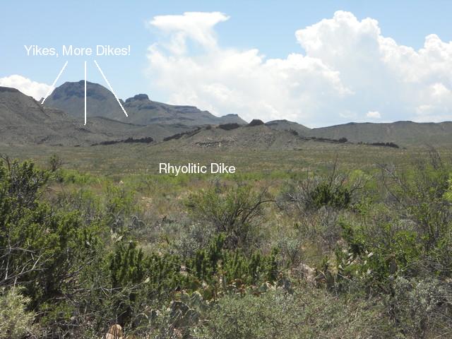
On the way out the sun angle was great to take the following photo of one of the many rhyolitic dikes you can see protruding above the ground around the Chisos Mountains. A dike is the result of a sheet-like intrusion of magma that cuts across whatever geologic structure that was there previously. (As a result it is called a non-concordant intrusion.) There are two other dikes in the picture. All three are parallel and strike north northwest to south southeast. If such an intrusion reaches the surface, it produces a fissure eruption. You have probably seen videos of the spectacular fissure eruptions of Kilauea in Hawaii. However, those spew basaltic magma. The magma that solidified into the rock of these dikes was a much more viscous silicic (high in silica) magma. When such a magma reaches the surface and has a high volatile content (gases, mostly water vapor, dissolved in the magma), a violent eruption may take place, not the "fountains" of lava you see in the Kilauea videos.
BACKWARD to Devil's Den
FORWARD to Santa Elena Canyon
ALL THE WAY BACK to the Contents