A Radiant Volcano: Dominguez Mountain
In late October, 2015, when I made this trip, the park had just experienced a heavy rain event due to an upper-air low hanging over northwest Mexico. I had to postpone the trip for a week as the River Road was closed, and I needed to use it to get to the Dominguez Spring campsite. Originally, I had planned to backpack in and spend at least two nights in the Dominguez Spring area, but circumstances were going to nix that.
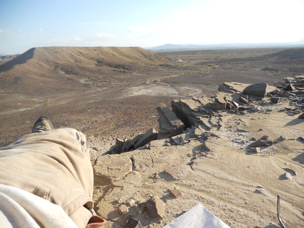
Despite leaving for the Dominguez Spring campsite early in the morning starting at Paint Gap, it took hours of nerve-wracking driving, forcing my 4WD Ford Ranger through scary stretches of mud and water. Once my vehicle seemed to be practically on its side due to the unevenness of the thick mud. Of course, it only seemed that way because i was trying to keep from falling into the passanger seat. (Thank goodness for seat belts.) The only reason I persevered was that a park vehicle, possible rangers checking out the road, had gone before me, as evidenced by a set of ruts. If they could make it, so can I, I thought. (Well, in reality I wasn't all that confident!)
The late arrival at the campsite meant I had to change my plans. Also, my left hip was bothering me, so I decided to make a one-day trip in and out, leaving very early in order to have as much time as possible at the mountain. It would still be a 14-mile round trip, not counting sight-seeing, but I wouldn't have to carry as much water, and the 1200-foot elevation gain is gradually ascended over a seven-mile stretch. I didn't have much information about Dominguez Spring, but when I got there I found water coming right out of the rock, clean and clear. At that point I wished I had been able to camp there after all, as I would have all the water I needed to stay and hike back. Despite the hip problem, I could have toted a less weighty pack with just enough water to make it to the spring.
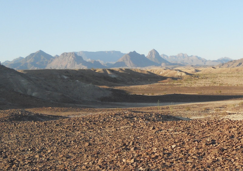
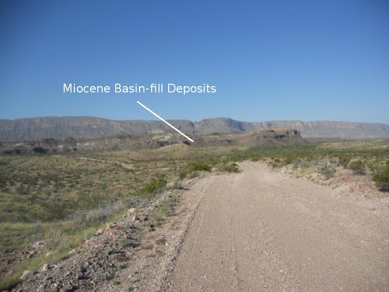
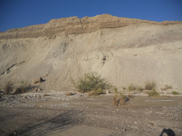
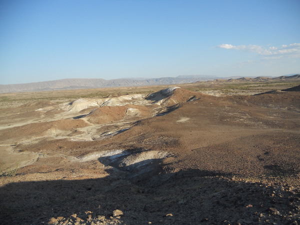
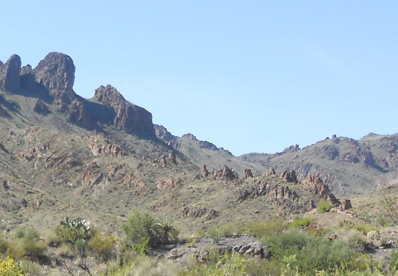
I didn't have much time to take pictures on the way, but I did get a few in. The first photo was taken on the River Road, looking west-southwest with Sierra Ponce (the Mexican name for the continuation of Mesa de Anguila on the Mexican side of the Rio Grande) in the distance, at a point about a mile west-northwest of Buenos Aires. The ridge is apparently composed of the Delaho Formation as defined by a pair of geologists with the last name of Stevens who studied the rocks and fossils in this area. This formation consists of Miocene basin-fill deposits of rock debris ranging in size from clay to cobble and is denoted on the new USGS map (Scientific Investigations Map 3142, 2011) by the symbol Ta.
There is a down-dropped crustal block in this area that resulted from the crustal stretching that occurred in the Basin and Range Province over the past 17 million years, creating the Delaho bolson (a flat basin in the desert) in which the sediments were deposited. Other down-dropped blocks were formed across Big Bend during the same activity, such as the Tornillo bolson. The Miocene lasted from about 23 to 5 million years ago, so the crustal stretching occurred during the middle to latter part of the Miocene (and continues today over much of the western states). The Stevens were able to find vertebrate fossils of Miocene age in these deposits. As you can see the higher sections of the road were generally OK. This stretch was like a super highway. Down in the arroyos it was a different story.
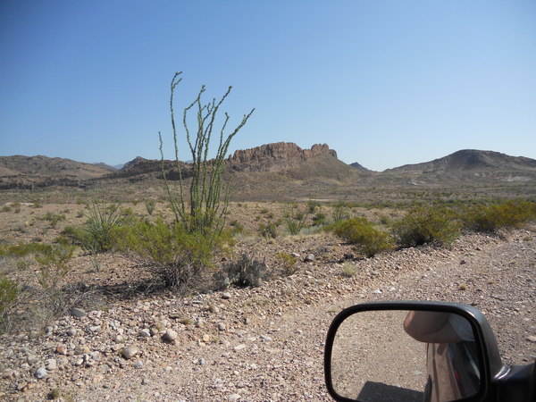
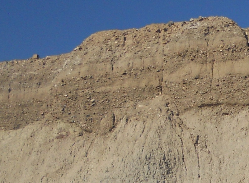
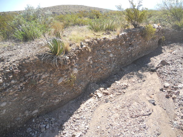
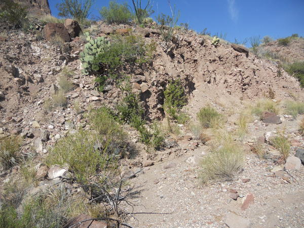
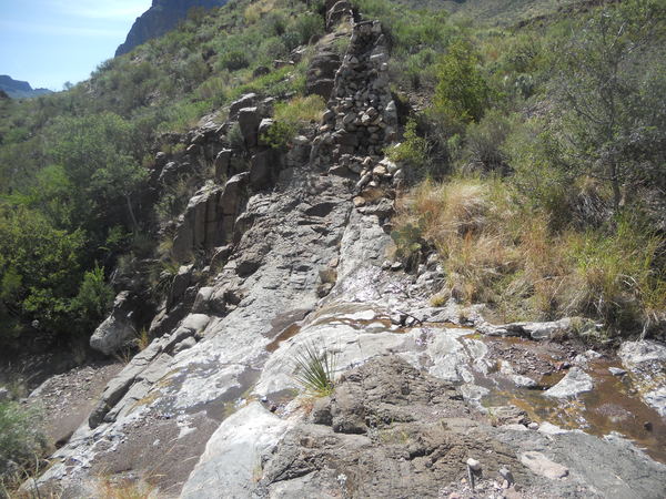
There are some volcanic dikes in this part of the park. A volcanic dike is formed from a sheet-like intrusion of magma associated with volcanism. Often they are more resistant to erosion than surrounding material, resulting in wall-like features such as the one in the image below. On the USGS map this dike is not indicated as being associated with the Dominguez volcano, which is the object of my trip; however, this dike, and several others in this area, do trend toward Dominguez Mountain, which is the focus of a rather massive dike swarm radiating away from it. (Hence the title "A Radiant Volcano".)
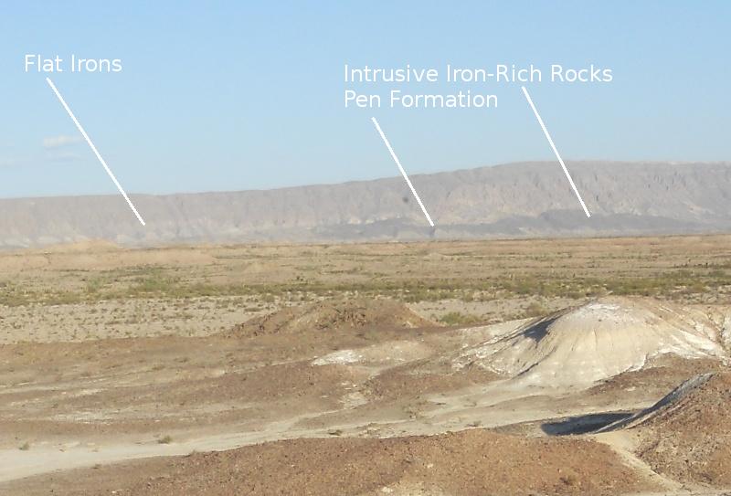
The hill in the background on the right is topped with trachyte, a volcanic rock rich in alkali-metal (sodium, potassium) feldspar. Feldspar is the most abundant type of mineral on the surface of the Earth and high in silica. This trachyte of Oligocene age (in this case about 30 million years old) had been mapped as the three-million-year older Tule Mountain trachyandesite until later work showed it to be a separate unit. It outcrops in many areas here to the southwest of Triangulation Station Mountain and rests on top of a poorly studied member of the Chisos formation called Tcy on the USGS map. Ages for this member range between 45 and 33 million years. The dike cuts through this member and the trachyte and is thus younger than both. This dike is about a mile northwest of Sierra Chino camp.
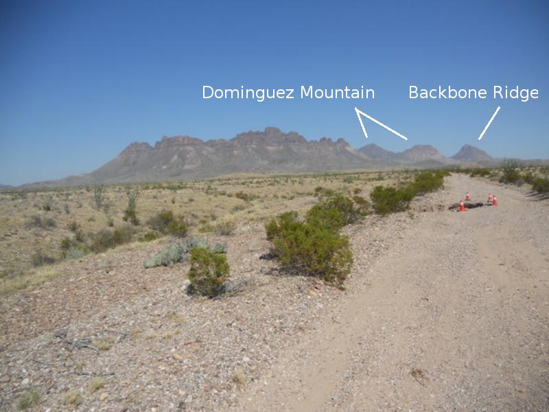
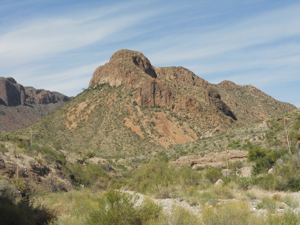
For context the following is a view of Punta de la Sierra, the mountain ridge in the center of the photo, Dominguez Mountain, and Backbone Ridge. I was amazed at how prominent Punta de la Sierra appeared. From the South Rim it is very unimpressive. The rock of which it consists is almost entirely the aforementioned trachyte. You can tell from the bedding planes on the mountains that there were numerous flows of this volcanic rock.
From here it appears that Dominguez mountain is broken into two parts. This is a little misleading, as that on the right is apparently part of the rim of the old volcano. From above (satellite or aerial view) you can see a circular pattern outlining the volcano with the highest point lying near the center. Backbone Ridge is an igneous intrusion of granitic composition. I am not aware of a date for this feature.
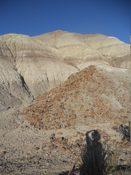
The orange cones were placed by a park employee named Romaldo I met on the way. He was driving west while I was driving east. He had valuable information on the condition of the River Road in the direction I was going. He warned me of bad spots to the east and I warned him of bad spots to the west. He recommended I exit to the east when leaving, promising they would take care of those eastern bad spots with a road grader by that time. And they did. There are a lot of really good people working for the park service. Hey, Congress! Fund the park service adequately! Our parks are the crown jewels of the nation!
My late arrival at the Dominguez Spring campsite meant putting off the trip to Dominguez Mountain a day but also gave me some time before sunset to look at the geological features in the vicinity. Crossing over an arroyo to the east of the campsite (the same one that crosses the River Road for one of the worst spots to get through), you find this water-cut bank with the Black Peak Formation (TKbp on the USGS map) exposed. Above the Black Peak is apparently alluvial (water deposited) material of middle to late Pleistocene age, designated as Qia1 on the USGS map.
The Pleistocene began about 2.6 million years ago and terminated 11,700 years ago. The Black Peak was laid down from the late Cretaceous into the Paleocene; that is, roughly 70 to 60 million years ago. This means something like 60 million years of geologic history is missing here, between the Black Peak and the alluvial deposits. In geological terminology the alluvium rests unconformably on the Black Peak. You can see in the following closeup that the contact between the two is uneven, meaning the Black Peak was being eroded before the alluvium was deposited. Note the alternating beds of clay and gravely sandstone and how one clay bed pinches out to the left. When water flow is swift enough, very little clay is deposited as it is mostly washed away. The presence of clay means the flow was very slow or even stagnant.
In the next photo you can see me patting myself on the head for finding this next outcrop of the Black Peak, not far from the cut bank shown above. You see the different colors of mudstone that makes up much of the Black Peak. On the very top there is more alluvium, but there also appear to be beds of shale in the Black Peak, the debris of which is in the foreground, as will be shown below.
And here is the aforementioned shale. At this location it is a medium brown. Although most of it lay as debris on the ground, there were a few outcrops. It appears to be a bed in the Black Peak Formation, but its absence on many of the exposures is puzzling. I suspect the shale may form "lenses" of material in the Black Peak. The next picture, taken while lying down – don't ask – is back across the divide between the shale, dark rocks across the divide, and the lighter-colored shale on top of this hill.
Shale is a type of mudstone that shows cleavage along bedding planes. It appeared to me that both shales are part of the Black Peak. The top of this hill is flat due to shale cleavage, and I think the hill across the way is flat for the same reason. I did wonder if the light-colored shale could be part of the much younger alluvium, but the closeup of the alluvium presented above shows it to be a much different type of deposit, due to flowing water, while shale is deposited in a quiet environment such as a lake for a terrestrial deposit like the Black Peak.
Below is rather typical view in the Dominguez Spring campsite area. You see both the mudstone and shale of the Black Peak Formation in low hills and ridges between stretches of drainage. Sometime during the time span of the deposition of the Black Peak, there was the impact of what was likely an asteroid in what is now the Yucatan of Mexico. This was the blow that at least contributed to the demise of many species, including the dinosaurs, flying reptiles, and marine reptiles. I have not yet seen any discovery of a horizon marking this event within the Black Peak. You would think something would have to be there unless there is a gap in the formation where evidence of that impact was eroded away.
In the distance in the above photo is Mariscal Mountain, which owes its existence to folding during the Laramide orogeny, which took place from the late Cretaceous into the Tertiary. The crustal compression that occurred in Big Bend during that orogeny formed the Mariscal anticline, of which Mariscal Mountain consists, where the rocks are folded upward, like putting your hands on a bed sheet and pushing them together. In the following closeup you can see dark colored rock, which appears to be on the side of Mariscal Mountain, but is actually on this side away from the mountain. It consists of intrusive igneous rock rich in iron, hence the dark color. On the USGS map it is denoted as Tib. Here, it has intruded the Pen Formation of upper Cretaceous age, so it is younger than that. However, there are no dates of this intrusion that I know of.
The USGS map identifies this as the same sort of intrusive rock as that discussed in the Devils Den field trip. My best guess from going over the information available is that these intrusions are on the order of 30 million years old. On the side of Mariscal Mountain there appear to be "flat iron" features, likely of the upper Cretaceous Buda Limestone. I can't be sure since I haven't been there, but the USGS map is consistent with this interpretation. In any event they indicate the upward folding of the rock on this side of the anticline to the point of their beds being vertical according to the USGS map.
Finally. It's time to head up to Dominguez Spring. In the following photo you see Punta de la Sierra and a nearby hill composed of the Black Peak Formation. The trail starts off as an old road. In some places it is easy to follow, but where it crosses drainages, you can lose it. This happened to me but you don't really need the trail as you can follow arroyos up toward the spring, so i just kept on going. However, it is more convenient to stay on the trail. Knowing the road crosses the drainages at right angles is a help in not losing it. Later on the road tracks peter out and you need to follow cairns. However, not all of the trail is equally well marked. Looks like some maintenance of the trail is in order.
I realize this isn't too exciting, but here is an exposure of alluvium deposited within the last several thousand years, possibly as long ago as the last ice age. Note the fairly well-rounded clasts (a clast is the geological term for a particle of sediment, from clay to boulder) and the wide range of clast sizes: clay, silt, sand, gravel and cobble. This sediment would be termed subrounded but poorly sorted. The rough bedding is what indicates it was deposited by water. The roundness of the clasts may mean it was worked and reworked by water – deposited, eroded, and deposited again, abrading the material into rounded shapes. The large variety of clast sizes indicates a turbulent final deposition – the result of one or more flash floods. One lonely lechuguilla clinging for dear life on the bank is seen in a landscape dominated by creosote, blind prickly pear, mesquite, ocotillo, a few desert willows, and a nasty little bushy cactus called tasajillo. (I kept walking into the damned stuff!) In its favor, I hear it can be a valuable plant in xeric landscaping.
For contrast here is an exposure of colluvium, geological debris deposited by a variety of gravity-driven processes that covers the slopes of hills and mountains. This exposure consists of debris from Punta de la Sierra. No bedding planes are seen and the clasts are angular. This sediment is both poorly sorted and angular, indicating little weathering due to water action, but rather reflecting the various erosional processes involved.
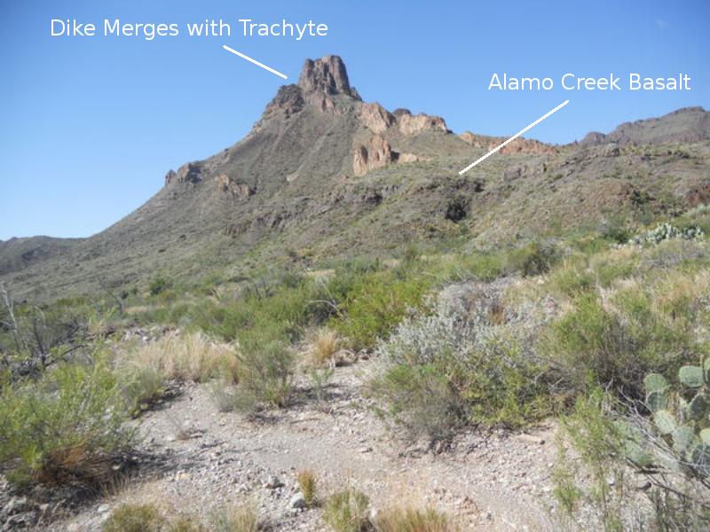
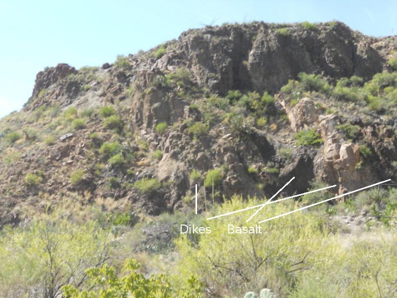
Definitely more exciting is what you see when you pass the east side of the Punta de la Sierra and approach Dominguez Mountain. Below you see several dikes of the massive dike swarm to the south of the old volcano. One dike seems to merge into the trachyte at the top of the peak, and some think that the trachyte is a result of the volcanism associated with Dominguez Mountain. You can also see an outcrop of the Alamo Creek Basalt member of the Chisos Formation. It consists of a number of flows ranging from 46 to 47 million years old and is the bottom member of the Chisos Formation in most of the park. (It overlies some older volcanic rocks of the Chisos around Dogie Mountain.) Basalt is an iron-rich volcanic rock. Note the dark color. Rocks that are dark-colored often contain either carbon (for example, black shale) or iron-rich minerals.
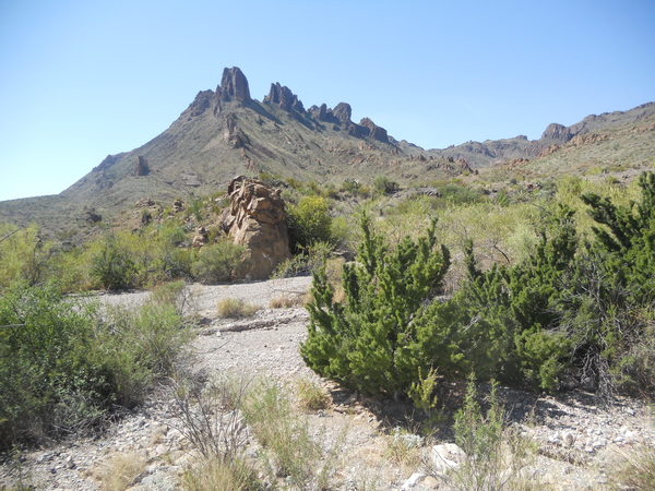
Dikes march dramatically south across the landscape toward Punta de la Sierra in the following photo. At this scale the photo doesn't do justice to the view, so below that is a closeup.
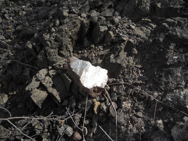
The next picture is a closeup of a dike exposed in the wash that separates Dominguez Mountain from Punta de la Sierra. You can see little holes called vesicles, which were gas bubbles in the magma and are now little empty spaces in the rock. Typically, most of the lava from volcanic action is erupted from fissures around the volcano. The magma left to cool in these fissures results in dikes. Also note a rock fragment (xenolith) in the dike, torn from the country rock through which the magma forced itself up. ("Country rock" does not mean the same to a geologist as to a cowboy. It means the rock in place before the volcanism occurred.)
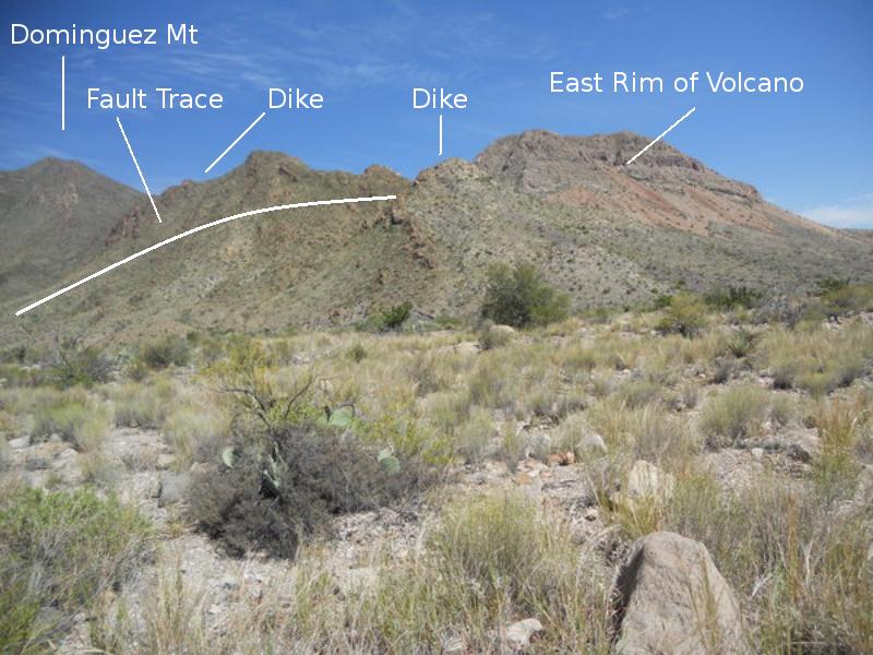
A bit farther along the wash you come across this view, looking north. The fault trace shown is drawn as best as I can do it. According to the USGS map it continues to the left up the wash but is not seen at the surface as it is covered by alluvium. The fault probably provided a weakened line in the rock for water to eat into and form the wash. The rock on the right side of the fault is our old friend, the Black Peak. That on the left is called Tcstr on the USGS map, a member of the Chisos Formation composed of sandstone, tuff (consolidated volcanic ash), and rhyolite, which is a volcanic rock rich in silica and poor in iron.
The ridge on the right is the remnant of the east rim of the volcano, featuring Dominguez Mountain intrusive rocks labeled Tdi on the USGS map. This rock is largely iron-poor, silica-rich granite-like rock but also includes some more iron-rich (mafic) rock. Since the Black Peak is much older than the Tcstr, the movement on the fault was relatively up on this side and down on the far side. The fault was likely associated with the Dominguez Mountain volcanism as it is one of the number of faults that circle the old volcano.
The placement of dikes from Dominguez volcano was so thick that the country rock was almost crowded out. Below you see a series of dikes running south from Dominguez Mountain just about taking out the original rock, the Alamo Creek Basalt. Unfortunately, the photo is a little blurry.
The mountain in this picture, looking northwest, appears to be the remnant of the west rim of the old volcano. Like the east rim, it is composed of the aforementioned Tdi. According to the USGS map, a fault runs north-south on the right (east) side of this mountain, responsible for the break between it and Dominguez Mountain out of the picture to the right.
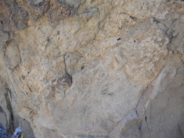
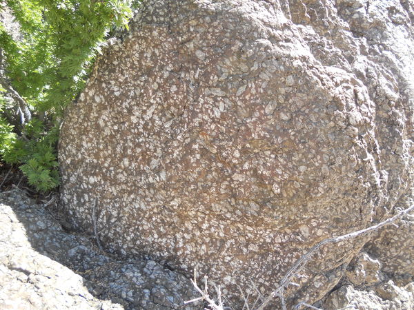
And here is a strange-looking rock. This is a dike exposed on the north side of the wash running between Dominguez Mountain and Punta de la Sierra. It is riddled with what are apparently large, weathered, one to two inch feldspar phenocrysts. A phenocryst is a crystal in igneous rock embedded in a background (groundmass) of much smaller crystals. Their presence implies the magma cooled underground sufficiently for crystals with a higher solidification temperature to form and grow unimpeded before the magma cooled more rapidly and solidified, inhibiting the formation of any more sizable crystals. This abundance of feldspar indicates the magma was quite high in silica.
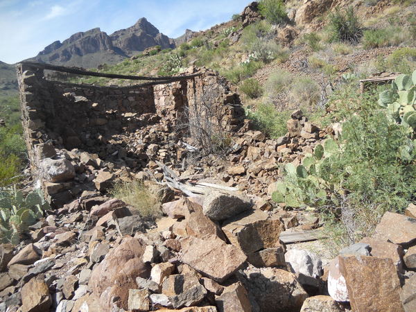
At last, here is Dominguez Spring. A dike has bottled up groundwater flowing beneath the surface of this drainage, forcing it to the surface. The water appears to be very clean and certainly clear. You can see the remnants of a dam that was constructed across the spring to hold the water. I don't know if this dam was ever completed, but there are remnants of it on both sides of the spring. At this point I wished I had packed in a sleeping bag so I could have stayed the night. The second picture below is of one of the ruins at the spring.
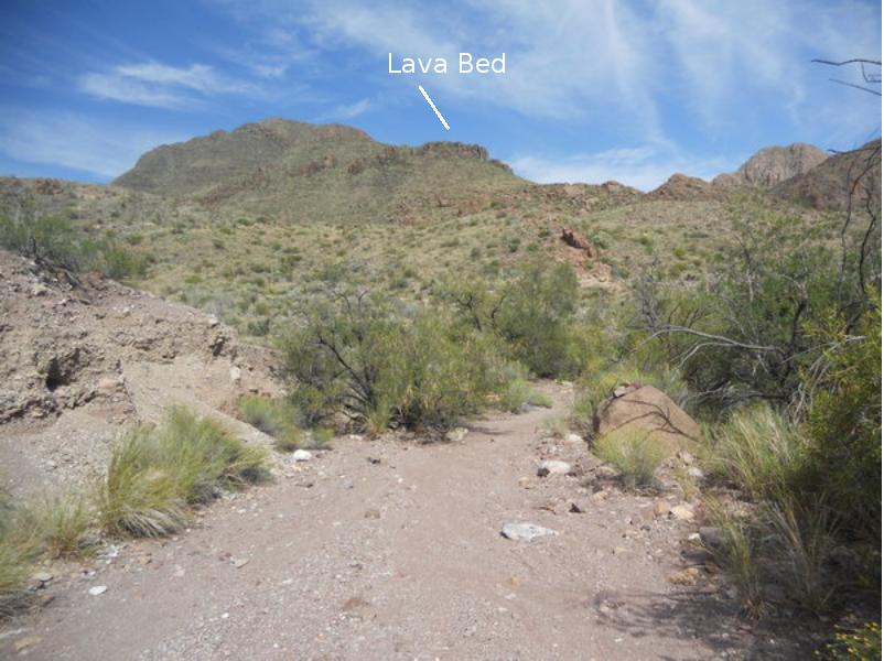
This following image, looking toward the direction of Dominguez Mountain, is of what appears to be a lava bed produced by the old volcano.
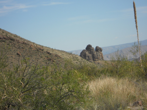
The following picture is a mystery to me. According to the USGS map, this striking rock formation, that looks like stone giants guarding the old volcano, is made up of the Black Peak Formation. The problem is, I never have seen any rock of the Black Peak this resistant to erosion. Plus, I can't detect just from looking any indication of bedding planes, the Black Peak being a water-deposited unit. Looks like an item for future investigation.
This has been a long feature and we are finally at the last photo. I supect I will incorporate a lot of the earlier material into a hoped-for tour of River Road geology. As I was making my way back to Dominguez Spring camp, a flash of light caught my eye on a hillside. Curiosity took over and I went up the hill to see just what this bright light was. Turns out it was the following, a mirror-like so-called "slicken-sided" rock indicating fault movement. The USGS map implies there is a fault above this location in the Alamo Creek Basalt, and the rock there did appear to be basalt. Slicken sides don't always mean rock smoothed by fault movement. When I was a physics professor at Texarkana College, teaching geology on the side, my students and I came across numerous examples of slicken-sides in the shale of the Jackfork Formation in Arkansas, apparently produced by differential motion in the shale as it was folded by tectonic forces.
I got back to camp just as it was getting dark. A road grader was parked close to the River Road implying that the park personnel had worked on the River Road to the east as promised. The bad spot due to the arroyo to the east of the campsite was still there – and still needed low 4WD to cross – but it was much improved from the stinky swamp it had been. Although Dominguez Spring is a long hike in, it is well worth it if geology and stark scenery is your bag.
BACKWARD to Santa Elena Canyon
FORWARD to TBD
ALL THE WAY BACK to the Contents