Mountaineers, Meet Mountain Ears: Mule Ear Trail
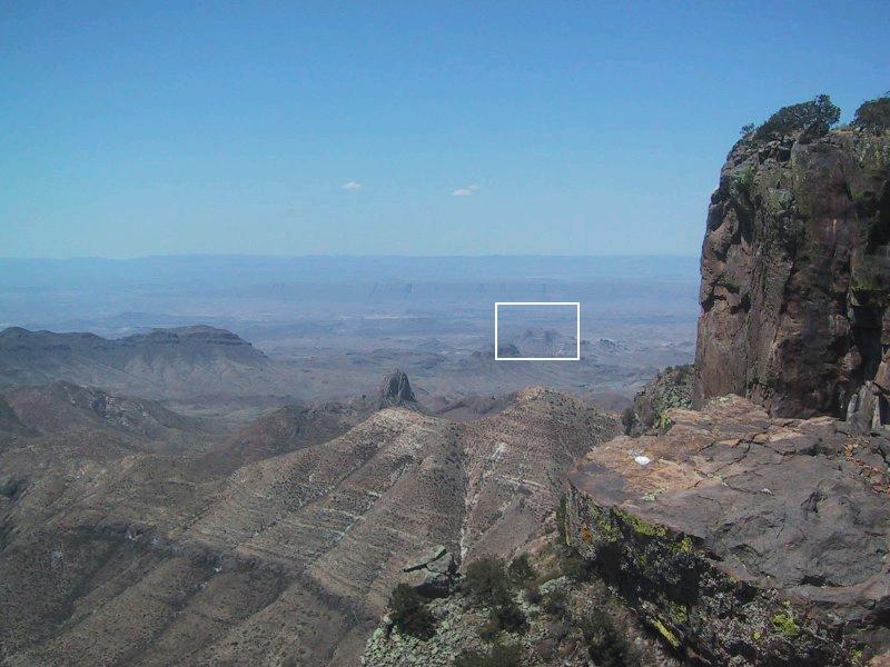
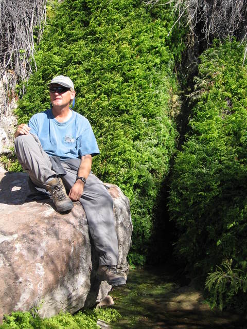
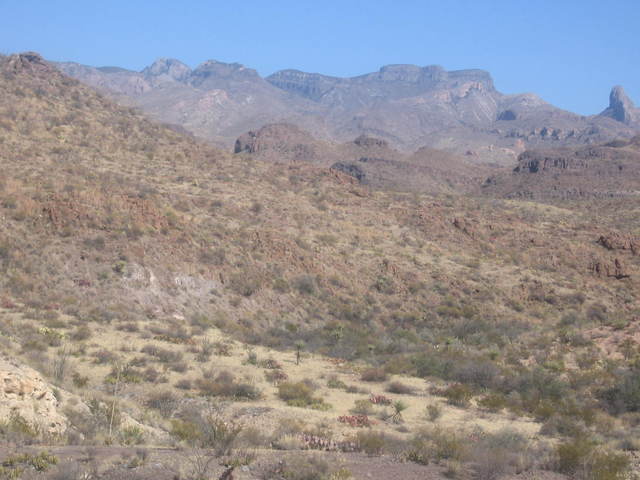
From the South Rim of the Chisos Mountains, the Mule Ears look practically microscopic (see below). Were they named from this perspective, they might have been called the Elf Ears. So, what do they look like "up close and personal"? Can you pat the "mule" on its head? Can you string a hammock between the ears and relax? Will the sight be rather disappointing? Well, the only way to find out is to go there, and my brother, Randy, and I made this rather short but splendid hike in January, 2009.
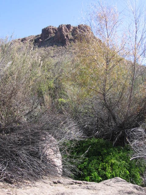
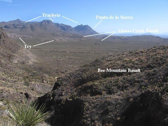
About half way to the Ears along the Mule Ear Trail, you happen upon one of the great oases in Big Bend National Park. Coming across a source of plentiful running water in the desert is a surreal experience: greenery and aquatic life looking so out of place among cactus spines and lizards. Below you see the entrance to this oasis, Mule Ear Spring. The hill in the background is topped by a lava flow previously thought to be the Tule Mountain Trachyandesite. Trachyandesite is a type of andesite that is high in alkali metals, such as sodium and potassium. Andesite is a volcanic rock with a silica content (pure quartz is pure silica) less than rhyolite (a volcanic rock with the same general composition as granite) but greater than basalt. The 33-million-year-old Tule Mountain lava flows were thought to have covered much of the western part of the park, but recent evidence establishes that the trachyandesite in an area that includes the Mule Ear Trail resulted from lava flows three million years later. This trachyte is also volcanic rock high in alkali minerals, but includes basaltic as well as andesitic compositions
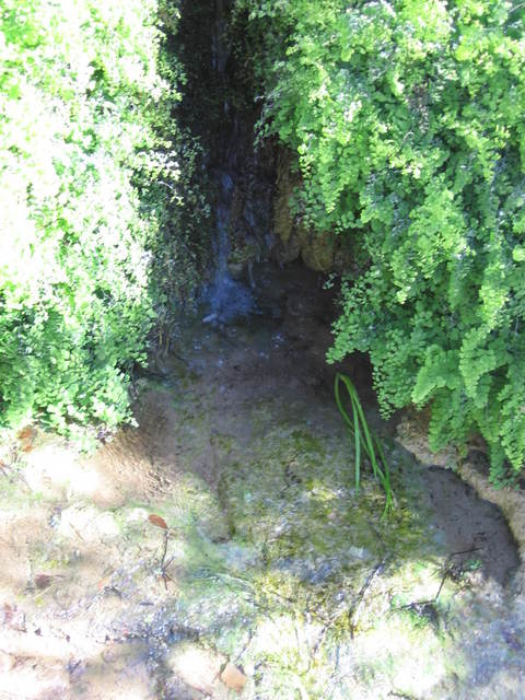
The next three images are of the spring itself. There is a nice flat-topped boulder on which to rest and enjoy the running water. A spring results when the local water table is above the surface of the ground. There is a drainage above the spring that is usually dry and which, when it contains water, flows over the following members of the Chisos Formation. In order from top to bottom they are the 30 million-year-old trachyte, beds of the undivided (not yet well-studied) Chisos Formation, an upper bed of the Bee Mountain Basalt (not dated at this location), the 33.6 million-year-old Mule Ear Spring Tuff, and finally over a lower bed of the Bee Mountain Basalt. (This sequence of rock units was clarified by a USGS map, Scientific Investigations Map 3142, published in 2011.) The tuff consists largely of volcanic ash.
It was hard to tell because of the vegetation, but it appears the spring emerges at the boundary of the tuff and basalt. Perhaps the tuff is porous where it outcrops on the west side of this hill. If so, this could explain why the spring is here. The tuff appears to be at its lowest point topographically in the drainage. You could speculate that water seeps into the tuff and percolates downhill, making the tuff a sort of aquifer. Then when the water reaches the lowest point here at the drainage it is prevented from further downward movement by the (presumably) impervious Bee Mountain Basalt, which lies beneath the tuff, and appears at the surface. However, beds of the Chisos Formation are also exposed in this area just below basalt, so it could be these rocks are the ones acting like an aquifer.
 |
 |
 |
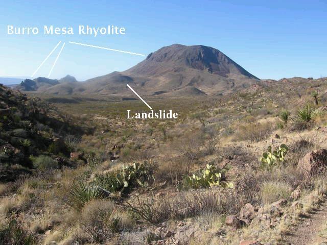
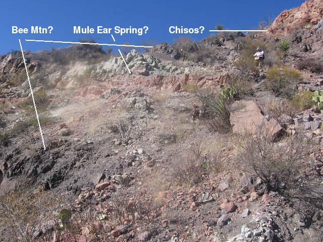
Looking back to the west after passing Mule Ear Spring, you can see Trap Mountain in its entirety. The trail goes around the southern side of this mountain from the Mule Ear Peaks overlook just off the Maxwell Scenic Highway. The word "trap" is a mining term for fine-grained rock, although I'm not sure this is the origin of the mountain's name. The mountain consists largely of the 29 million-year-old Burro Mesa Rhyolite. Rhyolite is generally a light-colored rock; however, here it seems to have weathered to such a dark color it could be mistaken for a more iron-rich rock. Note in the image below the ridges are also of the Burro Mesa Rhyolite. This implies the rhyolite is on the order of several hundred feet thick at this location. Note also the hump labeled in the photo. According to the new USGS map, this is a landslide that occurred in the past million years or so. Two other landslides are located on the sides of the mountain out of the picture. Also, according to the map, there are numerous rockfalls below the exposed rhyolite. The rest of the material on the side of the mountain was moved downslope by various processes involving gravity and is called colluvium.
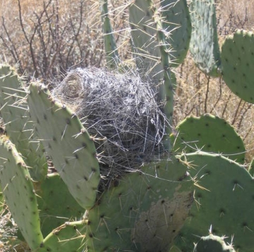
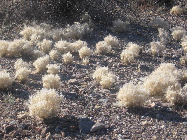
Several javelina were observed making their way up the drainage that runs to the south of Trap Mountain, but we weren't able to get good pictures. We also came across an abandoned cactus wren nest and fluff grass in its weird-appearing winter dormant state. (Much thanks to Wynn Anderson of the University of Texas at El Paso for identifying this plant for us.)
 |
 |
Now here is a telephoto view of the mountains across Smoky Creek valley, with one of the "ears" just on the right edge of the picture. The clear air is misleading here, as the "ear" is actually on this side of the valley, although it can be mistaken as continuous with the mountains on the far side. The dark rock outcrops from the center of the image to the right are of Bee Mountain Basalt. The mountains across the valley are topped with trachyte, once again that which used to be considered the Tule Mountain Trachyandesite. Contradicting my earlier presumption, the new USGS map indicates no Mule Ear Tuff below the cliffs.
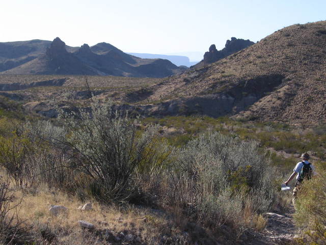
The trail tops a small pass and descends toward Smoky Creek, seen below. The view is southeast, looking over outcrops of Bee Mountain Basalt. The tiny "peak" on the floor of the valley was what I originally thought to be an igneous intrusion but consultation with the recently published USGS geological map makes it appear to be part of the exposure of the Alamo Creek Basalt across the canyon. Also in the valley are exposures of the so-called "younger" Chisos rocks (Tcy) of Eocene and Oligocene age. The western edge of the Punta de la Sierra is seen in the distance. Beyond that in the far distance are the mountains of Mexico. Punta de la Sierra, like the mountains across Smoky Creek, is topped with trachyte. Three radiometric dates for this unit – none of which are close to this area – pin the trachyte at about 30.3 million years of age. Much of the rock in the hills on the right side of the photo consists of the Alamo Creek Basalt member of the Chisos Formation. This member consists of a number of basalt flows that range in age from 46 to 47 million years. No dates of the basalt in this picture appear to be available.
As you make your way through the pass you encounter the Mule Ear Spring Tuff as seen below. This unit outcrops in numerous locations in the area. I'm going to take the plunge and relabel the picture I had here, emboldened by the support of the USGS map, identifying the dark rock above and below the tuff as Bee Mountain Basalt and the light rock at the upper left resting on the basalt as belonging to the Chisos Formation. I'm 65% confident I'm correct. :-/ Note the various colorations in the tuff due to compositional differences and/or weathering.
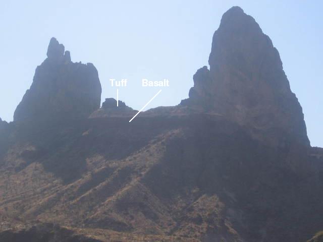
Beyond the pass you descend toward Smoky Creek, and the Mule Ears become more and more impressive. The 2011 USGS map has been great in clarifying the rock units here. The "ears" are mapped as rocks of the Wasp Spring member of the Burro Mesa Formation, dated to about 29 million years ago. These rocks record a violent eruption on this side of the park. The two ears are remnants of a pair of dikes, which were originally sheets of magma forcing themselves upward through fractures in the rock. As such, they were likely feeding fissure eruptions like you may have seen around the Kilauea volcano in Hawaii, except these were probably far more explosive. For some unknown reason, all that is left of these frozen sheets of magma are the two pillars, triangular in profile, that side by side appear as the ears of a gigantic, crouching mule. What are the odds of that? Between the ears is the Mule Ear Spring Tuff and below that a ledge of the Bee Mountain Basalt, which was erupted over a period of several million years, from about 34 to 30 million years ago. The slump-like feature appears to be what the USGS as mapped as a landslide deposit.
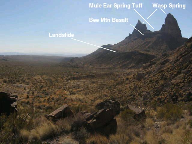
In the image below you can see the tuff and basalt more clearly. From this vantage point the Mule Ears appear like an outsize Egyptian ruin – the remnants of an incredible edifice towering over Smoky Creek Canyon. This is a far cry from their appearance from the South Rim. Admittedly, the light from the low winter sun wasn't all that great for photography when Randy took these pictures. Nevertheless, the sight was awesome. Only the distance and additional elevation of the South Rim makes these "ears" appear unimpressive from that perspective.
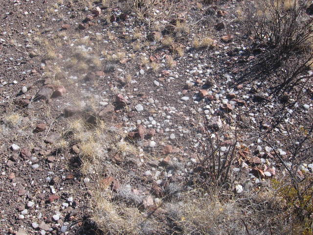
Occasionally along the trail you come across numerous calcite crystals lying on the ground.
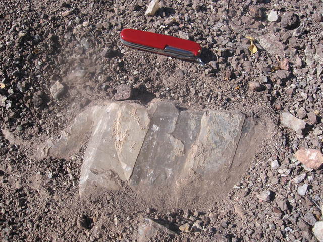
This seems to be a puzzle, because the igneous rocks in the area aren't the direct source of these crystals. I have seen calcite veins in other parts of the park, notably along the Strawhouse trail, presumably from calcium carbonate precipitation out of groundwater. However, these veins (except for some small ones in the Grapevine Hills) were in limestone, which is largely calcite to begin with. Another location for calcite veins is in soil and sediment, so possibly these crystals weathered out of such. Since calcite is rather soluble in water, I doubt this was the case. Note the large calcite crystals in the next image, exposed by erosion near the trail, in the rare rhombohedral form for crystals of this size. Although these may have formed from groundwater as a vein in a fissure in the volcanic rock, I wonder if something else has gone on here, perhaps involving the fact the volcanic rock had to rise through older Cretaceous rocks, many of which consisted of limestones. It may be tempting to collect specimens such as these, but we left them for others to hopefully enjoy and leave for hikers after them.
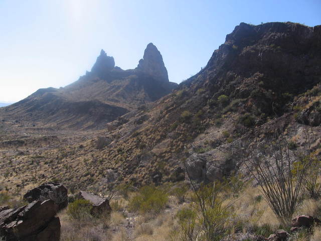
One last dramatic photo of the volcanic necks on the west side of Maxwell Scenic Drive as we returned to the trail head. The lowest southern reach of Trap Mountain is on the right and the notch of Santa Elena Canyon is in the distance. The low winter sun made for stark photography.
BACKWARD to Ernst Tinaja
FORWARD to Mesa de Anguila
ALL THE WAY BACK to the Contents