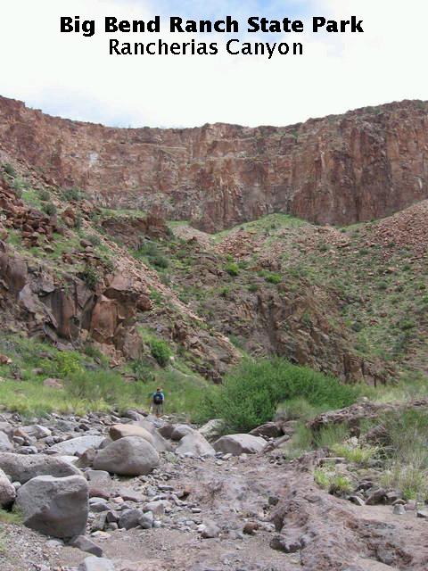
According to the guide book, the hike up Rancherias Canyon in Big Bend State Park is "moderately strenuous" and "rock cairns mark the way from the trailhead to the falls". I'm here to tell you that is crap. You better be in really good shape and have a topographic map with you if you are going to undertake this trip. The rock cairns are few and far between and difficult to find, and the trail degenerates from difficult to identify to nonexistant. If there are any rock cairns in the upper reaches of the canyon, you can't tell them from the natural jumble of rocks.
You really need a topographic map to avoid going up the wrong drainage. As experienced hikers and backpackers know, it is easy to follow a drainage downstream, but tricky to work your way upstream. When you come to a branch in the drainage, which direction do you follow? This is a particularly critical decision in desert environments, where the primary drainage channel may be difficult to identify. A topographic map makes this hike much more straightforward.
But not easy. I can think of only one or two hikes I've taken that were more demanding. The Rancherias Canyon hike does not start out as a difficult one, but by the time you get to the upper reaches of the canyon, you are doing a lot of boulder hopping and rock scrambling, usually in oppressive heat. I would suggest making this a two-day trip, camping at the head of the canyon. My brother and I hiked it in a day, but we were dog tired by the time we made it back to the trailhead.
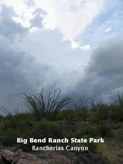
So much for bellyaching. We undertook the hike in June, which would seem to be incredibly stupid due to the heat, but fortunately spring 2007 had been unusually rainy and cool in West Texas, and this regime extended into the early summer. In fact, we were concerned about flash flooding as we began our hike, because thunderstorms were moving across the area, like the one in the following image. The storms eventually moved away, but at least some cloud cover lingered during the morning, which limited the temperature somewhat. On the other hand, the humidity was higher than usual.
Big Bend Ranch State Park was a working ranch in the remotest corner of Texas to the west of Big Bend National Park before it was donated to the state. It is a region that experienced some of the same volcanic activity as the national park to the east. Volcanoes in both Texas and Mexico contributed to the geology.
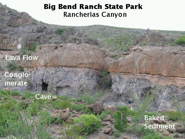
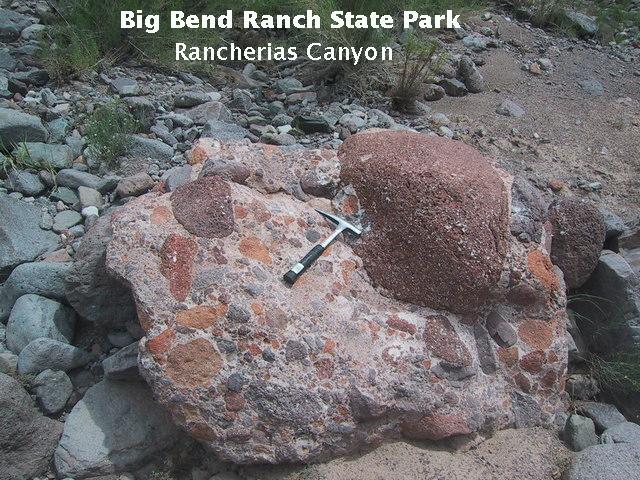
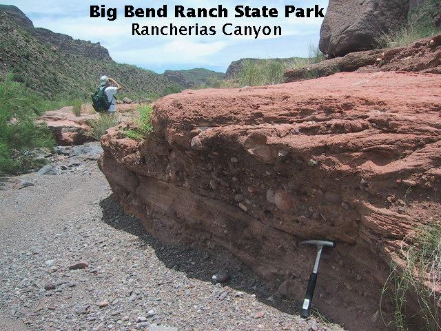
One of the first interesting items of geology you come across as you begin your trip up the canyon is an apparent disconformity, with conglomerate lying over basalt.
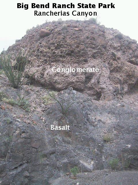
A disconformity is a break in the geological record where the rocks above the disconformity are parallel to those below. A conglomerate consists of sedimentary deposits where much of the volume is occupied by sedimentary particles (clasts) the size of gravel or larger. The top of the basalt was an erosional surface on which the conglomerate was deposited. Note the uneven surface on top of the basalt beneath the conglomerate in the image above as well as in the one below.
I suppose, technically, the contact seen here is a nonconformity, since sedimentary rock lies over crystalline rock. However, a lava flow is much like a sedimentary layer, only hotter and faster, so if I were in charge of geological nomenclature, I would call this a disconformity.
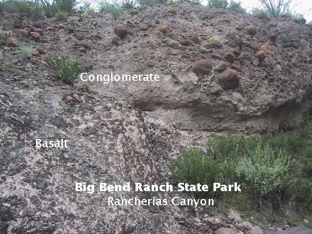
The clasts comprising the conglomerate are rounded, indicating the conglomerate was deposited in moving water. The size of the clasts indicates the currents were often very swift. According to the geologic map published in Guidebook 27: Geology of Big Bend Ranch State Park, Texas by Christopher D. Henry, both the conglomerate and the basalt may be deposits of the Closed Canyon Formation. The basalt would then be one of the flows that occurred between 18 and 25 million years ago, and the conglomerate probably deposited as part of an alluvial fan. In any event, the basalt was eroded by weathering and probably the abrasive action of sediment moving in the swift water before the sediment finally covered it for good.
A little farther up the drainage leading to Rancherias Canyon, but still only a mile or two from the trailhead, you encounter yet another disconformity: what appears to be a volcanic flow lying over the conglomerate you saw farther back along the trail. However, you have crossed a fault, and what you are looking at is apparently a conglomerate lying between a couple of volcanic flows of the Oligocene Rawls Formation (again according to Mr. Henry). The previous basalt and conglomerate were deposited in the Miocene.
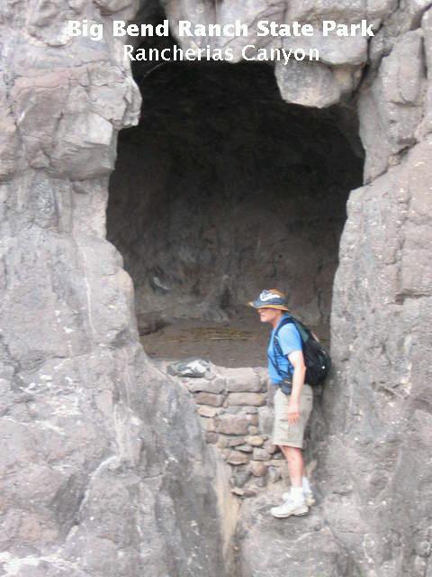
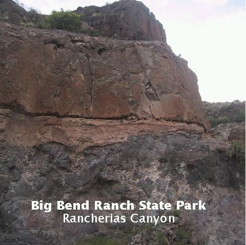
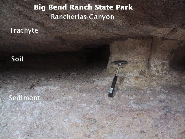
The image below shows the contact and what I am fairly sure is baked sediment between the conglomerate and the upper volcanic deposit. This sediment could have been part of a marsh, spring, or other such feature. For scale note the guy in the blue shirt toward the right (me). Also note the cave below the contact on the left.
Below is the picture I was taking: a close-up of the contact, showing the volcanic rock and conglomerate with baked sediment between.
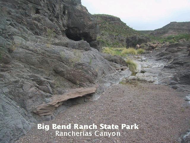
The presence of other cavities in the rock outcrop leads one to conclude the cave (see introductory image) was naturally formed, at least in part. It may have been an especially deep cavity that was deepened further by human effort. The cavities are probably being created as weathering around large clasts or clusters of clasts loosens them and they fall out of the outcrop. The cave has undoubtedly been used for centuries by Native Americans, explorers, and cowboys, and has been shored up with rocks at one entrance (there are two) to make it more amenable to habitation.
The disconformity appears again farther up the trail. The conglomerate is now underfoot, the volcanic rock is at eye level, and the contact between the volcanic rock and the sediment is knee-high.
The close-up of the contact below shows what I think is a baked soil layer between the sediment and the volcanic rock (probably trachyte, see below). Certainly, the layer in between is much less resistant to weathering and erosion than either the sediment below it or the above and shows this by wearing away and forming a gap. As the volcanic rock is undermined, chunks break off under the stress of their own weight, widening the channel.
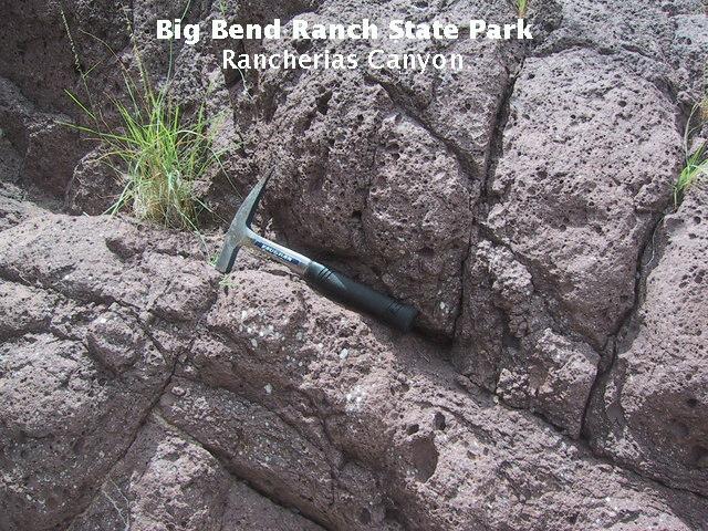
The next image is a close-up of the conglomerate. Many of the clasts appear to be of weathered basalt and other volcanic rocks. (Note: The rock hammer is used only for photographic scale in state and national parks... well, and to look cool if you happen to meet other people on the trail. It is also handy for digging "cat holes" in the rocky soil and for driving tent stakes.)
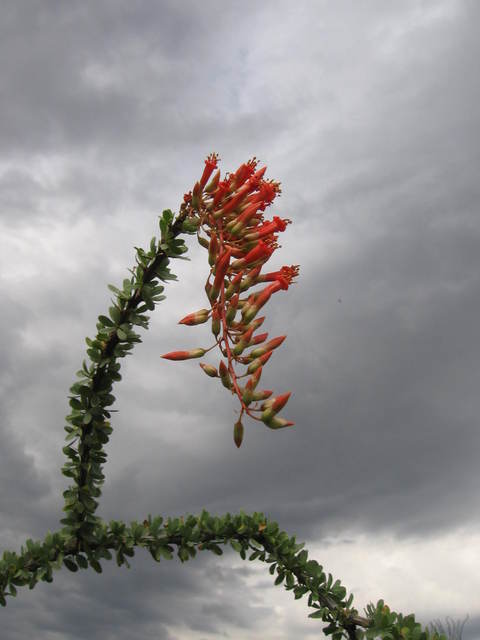
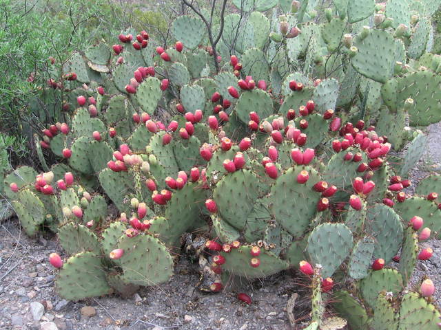
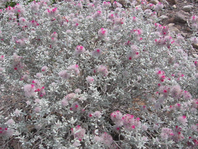
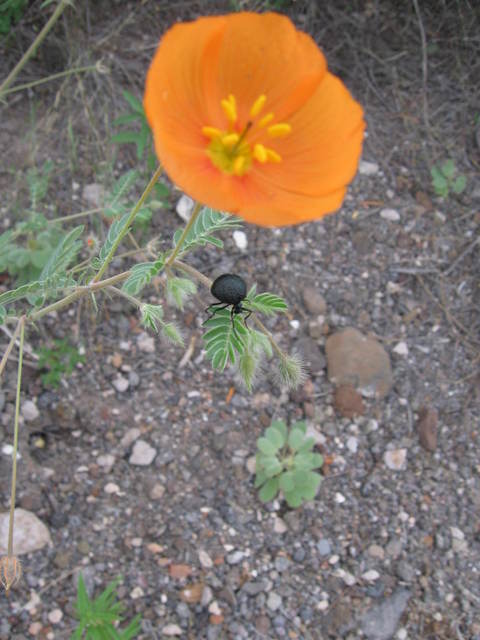
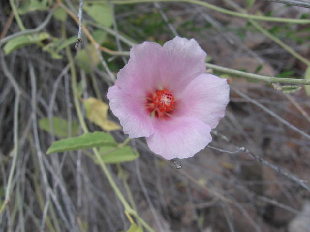
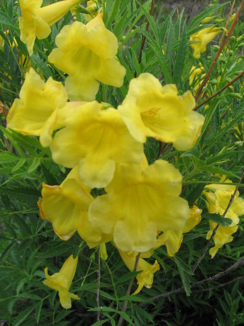
At this point let's take a break from geology and enjoy a few of the myriad species of wild flowers you find along the Rancherias Canyon trail. The first is a late-blooming ocotillo. Secondly, a clump of prickly pear cactus sporting its bright red fruit known as "tunas". Then you see what I'm fairly sure is a bush of cenizo in bloom, which I understand is also called Texas Sage or Purple Sage, although they say it isn't really a sage. The orangish flower accompanied by a little black beetle with an enormous derriere, is a Mexican poppy. The flower below it and to the left really looks like a primrose to me, but I can't find a primrose species that looks exactly like it after a search of the Web, so it may be something else. The last flower I hadn't been able to find until I googled "daffodil" and found out it is probably esperanza, also known as yellow bells and yellow trumpet. All these flower pictures are credited to my brother Randy.
 |
 |
 |
 |
 |
 |
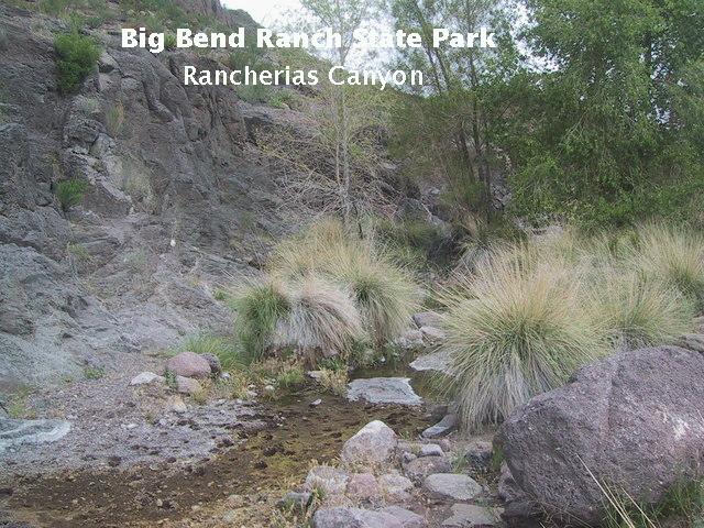
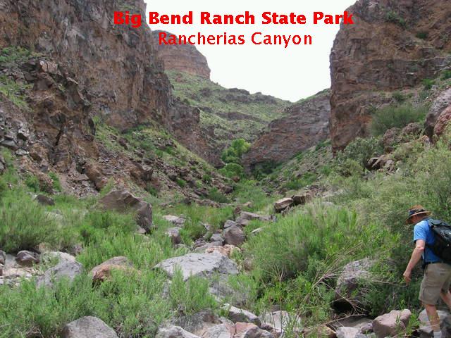
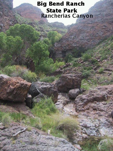
Rancherias Canyon consists of shear walls of volcanic rock, mostly trachyte that was erupted either from or near the Bofecillos volcanic vent several miles to the north during the early Oligocene. Much rock-fall debris has accumulated as talus (scree) slopes at the base of the cliffs.
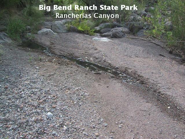
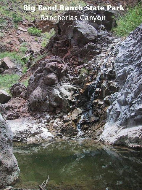
Occasionally, you come across springs in the canyon, such as the one pictured below. Water is still flowing beneath the dry stream bed. Where it encounters some sort of geological feature that impedes its flow, it may pool up enough to reach the surface, and you have a spring. The water then flows out of the pool and back underground, as seen in the second image.
Just upstream from this particular spring are some strange shelf-like features – one is pictured below. My guess is that sediment deposited when the pool associated with the spring was higher became cemented and was left behind as the climate grew drier and/or erosion lowered the stream bed.
Not all the rock you come across is trachyte. Here is an outcrop of basalt. Note the small cavities in the rock that were gas bubbles when it was molten. These holes are called "vesicles" and the rock is categorized as "vesicular basalt".
Another type of rock you encounter as you go up the canyon is red sandstone ("redbeds"), deposited between volcanic episodes. The red color comes from oxidized iron that serves to cement the sand together. Note the presence of gravel and cobbles in the sandstone, indicating an occasional increase in the speed of the water involved in the deposition. Brother Randy surveys the upper reaches of the canyon where we are headed at this point.
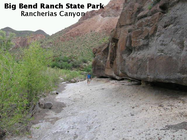
To give you an idea of how difficult the "trail" is as you get deeper into the canyon, take a gander at the following two photos.
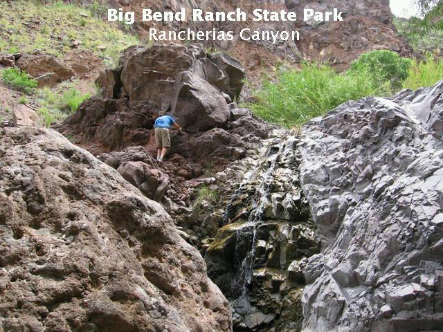
The goal of the hike, other than not breaking an arm or leg, is to reach the waterfall at the end of the trail. After having made it all the way up to the first pouroff, pictured below, we were uncertain as to how far it was yet to the falls and time was running out, even though we got an early start. This is why I think an overnight trip is preferable to a day hike.
Unfortunately, the falls were north of the edge of our topographic map – an "afterfact" we learned. I brought with me the maps recommended by the guidebook, but you need the Agua Adentro Mountain quadrangle in addition to those mentioned in the book. Completely bushed at that point, we reluctantly decided to enjoy the pouroff and the frogs and tadpoles frolicking in the pool at its foot, then head back. However, I did climb to the top of the pouroff to see if I could spy the waterfall in the distance, but without success. I'm still waiting for my Agua Adentro Mountain quadrangle to arrive in the mail, but I suspect we were closer to the waterfall than we thought.
UPDATE: According to the Agua Adentro Mountain quadrangle, it appears that what we saw actually was the falls. Additionally, although the guidebook we had stated it was not advised to continue up the canyon beyond that point, the topo didn't indicate a problem. Of course, with 40-foot contour intervals, not every impediment to travel can always be seen.
Unfortunately, those tadpoles and frogs, and one large snake that streaked across the trail between us, was the only wildlife we encountered. This was very disappointing, as we understood herds of javelina frequented the canyon. Sheesh, you would at least think you'd come across a rattler with all the rock scrambling you had to do. (I'm sure they were there, out of sight.)
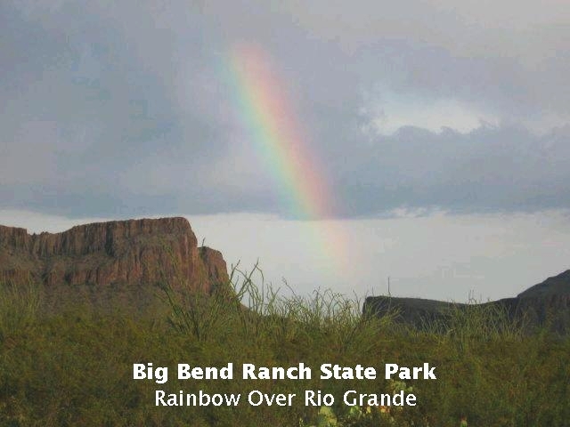
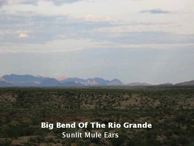
Thunderstorms once again threatened as we finally made it back to the car, and the sun was close to setting. We were rewarded for the day's exertions while returning to Lajitas by a beautiful rainbow over the Rio Grande and a striking view of Mule Ears illuminated by a solar beam piercing the clouds. Then we rewarded ourselves with beer and a delicious, spicy meal at the Starlight Theater in Terlingua.
FORWARD to the Lost Mine Trail
BACKWARD to Persimmon Gap
ALL THE WAY BACK to the Contents