So you want to see some evidence of violent volcanic activity in Big Bend's past? Well, tuff. ...I mean, really. And with that awful pun I introduce you to Tuff Canyon, which is right on the Maxwell Scenic Drive that runs beside the Chisos Mountains on the west side of the park.
Tuff is a type of pyroclastic volcanic material. "Pyroclastic" is basically Greek for "fiery pieces", referring to hot material explosively ejected by volcanic action. Tuff consists of volcanic ash, plus whatever else happens to be thrown out along with it. It can be rather friable (easily broken apart by hand), if it wasn't too hot when it fell and was never consolidated, or quite hard, if it was hot enough for the ash particles to fuse together upon deposition. Typically, tuff has a high silica content, silica being one of the hardest of geological substances.
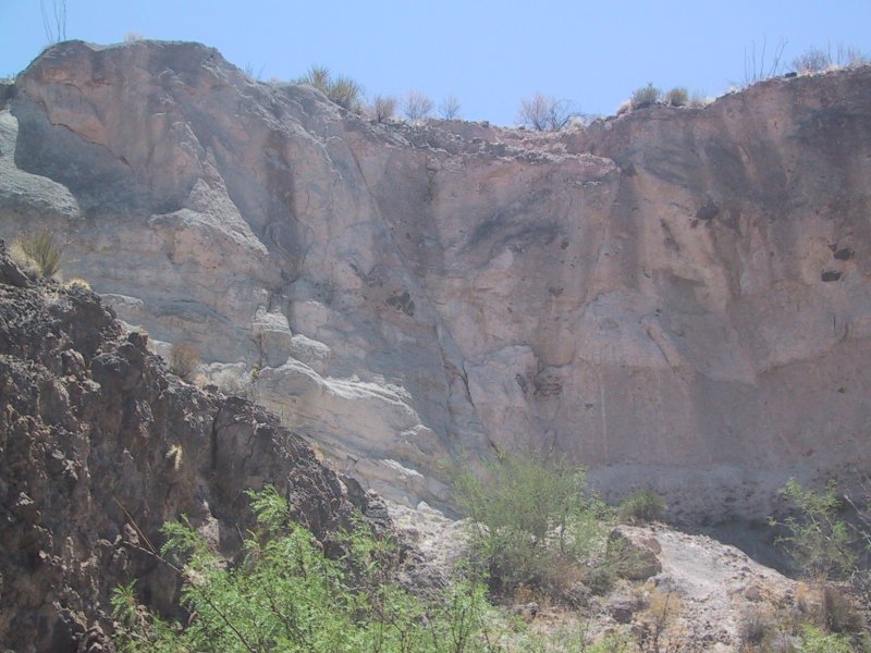
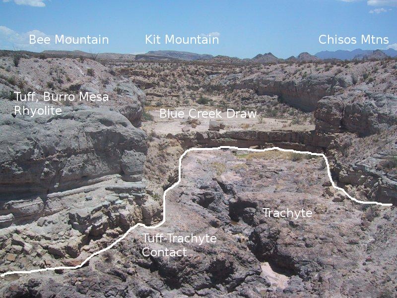
The view below is what you see from the visitors area on the side of the road. I have made some major changes to this feature from the original due mainly to the issuance of the new USGS map, Scientific Investigations Map 3142. In the original I suspected the tuff you see here is the Wasp Spring, although I accompanied that identification with a question mark. The new map says the tuff belongs to the rhyolite member of the Burro Mesa Formation, dating to about 29.4 million years before the present. Also, the rock on which it was deposited is not the Bee Mountain Basalt as originally thought, but a volcanic rock called Trachyte. A radiometric date of this rock sampled at the canyon gives an age of 30.4 million years. Trachyte has the composition of granite but without the significant quartz content.
I also originally speculated that the volcanic ash of Tuff Canyon might rather belong to the what is now called the Mule Ear Spring Tuff member of the Burro Mesa formation and not the Wasp Spring. According to the USGS map that unit does appear farther upstream in the canyon. It dates to around 33.7 million years in the past.
The canyon itself was carved by Blue Creek, usually dry, which rises in the Chisos Mountains seen in the distance. Also seen in the medium distance are Kit Mountain and Bee Mountain.
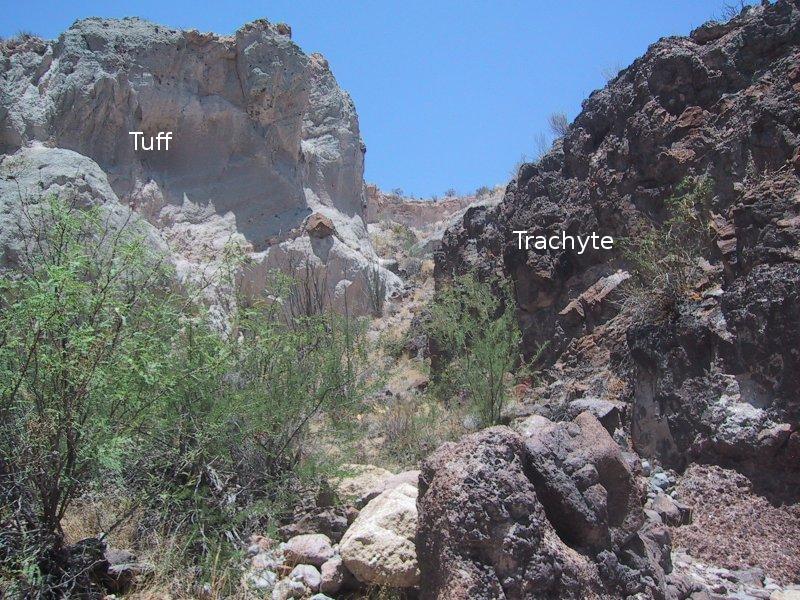
Below, you can see the contrast between the dark trachyte and the light-colored tuff.
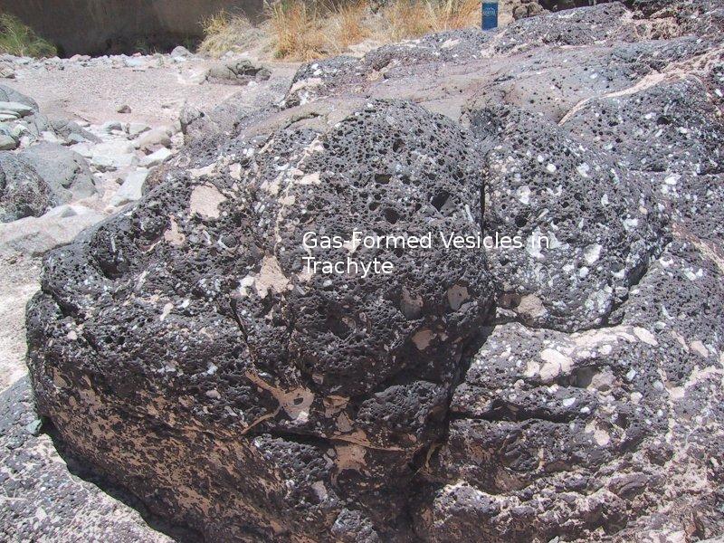
The trachyte is often full of vesicles, which were once bubbles of volcanic gas in the lava. The white stuff is just some of the ashy tuff that has adhered to the trachyte.
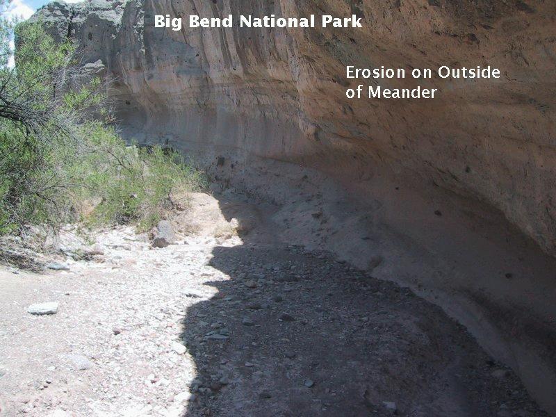
It's interesting that you can find typical stream-formed features in the canyon. For example, there are meanders, which are formed when streams and rivers attempt to reduce their energy as they encounter the friction of the stream bed. Pictured below is the outside of a meander in Tuff Canyon. The outside of meanders are sites of enhanced erosion, which can be seen as the hollowed out area in the image.
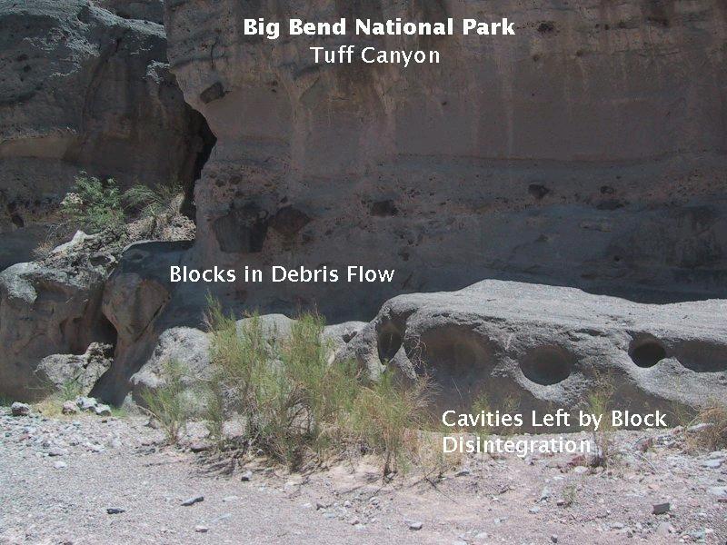
Boulder-sized blocks of rock appear in the tuff in places. Where they have been removed by erosion they leave cavities. Below you can see both some of the blocks and cavities in the dry stream bed.
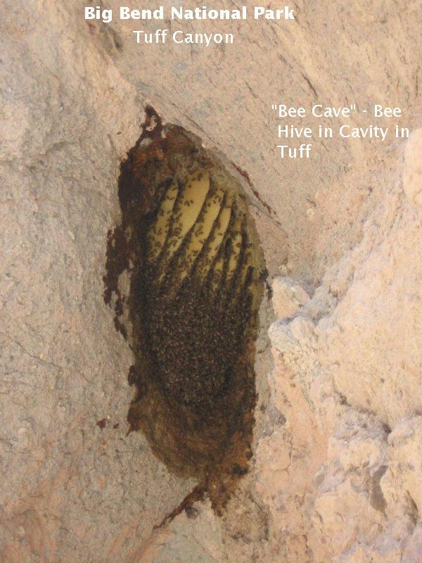
Finally, some of the cavities are great places for bees to settle down and enjoy the good life of making honey from the nectar of desert flowers. Below is one such hive, with some rather yummy-looking honey combs. Note the sand- and gravel-sized particles embedded in the finer ash. The presence of these larger particles (and the blocks mentioned earlier) indicate the tuff was deposited not too far from its source. Ash, being fine, can be carried larger distances in the air than can particles the size of sand, gravel, and boulders. The larger the particle, the more ballistic its trajectory.
FORWARD to the Road to Terlingua
BACKWARD to the Hot Springs Trail
ALL THE WAY BACK to the Contents