I Will Fear No Evil Foreign Tourist: In the Valley of the Shadow of Death
On my way back from visiting relatives in California in July 2018, I decided to spend some time in Death Valley National Park. I thought it might be interesting to compare and contrast this park with Big Bend National Park, so I'm putting it among the Big Bend field trips. Both are desert areas with relatively moist mountains, and both have topographical expressions of the Basin-and-Range Province. This geological province resulted from crustal extension over the past 17 million years accompanied by volcanism. The basin-and-range topography appears to be all over Death Valley National Park. The same is true for Big Bend National Park, but it is best expressed in its "iconic" form east of Tornillo Creek.
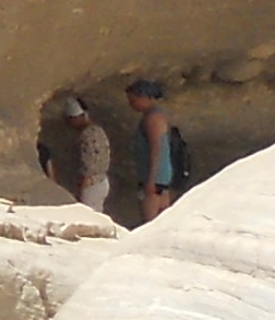
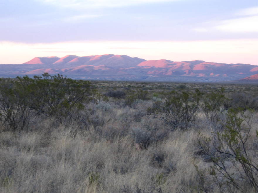
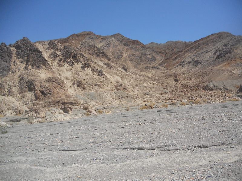
There were quite a few tourists of the foreign persuasion while I was there. One family was definitely French, while others appeared to be northern European – possibly German, Dutch, or Swedish. Also tourists from eastern Asia. Maybe they were originally going to visit Washington D.C. but decided the atmosphere was not as hot in Death Valley. Anyway, a few of them were quite game, hiking into such fire pits as Mosaic Canyon all the way to where it ends in a dryfall. (It appears what we call "pouroffs" in Big Bend are called "dryfalls" out there.) It is a rather short hike, but air off the surface in the afternoon was scorching hot. This was the beginning of an "excessive heat warning". (I thought excessive heat was all you had in Death Valley in July.) I couldn't believe the number of people – and cars – in the park when I was there. I've never seen Big Bend that crowded.
Both Death Valley and BBNP have an extensive volcanic history. There are differences. Both had periods of volcanic activity due to the same basic cause – the collision of the oceanic Farallon Plate with the North American Plate. Notably though, these volcanic periods occurred at different times and not exactly in the same way. The volcanic activity along the western coast occurred mostly during the Mesozoic due to a relatively close-by subduction zone as the Farallon Plate was subducted beneath the North American Plate. (The history of subduction over the Mesozoic was actually more complicated than this, but this simplification will do for present purposes.) The effects of subduction didn't reach Big Bend until the Eocene Epoch, around 200 million years after its effects were beginning to be felt in what is now California.
During the West Texas volcanics, the Death Valley region was fairly quiet. These volcanics extended north from Big Bend National Park to the Davis Mountains and beyond, south into Mexico, and occurred much farther from the subduction than those in California, making them more continental-like and less like volcanic arc action. Hence the Texas volcanics were generally more explosive (as you would expect in a state like ours). After Texas quietened down, the basin-and-range extension led to volcanic action over the Basin-and-Range Province west of Texas, including in Death Valley. There was no basin-and-range volcanic activity in West Texas as far as I can tell.
Another big difference between the geologic history of the two parks involves the periods of mountain building ("orogenies"). The subduction off what is now the west coast of North America led to three pulses of mountain building that affected Death Valley during the Mesozoic. There was another pulse that began in the late Cretaceous and continued into the early Tertiary Period called the Laramide orogeny. None of the references I've consulted mention the Laramide orogeny in Death Valley. It certainly affected BBNP, with major folding and faulting action including a major thrust fault in the Persimmon Gap area.
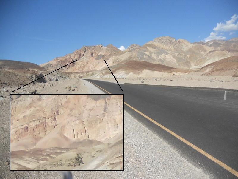
I stayed at the Panamint Springs Resort and began my travels from the western entrance to the park. This was to be the hottest July on record in Death Valley. The first photo, taken about a half mile east of the park entrance and looking north, is of cinder cones consisting of scoria of basaltic composition, basalt being an iron rich volcanic rock which is typically erupted in a relatively quiet manner – for volcanic action, that is. This eruption is said to be of Pliocene age. The Pliocene Epoch, from about 5.3 to 2.6 million years ago, is geologically recent. The volcanism here no doubt is part of that which accompanied the basin-and-range extension, which was an extension of the crust in the Basin-and-Range Province that covers an area from California into southern Idaho, Nevada, Utah, Arizona, southwest Texas, and southward into northwestern Mexico. It is estimated that the Earth's crust was stretched up to twice what it was before. (This is, of course, why the western states aren't even smaller than Texas. ;-) Thinning of the crust like this leads to continental-style volcanic action.
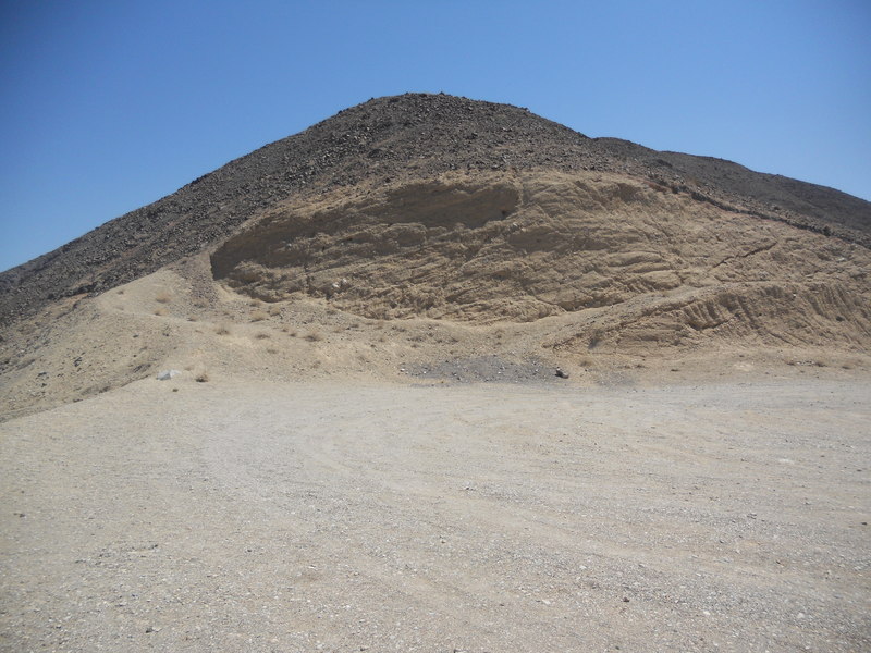
About two miles east of the park entrance, you encounter a deep V-shaped canyon named "Rainbow Canyon". The canyon begins abruptly just to the east of where the road passes the head of the canyon. It quickly deepens to several hundred feet which is likely due to what is called headward growth, where erosion eats back into a planar surface. As you can see below, the planar surface is topped with basalt overlying "granite". (More on this later.) Note the basaltic scoria in the foreground. Scoria is blackish to reddish volcanic rock particles full of vesicles (holes) due to gases in the magma and should be quite susceptible to erosion. (There is enough scoria here to landscape millions of fast-food restaurants and gas stations.) It is clear from the ledge-forming basalt layers, however, that much of the volcanic rock is fairly dense. Basalt is quite susceptible to erosion in wet climates but can be resistant in dry ones.
The above picture was taken from a trail that starts at a turnout you come across after passing the head of the canyon and affords you some nice views. Layers of Pliocene basaltic volcanics overlie "granite" in the canyon wall. The basaltic layers appear to be nearly horizontal, showing that they were deposited after the extreme folding and faulting that deformed older rocks in the park. Also note that the surface on which the basalt was deposited seems pretty horizontal at this location, meaning it had been eroded into a rather flat plane before being covered with volcanic material. Between some of the rows of volcanic rock, there appears to be sedimentary deposition, indicating some time passed between those volcanic events.
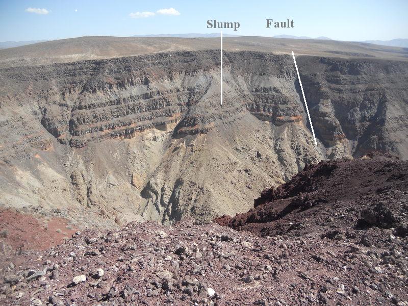
There is some structure evident in the far canyon wall. Not having a geologic map with me with the necessary detail, I can only speculate at what I was looking at. There appears to be a slump in the canyon wall as indicated. Also a fault appears to exist to the right (east) of that. Note that enhanced erosion is taking place in the fault zone, if a fault is what that is. What gives me pause is the lack of a fault scarp at the top of the canyon. However, I cannot think of another reasonable explanation for what is seen here. Fault scarps have been known to disappear from erosion.
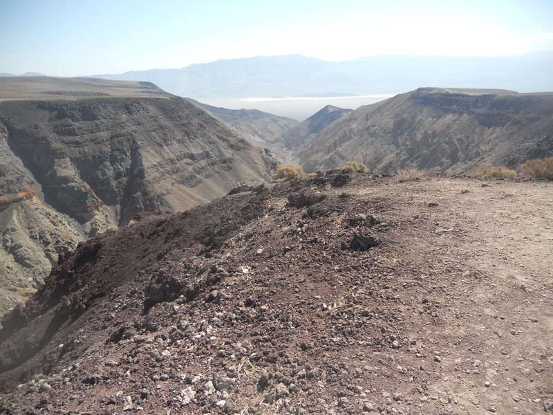
The next photo is looking down the canyon from the same location as the previous photo. Playa-covered Panamint Valley lies beyond the canyon. (A playa is essentially a dry lake bed in a desert region and indicates an internal drainage situation.) The mountains in the distance are expressions of the Hunter Mountain Batholith of Jurassic age, a batholith being a massive igneous intrusion. The rock of this batholith is called a quartz monzonite, which is a granite-like rock but with a somewhat different chemical composition from granite. There are other igneous intrusions in DVNP, and most of them appear to be batholiths. There are numerous igneous intrusions in BBNP also, but they tend to mushroom-shaped intrusions called laccoliths. A view of a notable laccolith in BBNP, the Rosillos Mountains, follows the next photo.
To get a better view of that part of the canyon that gives it the moniker "rainbow", you pull out at a roadcut through, what else, more scoria. The roadcut is displayed in the following image where the beds form an upward folded feature called an anticline. Note the presence of calcite veins in fractures through the scoria. In BBNP there are sediments with similar calcite deposits. (See the second picture below, taken along the River Road in BBNP.) There, as here, this indicates the sediment is quite old (Pleistocene or earlier). Behind this roadcut is a short hike to a view of the rainbow aspect of Rainbow Canyon.
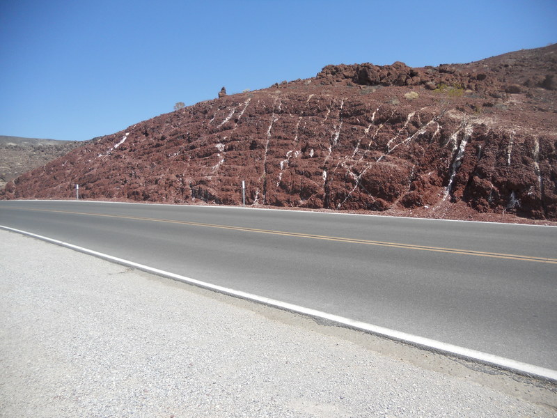
The book I used for a guide on this trip was Geology of Death Valley National Park (GDVNP) by Marli B. Miller and Lauren A. Wright. Professor Wright has extensively studied Death Valley geology and has published much material on this subject. Overall, the book is very good, but it could really use an index. However, the directions given on getting to a view of the canyon here were not the best as far as I'm concerned. If you follow their directions you go up the right side of the roadcut. There is a blocked off short scoria-gravel road, then a trail that appears to have been an old road. After that ends you have a bit of a scramble up scoria – not the best of footing. There is a trail that parallels the canyon. I went back down on the left side of the roadcut, and that seemed to me to be a shorter an easier route to the trail that follows the canyon ridge, although you do have to clamber over roadside railing.
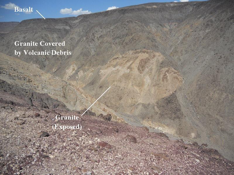
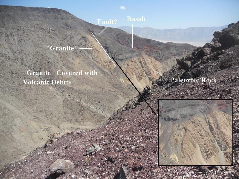
I ended up taking pictures from a low "saddle point" on the southwest rim of the canyon. In the image below looking northwest you can see the basalt layers overlying what GDVNP refers to as granite whose magma intruded Paleozoic rocks (which don't seem to be present in this photo but will appear in the next). According to GDVNP the "granite" is the same Jurassic quartz monzonite as that of the Hunter Mountain Batholith and, in fact, is the same batholith. I had a hard time believing this at first as the Hunter Mountain Batholith is miles away across Panamint Valley. On the other hand, the faulting due to the basin-and-range stretching might certainly have separated the batholith. For brevity I will refer to the quartz monzonite as granite.
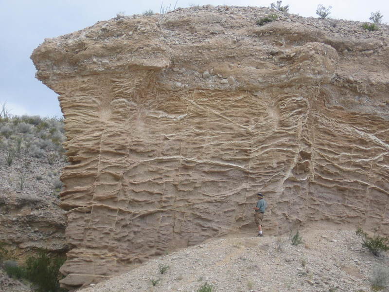
The next photo looking east contains the basalt, the granite, and the Paleozoic rock it intruded. Disappointingly, GDVNP does not identify the folded rocks other than saying they are Paleozoic limestone. I have not yet found a reference that identifies them more specifically in time and by formation name. The enlarged view in the insert clearly shows the angular unconformity between the basalt and the Paleozoic rocks. The beds are almost perpendicular to each other. The black line connects equivalent points in the broader picture and the insert. An angular unconformity indicates a large span of time between the age of the rocks beneath the erosional surface and the material above it. Clearly a lot of time passed between some time in the Paleozoic and the Pliocene, but a decent estimate cannot be made without knowing the geologic period of the Paleozoic rock.
Note that the basalt layers above the Paleozoic rock are truncated against the granite as indicated by the white line. GDVNP does not specifically identify this as a fault, but it certainly looks like one to me. The label "Granite" in the photo is in quotes because, although GDVNP seems to identify it as the monzonite, when digitally magnified I could see what appeared to be either bedding or foliation in the rock. (Unfortunately, I left my binoculars at home.) I'm not convinced it is not the Paleozoic limestone.
You can see a cairn just beyond the upper left corner of the insert. This was stacked on a steep (about 30 degree) slope with nothing for your feet to hold onto but the treacherous scoria. I don't know who had the balls to create this cairn or how the work was managed, but I hope the person's bones aren't at the bottom of the canyon.
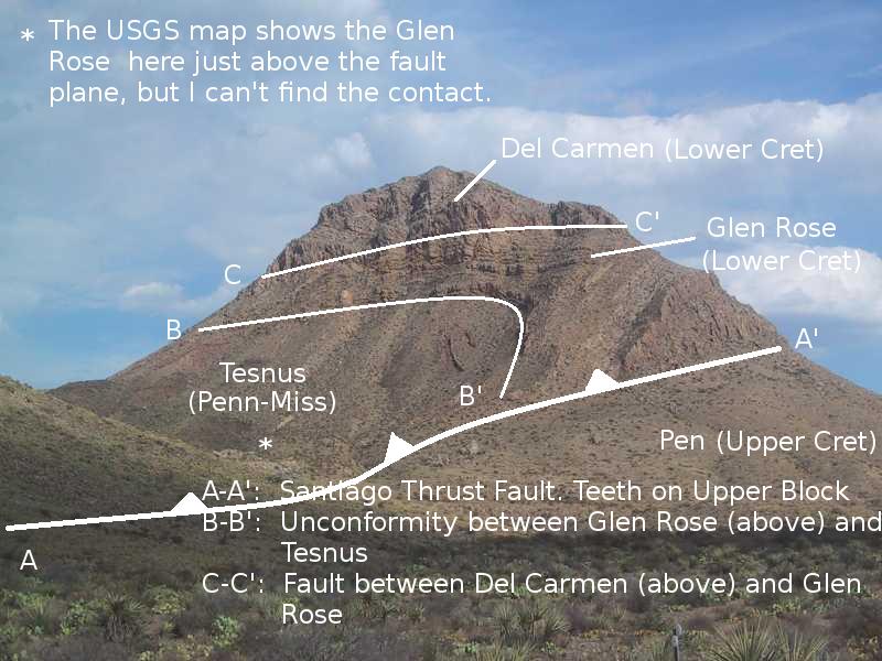
In Big Bend the major unconformity is between the Paleozoic (Carboniferous) Tesnus Formation and the Mesozoic (Lower Cretaceous) Glen Rose Formation, a time span of at least 160 million years. (See the photo below of Persimmon Peak.) This does seem to correlate to some extent with the unconformity exposed in Rainbow Canyon. In Big Bend there are no rocks between the Carboniferous Tesnus Formation and the Glen Rose. In Death Valley there are some rocks due to volcanic action during the Triassic Period, but no other rocks other than granitic intrusions until you get to the continental sediment depositions of the Oligocene Epoch. By this time Big Bend had already seen millions of years of sporadic volcanic activity. There was no invasion of the Cretaceous sea in the Death Valley region as there was in Texas. Rather, uplift and erosion was largely extant in the region after the Carboniferous and in Big Bend after the retreat of the Cretaceous seas. Uplift continues in both areas today. Since then only volcanics, continental sedimentation, and erosion have occurred.
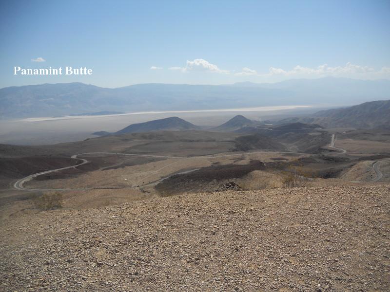
Let's back up a bit to a place called Father Crowley Vista Point to get a view of the road down into Panamint Valley. You can see Panamint Butte in the distance and the light salty sediment of the playa. Panamint Butte is covered with basaltic volcanic rock of the same age and likely same origin as that of the cinder cones seen earlier and what's underfoot at Father Crowley's. (The photo was taken at the end of a gravel road where the gravel was trucked in, so you don't see scoria in the foreground.) Panamint Butte is underlain by Pennsylvanian and Permian rock, according to GDVNP. Some of this could be the Paleozoic rock of Rainbow Canyon, but the book doesn't say. The valleys formed here are very recent – only a few million years old – which makes the idea that the rock I was standing on could have once been continuous with the mountains across the valley more believable. Rainbow Canyon is off the left in the distance. You pass Father Crowley's before you reach the canyon.
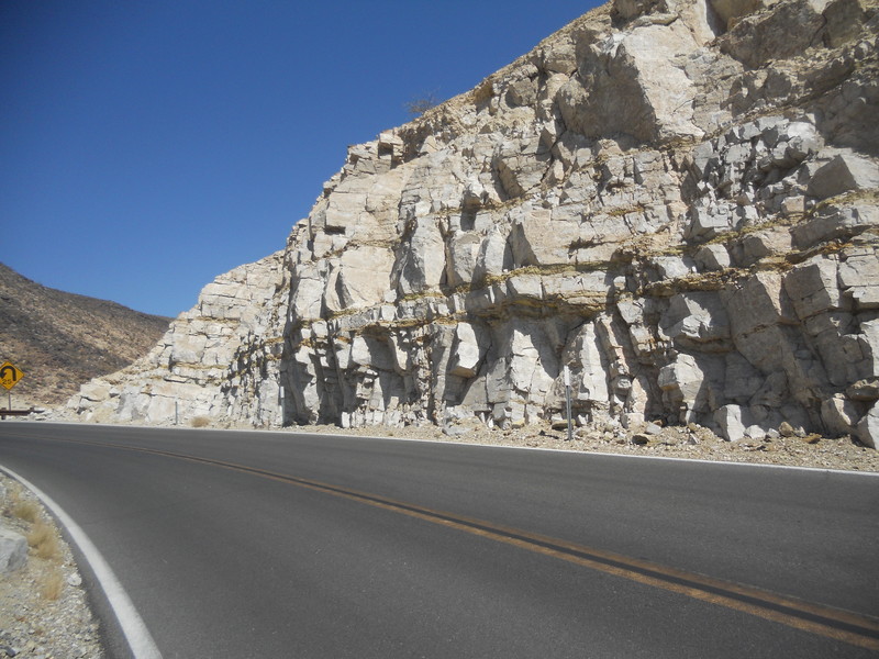
The next photo is of Paleozoic limestone in a roadcut after you pass Father Crowley's and before you reach the roadcut where you get access to Rainbow Canyon. Note that the beds are horizontal here rather than vertical like in Rainbow Canyon, but presumably they belong to the same formation. Again, there is no information on a more specific age or formation name. There is some Paleozoic limestone in BBNP in the Persimmon Gap area: the lower Ordovician Marathon Limestone and in the middle to upper Ordovician Maravillas Formation, which also contains chert and shale. Both the lower Paleozoic rocks of Big Bend and the Death Valley Paleozoic rocks were deposited when the areas were passive continental margins (in plate tectonic jargon).
About 3.5 miles farther along from where Rainbow Canyon was viewed there is a turnout where the young age of a basalt flow is obvious due to it resting on alluvium. The alluvium may have been part of an alluvial fan, which is a fan-shaped deposit of alluvium typically due to debris washing out of valleys in desert mountains. This means this area had already been subject to mountain building before this volcanic activity.
After passing over the flat floor of Panamint Valley, you climb up into the Cottonwood Mountains toward Towne Pass. Off to the left you can see the colorful rocks (if gray is a color) identified in GDVNP as belonging to the Nova Formation. These apparently consist of alluvial fans hardened into rock of either Pleistocene or Pliocene age. Looks like they were faulted upward by late basin-and-range action with other rocks to form the Cottonwood Mountains. In fact, Death Valley itself is only a two to three million-year-old basin-and-range feature. The rocks in the foreground appear to be more of that Pliocene basalt. The photo is not a telephoto, by the way. My telephoto zoom quit working, so I had to magnify the image digitally.
In BBNP the basin-and-range faulting, as in DVNP, affected the entire park, but the effects, to me, are most obvious in the mountains east of Tornillo Creek, where there is a plethora of horst and graben structures. Horsts are up-faulted crustal blocks that form mountains, whereas graben is something Donald Trump does to women. Check that. A graben is a down-faulted block that forms a low area, often a valley or a basin.
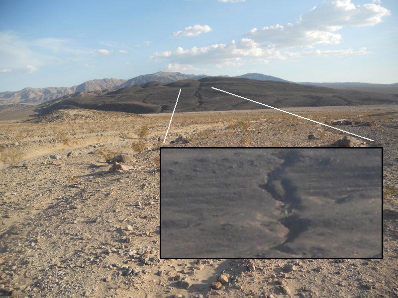
The basin-and-range extension occurred over the entire park, however, resulting in numerous steeply dipping normal faults that trend south-southeast to north-northwest. (Normal faults, as opposed to abnormal faults – ahem – are formed by tension and usually have steeply dipping fault planes.) These faults have resulted in several down-dropped basins east of the Sierra del Carmen and Sierra del Caballos Muerto Mountains. The most evident of these is the Tornillo Creek bolson. (A bolson is a flat valley or depression in a desert area.) It is bounded on the west by the Dugout Wells fault. Others are the Chalk Draw Basin in the northern part of the park and the Delaho Bolson in the west. Take a look at the Tornillo Creek bolson in the following image with the high Chisos Mountains in the distance. The Dugout Wells fault is just this side of the mountains.
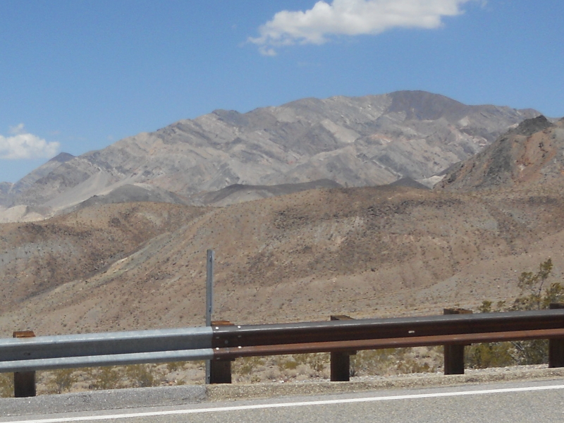
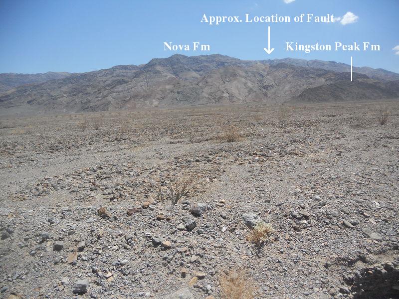
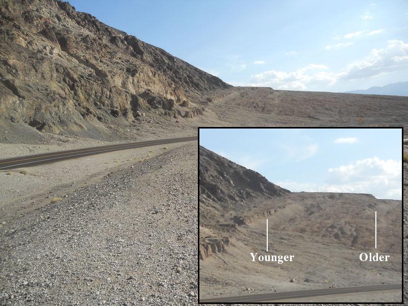
You come across some faults while passing over the Cottonwood mountains. GDVNP says you can see the Towne fault at Towne Pass. Unfortunately, they give no other directions on which way to look or what you might see. The rocks at that location were broken up in all directions, so I had to shrug that one off. They did a better job in pointing out the Emigrant normal fault a few miles farther east. The picture below is looking south. It isn't easy to pick out the exact trace of the fault, but the arrow points to its approximate location. The Nova Formation on the east side is relatively recent – Pliocene or Pleistocene – and the Kingston Peak Formation on the west is Precambrian. There is likely a time difference of close to 700 million years across this fault. There are no Precambrian rocks in BBNP.
After passing over Towne Pass I continued to head down California highway 190 to Stovepipe Wells. Just before you get there you pass the road to Mosaic Canyon. A few miles of bumpy primitive road gets you to the canyon and adjacent to the Mosaic Canyon fault, which is seen (or not) in the following picture. This is a low-angle normal fault and mostly what you see here is the ground-up rock in the fault zone. The fault lies between two Precambrian formations: the Noonday Dolomite and the Johnnie Formation consisting mostly of shale. In their proper stratigraphic order, the Johnnie lies conformably on top of the Noonday, and in fact the Noonday grades upward into the Johnnie. (Conformably means there is no time gap – or at least no apparent time gap – between the formations.) You get out of the fault zone and into the Noonday Formation as you enter the canyon.
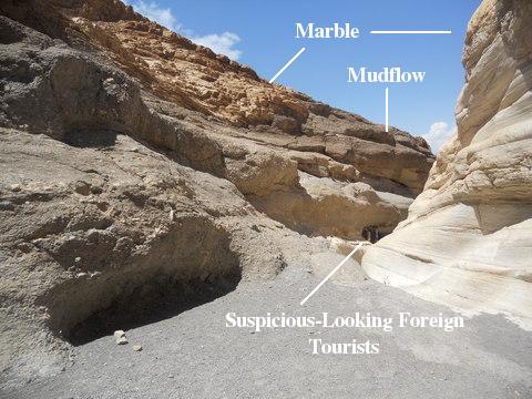
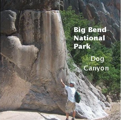
The GDVNP book says the mudflow deposits in the canyon resulted in "stunning" mosaic patterns. Stunned foreign tourists lying on the canyon floor proves them correct. (Some were not so stunned as the introductory picture shows.) Whatever, after entering the canyon you get views like the one below. The dolomite, which results when magnesium substitutes for calcium in limestone over long periods of alteration by fluids, has been metamorphosed into marble, a recrystallized and denser form of limestone or dolomite. Thousands of years of flash floods has smoothed the marble on the side of the canyon. Much the same occurred in Dog Canyon in BBNP. The following photo shows the mudflow overlying the polished marble and the one after that the polished limestone in Dog Canyon.
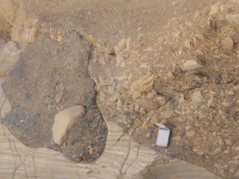
In the next picture you can see a contact between much older (Precambrian as mentioned) marble and the much younger mudflow deposits. The book does not give an age for the mudflow, but it is almost certainly Pleistocene or even earlier. The rock fragments caught up in the mudflow are responsible for the mosaic pattern. There was a great deal of variety in the clasts (fragments of geological detritus) in the mudflow deposits. They ranged from large to small and from angular to well-rounded. There were also lenses of angular clasts between layers where the clasts were smaller. There was no stratification in the deposits, indicating that it was probably a one-time event. The marble was evidently an erosional surface at the time, looking pretty much as it does today – again indicating how recent the mudflow was.
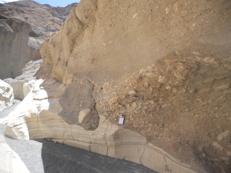
The next picture is a closeup of the mosaics in the previous photo. Note the wide variety in size and type of clasts and the large boulder-sized clast. The notebook is for scale. Also note the variation in thickness of layers in the marble, possibly indicating a flow of the rock under pressure when it was well underground. (Marble, limestone, and shale are particularly susceptible to deformation due to temperature and pressure.) An extreme example of deformation in BBNP is found at Persimmon Peak, an interpretive photo of which appeared earlier.
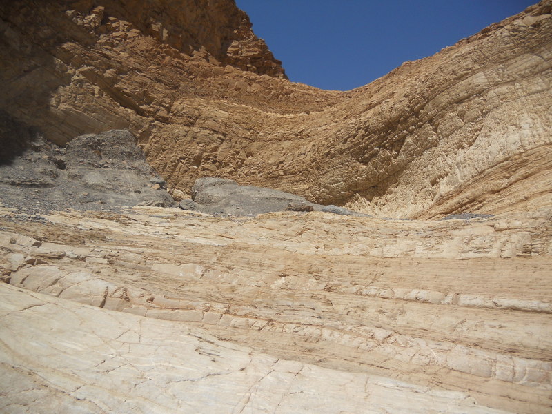
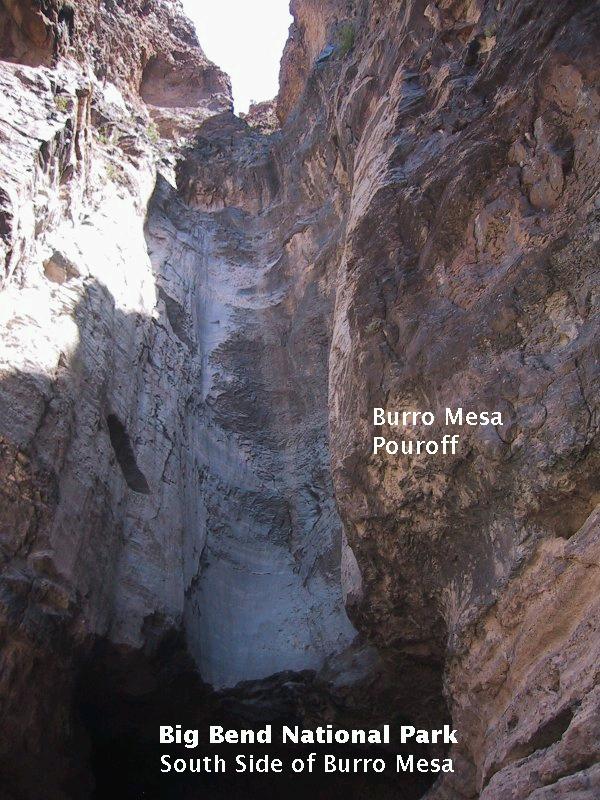
The hike up Mosaic Canyon ends at a dryfall, what we call "pouroffs" in Big Bend. I understand there are numerous pouroffs in DVNP just as there are in BBNP. Note the patches of remnant mudflow in the picture below. Following that is the Burro Mesa pouroff in Big Bend for comparison.
After leaving Mosaic Canyon and passing through Stovepipe Wells, you come upon a popular attraction: the sand dunes to the north of the highway. I did stop for a few minutes but declined to go out on them. After all, I've seen enough sand dunes in Saudi Arabia to last me a lifetime. So, it was now down to the south, through Furnace Creek and onto the road that goes down the west side of the Black Mountains. You might at first wonder how they got their name, but they definitely get black by the time you reach Badwater Spring, the lowest subaerial point in the United States.
My first stop on the west side of the Black Mountains was Desolation Canyon. This is one of several "wine glass" canyons in the mountains, so-named because they widen upstream from a relatively narrow outlet. This topography is supposed to be due to a period of erosion widening the canyon followed by a recent uplift with renewed erosion that carved out the narrow "stem" of the "wine glass" at the mouth of the canyon. The dark rock on the left is an outcrop of the Ordovician Ely Spring Dolomite. This, so far, is the only "black" in the Black Mountains.
My next stop was going to be Mushroom Rock, shaped like that from being sand-blasted over the millenia into what is called a ventifact, a rock sculpted by wind and sand. However, there were no signs, and I drove back and forth a couple of times to see what I might have missed. No Mushroom Rock was to be found. Only after I got back and searched online did I find out that it had been so abused and broken down that the park service has taken it off the list of things to be seen in DVNP. It is apparently a shadow of its former self. Very sad.
Next on the agenda was to motor around Artist Drive. This is a one-way narrow road, which will serve to mess me up a little. One point of interest is the fault responsible for the creation of the Black Mountains called the frontal fault. The foot wall of the fault and the striations on it caused by movement along the fault are visible at points from the road. The place from which to view the fault according to GDVNP was quite far away, but not wanting to miss the opportunity on this very long one-way road, I took the photo. Later, I saw a place much closer, but it was too late. Cars were behind me and this extremely slow RV was in front. I had to settle for a digital magnification to bring out the striations, which is what you see below. In the inset they are the markings going upward from left to right. In the field they trend to the southeast, indicating both dip-slip and strike-slip components of motion along the fault. Also, as you can see, the Black Mountains ain't yet so black.
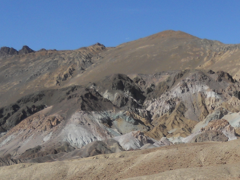
The major attraction on Artist Drive is the Artist's Palette, seen in the photo below and the closeup after that. GDVNP makes a bit of a sin of omission here in that it neither gives the age nor the type of rock you are looking at, part of the Artist Formation. From my experience the colored rock, especially, had to be volcanic ash. Some research upon returning home revealed that the Artist Formation consists of both sedimentary and pyroclastic layers. Pyroclastic deposits result from explosive volcanism and have a high content of silica (silicon dioxide). The colorful rocks indeed consisted of volcanic ash created by pyroclastic action as I had thought.
The Artist Formation originated between 14 and 7.5 million years ago, that is, in the Miocene Epoch, the epoch immediately before the Pliocene, during which the basaltic volcanics mentioned before occurred, and immediately after the Oligocene Epoch, which saw the end of volcanic action in BBNP. The Artist Formation eruptions therefore date to the basin-and-range extension. There is an error in GDVNP regarding what gave the rock its color. I knew immediately that attributing the green to "reduced iron" was a mistake. Reduced iron, if anything, is just metallic iron! The yellows and reds are indeed due to oxidized iron. Green is due to decomposed mica, although I have not been able to find out what element gives it that color. Green mica in metamorphic rocks, fuchsite (mind your mouth!), gets its color from impurities of chromium ions. The purples in the Palette come from impurities of manganese, not iron oxide as claimed in the book. The site is quite colorful, but some of the online photos I've seen are definitely color-enhanced.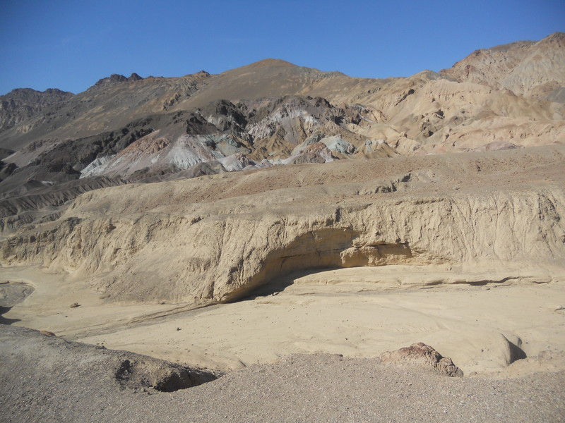
There have been numerous pyroclastic events in the Big Bend region, but none have been as recent as the rather unconsolidated material seen at Artist's Palette. Most of the more colorful formations in BBNP are sedimentary deposits.
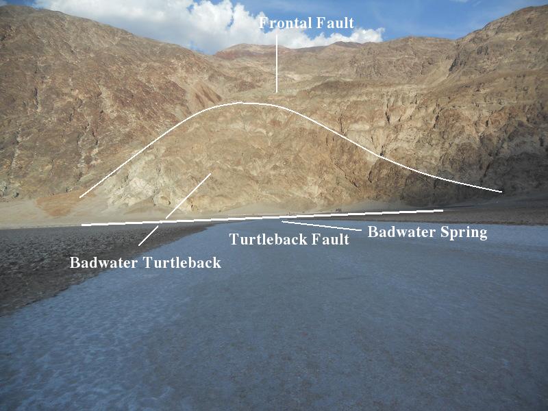
Badwater Basin is 279 feet below sea level and is the lowest point you can be in North America without diving gear. The water isn't so bad for some critters such as aquatic insects and the Badwater snail, but it is too salty to drink. The water originates in a spring, which, according to GDVNP, appears to be associated with the fault at the base of the Badwater turtleback (more in a minute). This is still active as is indicated in the following photos. Looking south, you see two small fault scarps in the alluvium bearing witness to recent motion along the fault. The relative age of the scarps is evident in the degree of degradation. Fault planes can act as underwater dams causing the pooling of groundwater.
The next photo, looking east, is of the Badwater turtleback. Turtlebacks are landforms shaped like a turtle's shell, formed as part of the hanging wall of a fault is detached from the foot wall along another fault. Thought to be unique to Death Valley, it has been argued that similar structures occur in areas of crustal extension in other parts of the world. The low Sun was not in the best location to display depth in the landscape. The curved white line is the ridge of the turtleback – the frontal fault of the Black Mountains lying in a crease just beyond it. The turtleback fault is at the base of the turtleback as shown. The lowest topographical point is actually west of the spring, and I'm guessing this is why there is a "salt superhighway" extending westward. I was probably very close to that point when taking this picture.
My final entry is of Shoreline Butte, looking west with Telescope Peak of the Panamint Mountains in the background. This location is quite a few miles south of Badwater Basin. There once were lakes in DVNP during cooler and wetter glacial times (no glaciers in Death Valley, of course). The lake that carved the wave-cut terraces visible in the insert in the photo below was Lake Manly, which occupied Death Valley thousands of years ago. In spite of down-dropped crustal blocks in Big Bend, there were no geologically recent lakes like Manly, at least none of any size that I'm aware of. The introduction of the Rio Grande into and through the park possibly prevented anything like that from happening.
BACKWARD to Pine Canyon
FORWARD to TBD
ALL THE WAY BACK to the Contents