A Mountain Range is Born: Pine Canyon
The high Chisos Mountains owe their existence to what happened 32 million years ago at the location of Pine Canyon. A small but violent caldera, the Pine Canyon Caldera, spewed out volcanic material high in silica, which tends to form rocks resistant to weathering and erosion. Silicate rocks are based on a tetrahedron consisting of a silicon ion (with an atomic charge of +4) surrounded by four oxygen ions (each with an atomic charge of -2) that form the corners of the tetrahedron. This configuration gives the tetrahedron a net charge of -4, which makes it a very versatile building block. One possibility is that the tetrahedra share oxygen ions to produce a mineral like quartz, which has two oxygens for each silicon atom in its pure form. However, there are a lot of positive ions available in the Earth's chemistry; such as sodium, potassium, calcium, iron, magnesium, and so on; and the number of silicate minerals formed from combinations of silica tetrahedrons and positive ions is enormous. The most abundant type of mineral is feldspar, which comes in a mind-boggling number of varieties, just on its own.
The more silica in the mineral, generally speaking, the more resistant it is – and thus the rock that contains it – to weathering. The high silica content of the rocks formed due to the action of the Pine Canyon Caldera has served to protect softer rocks they rest on. The high Chisos are a result, not so much of uplift, but of the fact the surrounding landscape has been eroded away more rapidly.
A caldera forms when a magma chamber beneath but close to the surface empties out due to venting of lava. If the overburden is too heavy for the magma chamber to support, the chamber's roof collapses and the result is a violent eruption, resulting in pyroclastic flows (literally "fiery pieces"): extremely hot volcanic ash, rock fragments, and volcanic gases. These flows can be deadly and were responsible to a large extent for the death toll from the recent (as of this writing in 2018) eruption of the Fuego volcano in Guatemala. Lava flows and ash falls also occur, as do "flash floods" of hot mud called lahars. All these forms are found as a result of the activity of the Pine Canyon Caldera.
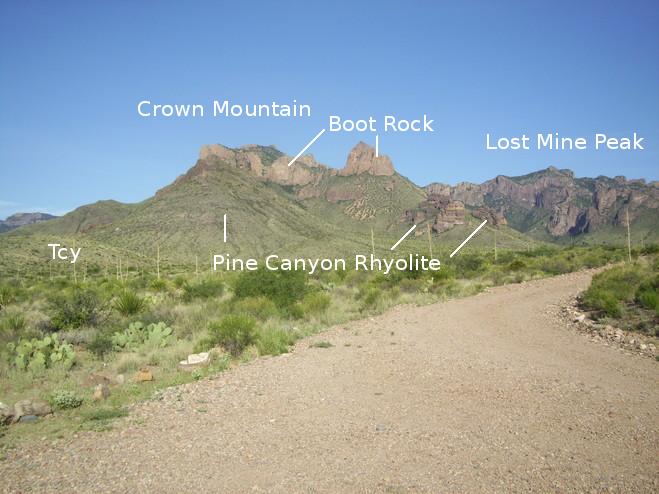
The road into Pine Canyon takes you into the heart of the caldera's remains. As you enter the canyon driving in a westerly direction, the following scene greets you. Crown Mountain and Lost Mine Peak are in the directions indicated in the photo but are not seen. What you do see is the Pine Canyon Rhyolite, the first major product of the calera's eruption. This deposit consists of the solidified pyroclastic flows mentioned above, forming a type of rock called ignimbrite. Rhyolite is a highly silicic rock with the composition of granite, and in the case of the Pine Canyon deposit, it is largely in the form of ignimbrite. Above the rhyolite is another deposit of rhyolitic composition: the Boot Rock unit. This unit contains a variety of volcanic rock, including ash-flow tuff, lava flows, volcanic breccia. Tuff is consolidated hot volcanic fragments, typically ash and rock fragments, and breccia consists of broken-up pieces of rock that can result from such things as landslides. The label "Tcy" refers to the foreground rock that belongs to the undifferentiated younger material, subscript "y" (but older than the Pine Canyon), of the Chisos Formation (dating to the Eocene and Oligocene epochs) on which the caldera rocks were deposited.
The rocks extruded by the Pine Canyon Caldera constitute the South Rim Formation. The oldest member of this formation is the Pine Canyon Rhyolite. Resting on the Pine Canyon is the Boot Rock member and above that is the youngest member, the Emory Peak Rhyolite. In addition there are three other members: the Ring Dike member, outflow deposits, and undifferentiated intrusive rocks. It looks to me as if the last two members have not been well characterized yet and await further study. Neither the Emory Peak nor the outflow deposits appear in Pine Canyon. All these rocks were emplaced about 32 million years ago and have since been eroded into the shapes now seen.
Pine Canyon starts out wide and gradually narrows until your reach the Pine Canyon pouroff. There are a number of pouroffs in Big Bend. They become waterfalls on the infrequent occasion when sufficient rain falls. Since my brother, Randy, and I were taking this hike after a relatively wet spell, we had hopes of seeing water at the pouroff. In the meantime, you content yourself with the canyon views. The following is of Crown Mountain, looking south, with outcrops of the Pine Canyon and Boot Rock making interesting scenery. The top of Crown Mountain is the fluted looking object in the distance.
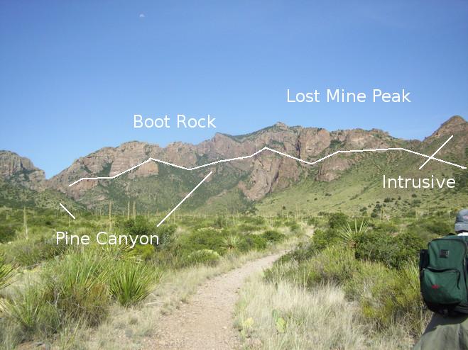
Straight ahead as you hike are the mountains forming the western wall of the canyon as well as the western boundary of the caldera. Both the Boot Rock and Pine Canyon members circle the location of the spent caldera. In the photo below I indicate roughly the arc of rock at the western side of the canyon. More or less, the rock above the segmented line is the Boot Rock deposit and below, the Pine Canyon member. On the extreme right of the photo the mountain is topped by the only instance of the undifferentiated intrusive rocks of the South Rim Formation in this part of the canyon.
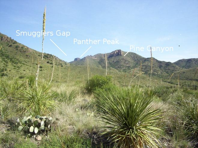
Below is a view to the north with Panther Peak on the far left. Smuggler's Gap is just over the foreground ridge on the left. The mountain in the center has outcrops of the Pine Canyon Rhyolite on this side, but its unseen summit consists of the Boot Rock.
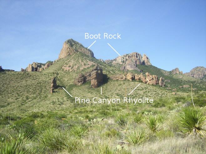
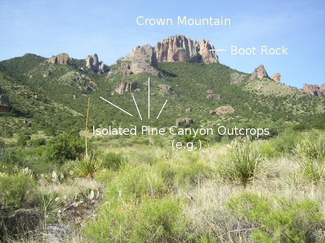
We are now farther up the trail and abreast of Crown Mountain. It is certainly easy to see how it got its name from this viewpoint. The "crown" is Boot Rock, and there are numerous isolated outcrops of Pine Canyon.
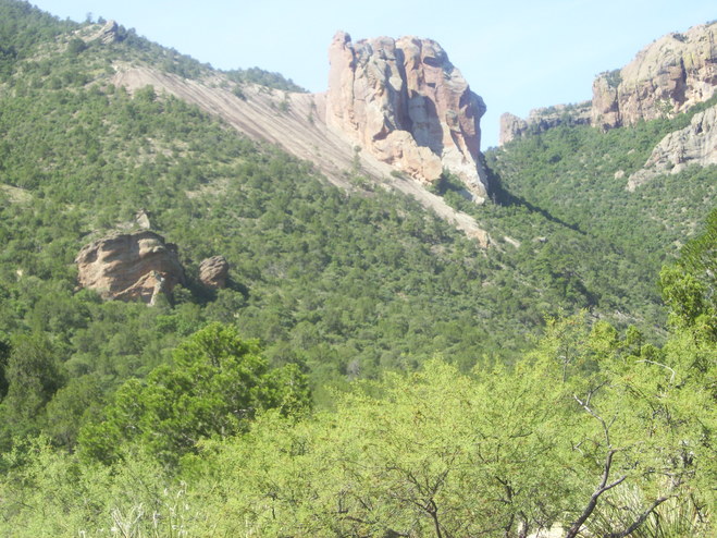
And here is an interesting-looking Pine Canyon member outcrop.
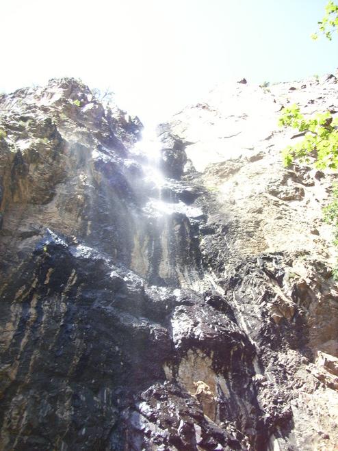
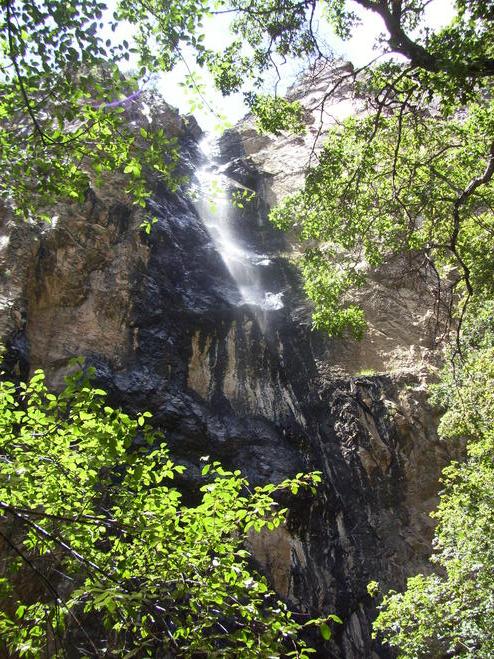
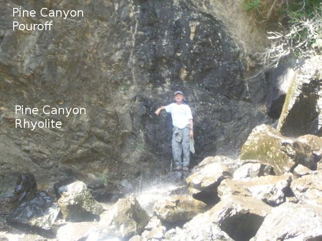
After making your way through a narrow forest as the walls of the canyon close in on you, you finally come to the Pine Canyon pouroff. And, we are in luck. There is still enough water from recent rains that the pouroff is a waterfall. The wall of the pouroff, etched in the Pine Canyon Rhyolite, has been polished by ages of water-borne silt and clay. Also note the abundant black desert varnish.
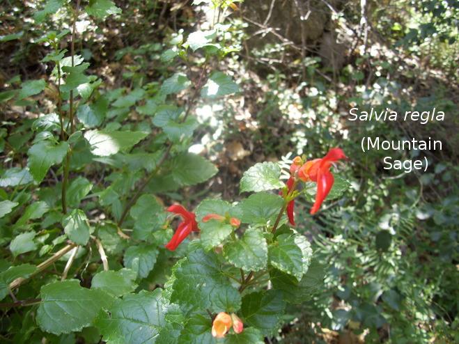
The presence of moisture in the sheltered pouroff area, even when there is no waterfall, produces a flora distinctly different from the desert you hike through to get here. In the following photo you can enjoy the color of Mountain Sage (Salvia regla).
Randy decided to enjoy the cool effect of the waterfall by standing behind it.
Now it is illegal (and immoral, if not fattening) to break off rock samples without a permit. So I had to look around for a natural subject. What I found is shown in the next picture.
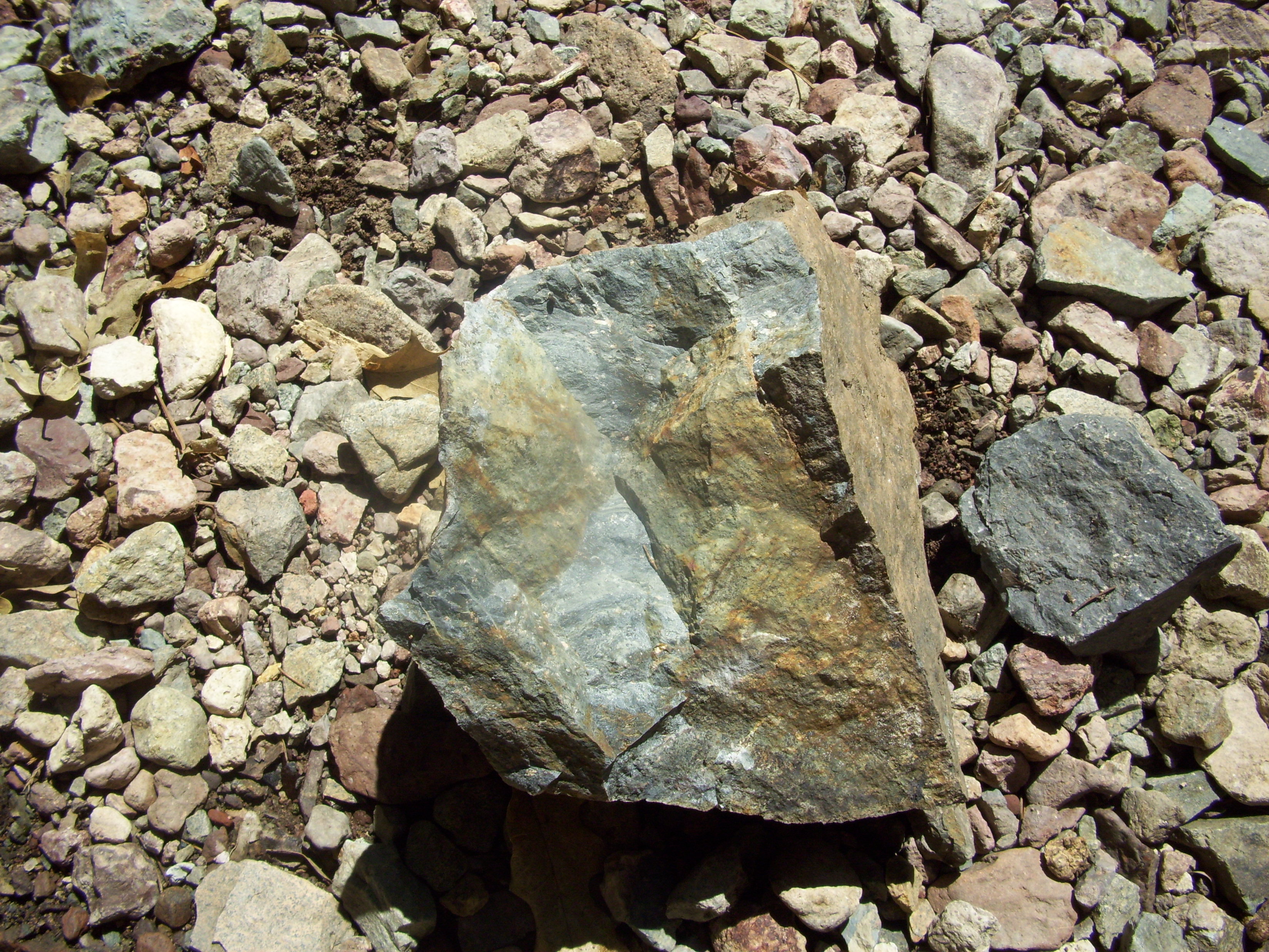
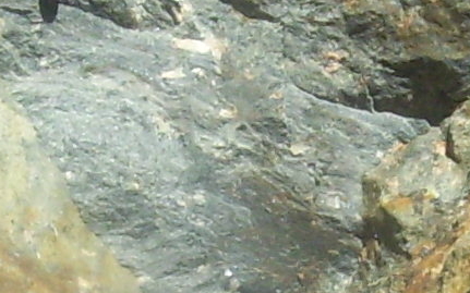
I examined this sample of the Pine Canyon Rhyolite and characterized it as follows. There are phenocrysts sparsely present in the groundmass of the rock. The most common phenocrysts appear to be quartz and potassium feldspar, but there was also a clear mineral with well-preserved cleavage, possibly plagioclase feldspar. I was stretching myself a bit since it was a long time ago I took a class in minerology, and that was the best I could do. A phenocryst is a relatively large crystal (visible to the naked eye) embedded in a background of small (not visible to the naked eye) crystals (the groundmass). The typical story you hear in geology class is that the larger crystals formed while the magma was cooling slowly. Later, when the rate of cooling increased – for example when the magma is extruded on the surface as lava – the rest of the magma cooled too rapidly for sizable crystals to form. In the following pictures are close-ups of a couple of relatively fresh surfaces of the rock. Note the wavy pattern in the groundmass, which may indicate some flow while the rock was still hot and malleable.
 |
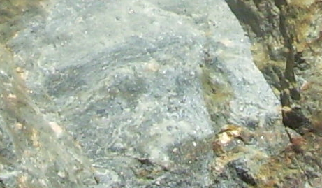 |
I realize you aren't going to get a whole lot out of the above images, but that's the best resolution the old digital camera has. The rhyolite here at the pouroff was dated radiometrically. The answer came to 32.1 million years of age.
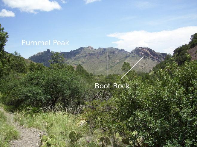
As we leave we catch a view toward the northeast of a mountain range with Pummel Peak on its northern end. These mark the northern border of the old caldera. They are topped with the Boot Rock member, but no doubt the isolated outcrops on the slopes are Pine Canyon Rhyolite, just as is the case for Crown Mountain.
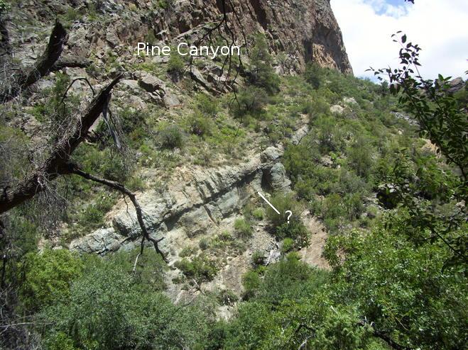
On the way out I espied a feature that looked like a sheet-like intrusion in the Pine Canyon Rhyolite. Or, possibly it was a tuff bed in the Chisos Formation the rhyolite was resting on, but there are no Chisos outcrops mapped on this side of the canyon on the recently published USGS map, Scientific Investigations Map 3142, 2011. So, I've marked the feature with a question mark as you can see. I should have crossed the gully to take a closer look, but time was a-wastin', and we needed to get back in time to set up camp while it was still light. We couldn't help but spend a good bit of time in the pleasant surroundings of the pouroff. This is an easy hike that I strongly recommend, especially if there has been recent rainfall.
FORWARD to TBD
BACKWARD to The Mariscal Mine
ALL THE WAY BACK to the Contents