Erosion As Sculptor: Estufa Canyon
Estufa means "stove" in Mexican Spanish, but the canyon was not living up to its name when we began our hike. Cold weather is not unusual in Big Bend during December (we were at Estufa Canyon on the 28th), but low temperatures were in the twenties that day. A complication to the below-average temperatures was the prospect of a winter storm bearing down on West Texas, with several inches of snow forecast. My brother, Randy, and I headed down the trail wondering if we'd need to improvise snow shoes to make it back. In spite of the ominous forecast, the clouds stayed away on our first day in the canyon, allowing the air to warm up for a pleasant afternoon's hike. (I did this hike again in April, 2014, this time alone. My brother, Randy, was off in other parts of the park birding. Some of the material that follows was from that hike.)
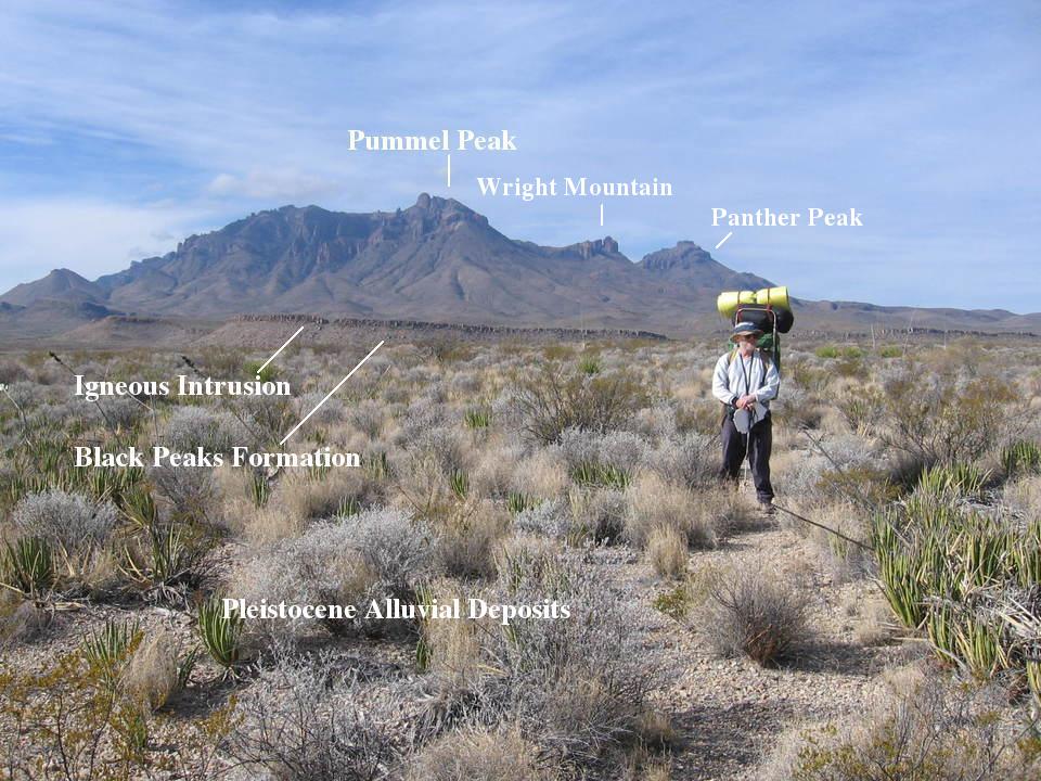
The following picture was taken on the first trip, looking west. To the left and right of that fine specimen of manhood in the photo is a line of intrusive igneous rock, possibly a sill. On the recently published USGS map, Scientific Investigations Map 3142, 2011, it is designated as "Tsi", intrusive rocks that pre- and postdate the activity of the Pine Canyon Caldera. Pummel Peak marks the northeastern edge of its remains. If it is a sill (a sheet-like intrusion of igneous rock that follows, in this case, preexisting bedding planes), then it is evidently resting on top of the Black Peaks Formation. At any rate, the Black Peaks Formation, is at the base of the ridge, as shown in the picture. The Black Peaks consists mostly of non-marine mudstone and sandstone, and was deposited from the late Cretaceous into the Paleocene. The surface on which our hero stands consists of desert pavement lying on top of Pleistocene alluvium (water-deposited sediment).
Behind Sir Totes-a-Lot, out of view between the igneous outcrops, is the Chihuahuan Desert Research Station. On my second trip to Estufa Canyon, there were researchers there tracking radio-collared mountain lions. They could tell when one made a kill. Then they would go to that location to see what the lion had eaten. (Fortunately, only occasionally a backpacker ;-) ). Pretty interesting stuff.
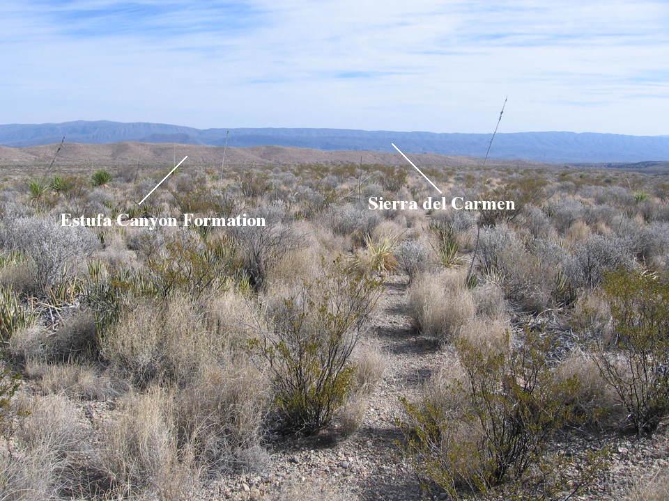
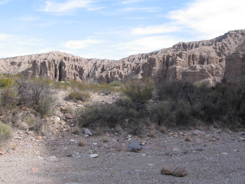
If you turn around and look to the east, you see the sediments out of which Estufa Canyon was carved and, in the far distance, the Sierra del Carmen. Estufa Canyon is in the Estufa bolson just to the east of the Chisos mountains. A bolson is a large, flat-floored basin often formed by a block of the Earth's crust that has subsided between surrounding faults. It is a topographical term generally restricted to the Basin and Range Province of North America. The down-faulted block responsible for this bolson is called the Tornillo graben. Several drainages from off the pediment on the east side of the Chisos Mountains combine to form the drainage that has eroded down through the sediment, creating Estufa Canyon.
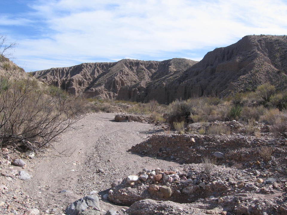
In the image below please ignore my brother and direct your attention to the topography behind him. (The view is toward the north.) The low area running from left to right on this side of the hills in the background is the arroyo that connects downstream to the dry creek that meanders through Estufa Canyon, heading for Tornillo Creek. The erosive forces have exposed the Eocene Canoe Formation beneath the geologically recent alluvium of Quaternary age, designated Qya (after Berry et al. in USGS Circular 1327). The hills in the background are underlain by the (informal) Estufa Canyon Formation (designated QTa, again after Berry et al.). These are older alluvial deposits, dating back to as old as the Pliocene, although their actual age is not well established. These are the sediments that form the walls of the canyon.
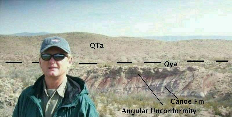
The Canoe Formation marks the beginning of volcanic activity in Big Bend, as it consists of deposits of tuff (defined as rock composed of volcanic ash and rock fragments) along with clay, mud, sand, and a few basalt flows. The mud and clay are "tuffaceous" (containing volcanic ash). In the image above, the Canoe lies beneath the Quaternary alluvium with its white and reddish beds at an angle to the bed above, forming an angular unconformity. However, check out the following picture I took on my second trip down the canyon. It appears that the beds of the Canoe trend toward horizontal to the left. As you will see farther down the trail, the Canoe and alluvial beds seem to become parallel. (Without doing careful mapping, however, you can be fooled by your perspective.) After considering what I saw in my second trip down, I think that the Canoe may have an undulating bedding pattern in this area: generally horizontal but with slight ups and downs. Additionally, the beds may have been affected by geologically recent Basin and Range faulting that created the Tornillo graben. The Miocene rocks that are exposed on the east end of Estufa Canyon below the alluvial beds are absent here. Were they present, they would lie above the Canoe and below the more recent alluvium. They must have once been here, as indicated by their presence at the west end of the graben at other locations, but were victims of erosion.
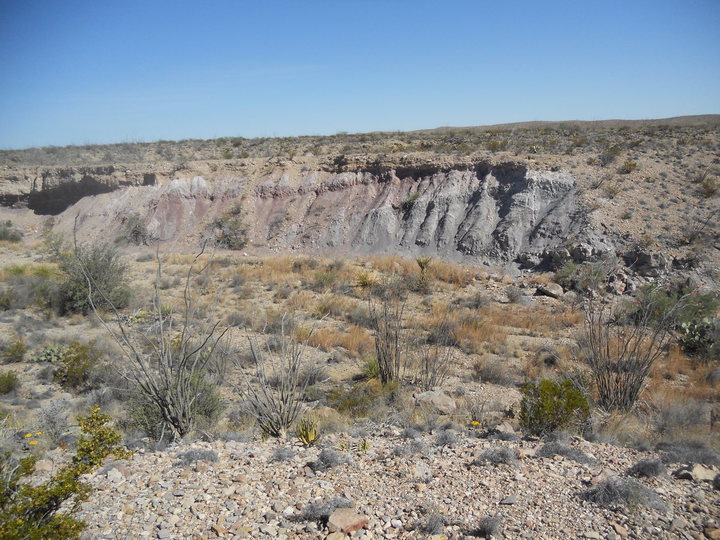
The dashed line in the second photo above, graced by the visage of my bro, marks the approximate surface trace of a fault belonging to the north-south trending Dugout Wells fault zone that establishes the western boundary of Tornillo graben, where the side we are on has moved up with respect to the far side. This is shown by the presence of the much older Canoe Formation on this side of the fault at about the same elevation as the younger alluvial deposits that underlie the hills (QTa). If erosion eats down fairly evenly on both sides of a steep dip-slip fault, older rocks on the upside of the fault will be seen at the same topographic elevation as younger rocks on the downside. The latest movement on this (Basin and Range) fault has to be relatively young, as it cuts through the Estufa Canyon sediments and is therefore younger than these. No major faults are shown on the east side of the graben on the recently published USGS map (Scientific Investigations Map 3142, 2011), indicating either the eastern side must be warped downward to the west or there is a fault of unknown location buried beneath the sediment on the east side.
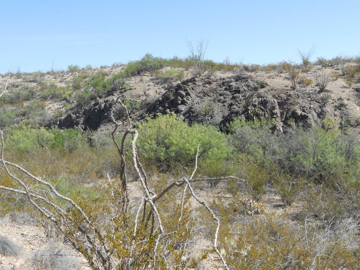
The following image is of an outcrop of the Canoe Formation composed of volcanic, gray-colored tuff. It is not well-consolidated and is probably heavily weathered but does contain relatively large crystals called phenocrysts (not visible in this picture) in a fine-crystalline background. These appear to be feldspar due to their light color and rectangular shape.
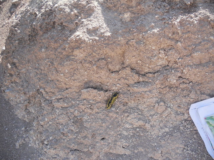
Here is a photo taken farther down the drainage that spills into Estufa Canyon. This seems to be the same type of rock shown in the previous photo. The rock is quite degraded; however, the phenocrysts of feldspar are still present and visible. The pocket knife is there for scale.
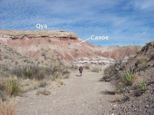
As you hike down the drainage toward Estufa Canyon, you descend stratigraphically through the Canoe Formation until you cross the fault mentioned above. In the following image, looking north, you see the younger alluvium atop the older Canoe Formation. Here, the Canoe appears to contain a lot of tuff and/or tuff-bearing sediment. Also, as pointed out above, the Canoe beds now appear to be more or less parallel to the alluvium. The parallel pattern was also seen in other locations farther down the same drainage.
After you cross the fault, you are in the informal Estufa Canyon Formation of Stevens and Stevens (Bulletin of the American Museum of Natural History, vol 279, p 177). ("Informal" means that it hasn't been generally recognized by the stratigraphic community, but often informal units are formalized if the work done in defining them stands the test of time and conforms with accepted code.) This sediment is thought to be basin fill derived from the direction of today's Chisos Mountains, deposited by flash floods on alluvial fans from the late Pliocene through the early Pleistocene (Berry et al). This sediment is also labeled QTa on the recently published USGS map.
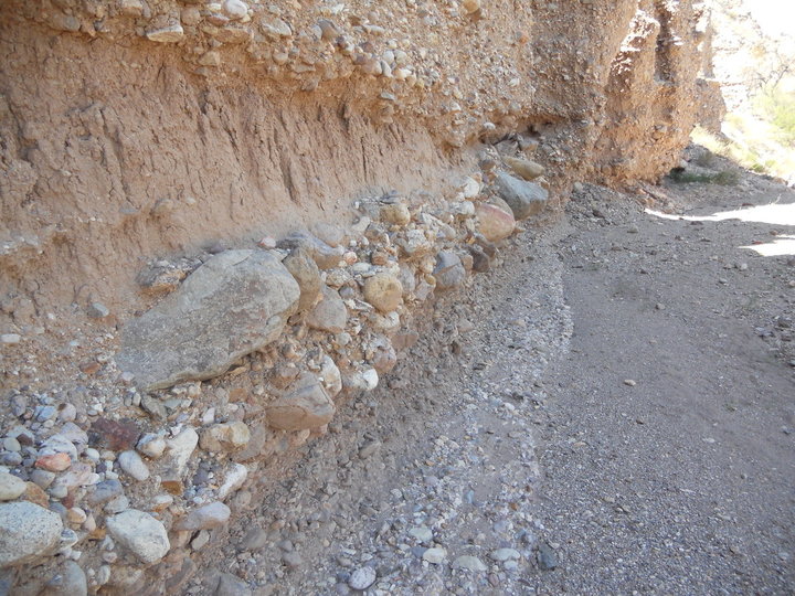
The picture below shows an outcrop of this formation in Estufa Canyon, just to the left of a cave (not seen in this photo) apparently formed by erosion of flash-flood waters. The rounded gravel and cobbles indicate they were weathered over time by running water, probably during a wetter climate in Big Bend. However, the sediment is very poorly sorted, indicating it was deposited rather rapidly by strong currents in its current resting place. The rounded clasts ("clast" is essentially the geology term for originally loose fragments of rock) and the poor sorting likely indicate an extended period of time when the clasts were weathered, deposited, and redeposited during occasional flash floods on an alluvial fan until being finally buried by subsequent flash flood debris.
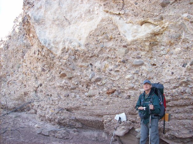
A sheet of calcite is located above my brother Randy in the photo above. Accumulation of calcite is usually part of the evolution of soil in relatively dry climates. Geologists classify this evolution in four stages, where stage III and IV are the oldest. The sediments we encountered were well-cemented with calcite (stage III) as shown here, but the sheet of calcite indicates this sediment has reached stage IV. The advanced calcite evolution is the reason this sediment is thought to be several hundred thousand years old.
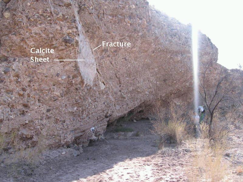
The calcite sheet mentioned above is in sort of an "island bar" in the canyon, in this case an erosional remnant where the currents have eaten down deeper on either side. A cave has been formed by water undercutting the "island". Note that the calcite sheet appears to have formed by deposition in a fracture in the rock. The sheet has probably been exposed by failure along the fracture, such that the rock on the camera side of the fracture has fallen away. (Or, maybe the calcite sheet is responsible for the fracture.) You can also tell in this picture that the beds are dipping to the east (since the photo is taken facing the Sun in the south). Recall the beds on the west side of the Dugout Wells fault zone were virtually horizontal. Farther down the canyon the beds will become close to horizontal once again. The dip of these rocks is probably due to their being just to the east of the Dugout Wells fault.
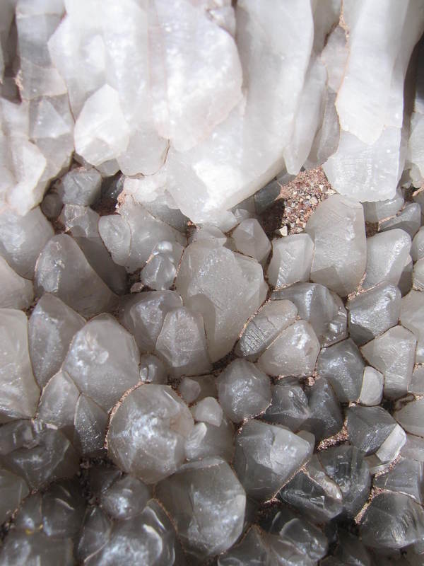
Below you see some of the nice calcite crystals found in the rocks of the Estufa Canyon Formation. Calcite seems to be almost everywhere in Big Bend. (If you happen to come across crystals like these, please leave them for others to enjoy. Also it is unlawful to collect in Big Bend.)
The informal Estufa Canyon Formation is a conglomerate. As indicated above, it appears to be due to many hundreds of thousands of years of sand, gravel, and cobbles being water-deposited as alluvial fans on the east side of the Chisos. Sand is moved fairly easily by swiftly running water, but gravel and cobbles are difficult to move and only move appreciably during periods of very strong flow such as during flash floods. Gradually, these are buried beneath more sand, gravel, and cobbles transported by later episodes of moving water. Now that the area is subject to net erosion rather than net deposition, the work of countless years of flood waters is exposed in Estufa Canyon.
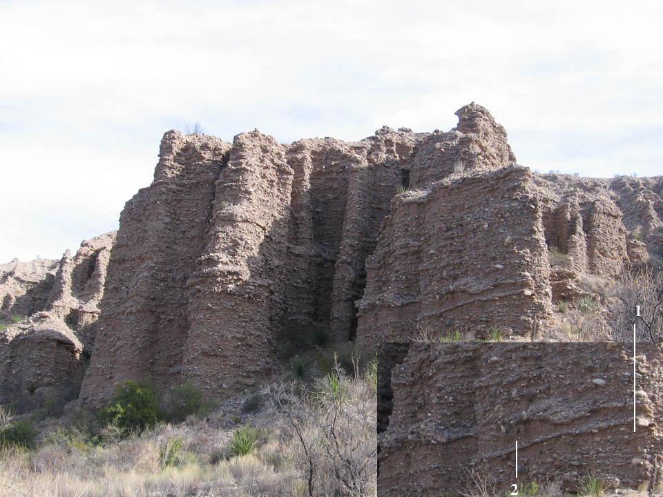
The picture below shows a cliff of the Estufa Canyon Formation. Note the bedded pattern, irregular but roughly parallel, which implies water deposition. In the inset you can see a detail of the depositional pattern. The line marked "1" indicates cross bedding, which could be due to the removal of earlier material by water action, followed by new deposition. Also note ("2") that finer material alternates with coarser material, indicating changes in the speed of the sediment-carrying water. For example, a fast flow may erode much of the finer clasts, leaving the coarser clasts behind, or, in another instance, may be strong enough to transport sand and clay, but not gravel. A slowing of water speed may allow finer material to be deposited. Hence, the coarseness of the clasts in sediment is an indicator of the speed of the water that deposited them.
Next is a photo of a lens of fine sand and clay in either the Estufa Formation or possibly the unit designated as "Qia", late to middle Pleistocene alluvial sediments, in the new USGS geological map. (These sediments look a lot alike to someone – like me – who is not an experienced sedimentary petrologist and both are found in the canyon.) Perhaps this was originally a swale (a marshy depression) that was eventually covered by debris from a flash flood. As you can see, some of the clasts are boulder size. They obviously had to be moved to where they are as they rest on other deposits.
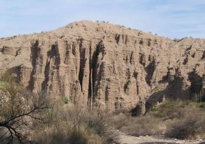
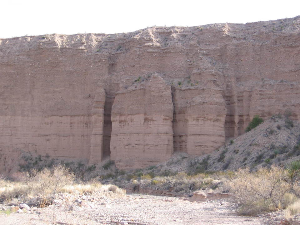
Farther down the canyon, the canyon walls get higher and the erosional topography more severe (at least as viewed from the canyon floor). The following photo is reminiscent of badland topography, and the satellite view of this area shows a parallel drainage pattern in the QTa sediments, but looking a little more dendritic in the Miocene sediments. A parallel drainage pattern looks just like its name: parallel drainages, whereas a dendritic pattern looks like the growth pattern of plant roots.
The walls of the canyon can reach heights close to 100 feet. Not as impressive as the canyons of the Rio Grande by any means, but the erosional beauty helps to make up for that. The following is a typical view, a couple of miles, more or less, from Tornillo Creek.
As you approach Tornillo Creek, you descend stratigraphically into older rocks. Below you see the Estufa Canyon Formation overlying the Banta Shut-in Formation of Stevens and Stevens of late Miocene age. (The Miocene occurred between 23 and 5 million years ago.) The Banta Shut-in Formation is noted for its Miocene mammal fossils (Stevens and Stevens). The overlying sediment looks very much like the Estufa Canyon Formation farther west, except that it consists of finer sediment than the conglomeritic texture seen in previous images above. In a previous incarnation of this virtual field trip, I wondered if it could be that all this sediment belongs to the Banta Shut-in Formation. Comparing the recent USGS geological map and our photos to Google Earth images, it is clear that this is the Estufa over the Banta Shut-in. The finer sediment is likely due to it being deposited farther from the source (the Chisos to the west). This spatial pattern is typical of sediment deposition around mountain ranges, as the heavier detritus gets deposited first where the water flow is stronger. As the flow weakens on gentler slopes, the lighter material settles out.
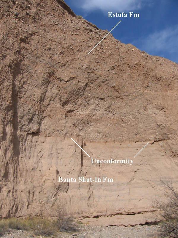
Although the contact here could be interpreted as indicating a sudden change in depositional environment, other areas (Stevens and Stevens) have shown the contact to be an erosional one with apparently a significant time gap between the deposition of the Miocene Banta Shut-in and the Pliocene to Pleistocene Estufa Canyon Formations. The next image appears to bear this out, as an uneven surface between the two formations is clearly evident. Note how the clasts get coarser higher in the Estufa Canyon section. This could be due to increasing topographical relief, an increase in precipitation, or both. A break in deposition is called an unconformity. Since the sedimentary beds appear to be parallel, or nearly so, above and below the contact, this would probably be designated a type of unconformity called a disconformity, as indicated in the two pictures below.
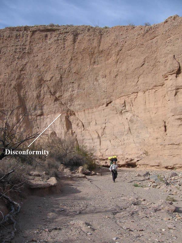
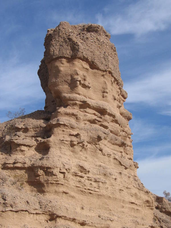
As you approach Tornillo Creek, the erosion becomes more advanced. Below you see an erosionally formed column containing the Estufa Canyon-Banta Shut-in contact. The Banta Shut-in Formation was divided up into several "members" by Stevens and Stevens. The rock seen in the picture below and those above apparently belong to the Bench member.
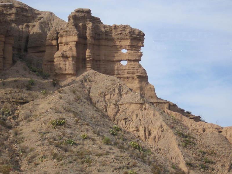
Now here's a weird sight. Erosion has eaten through a thin wall in the Banta Shut-in Formation, creating what appear to be cannon holes, and yet another column of rock, like the one pictured above, is apparently in the making. Since no battles were ever fought in this area to my knowledge, I guess these are really "canyon holes" (yuk, yuk).
I am a bit confused over the stratigraphy in this area as described by Stevens and Stevens. As you leave the canyon and approach Tornillo Creek (as we were doing when the above image was taken), according to them you cross first the Bench member of the Banta Shut-in Formation, then the Lower member of this formation. These units are described in their paper by stratigraphic sections but not much verbal description, and none of their stratigraphic sections were drawn at this location. In the previous incarnation of the field trip, I puzzled over what I saw versus what I thought Stevens and Stevens were describing, but in this version I am just putting this to rest for the time being. I don't have enough information to really say anything worthwhile.
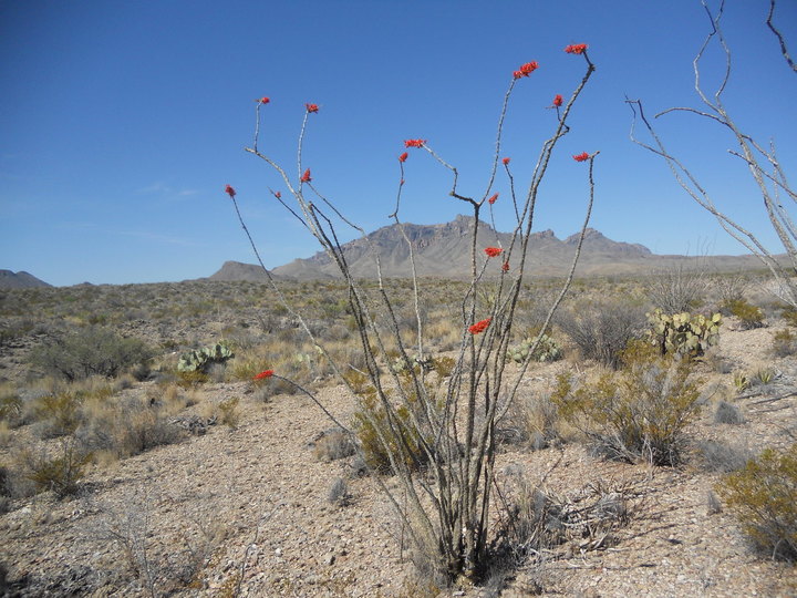
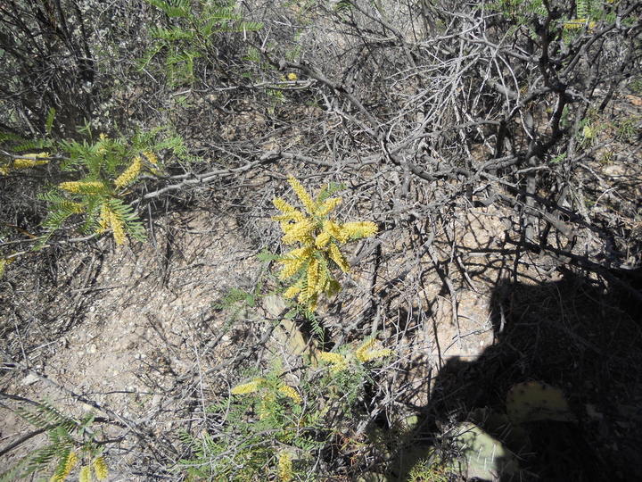
Finally, turning from geology to botany, here are a couple of pictures for you flower lovers. Both were taken on my second trip down Esufa during April. The first is a blooming ocotillo, just before you descend into the drainage that runs into Estufa Canyon. The second was taken later, of a flowering mesquite bush. The insects were having a field day collecting nectar.
BACKWARD to Mesa de Anguila III
FORWARD to Blue Creek Canyon
ALL THE WAY BACK to the Contents