"Rollin'... Rollin'... Rollin' on the River" Road East
I've been up and down the River Road a few times, but every time I was planning on visiting a certain location. Nevertheless, the geology along the road between locations was often fascinating, and finally, in October of 2019, I got my chance to do some more intensive exploring. There was a secondary motivation, returning to Mariscal Mine to check out the Ellis mining era, which I in my ignorance had overlooked when I was there years earlier.
The trip was not to be without its perils, however, mostly due to camera problems and absent-minded-professor issues. In many past entries in this virtual geology field trip feature I have bemoaned the less than stellar utility of the camera I own. Actually, I used to have a Canon Elf that worked great until I dropped it in a Sierra Nevada stream. So I started using my wife's Nikon. Not a bad camera if all you want to do is take pictures of your kids, but with a solid-state screen and no view-finder, it was difficult to use outdoors. It kept acting up the whole time and finally gave up the ghost when I dropped it in the Sierra de Chino. Luckily, I was able to retrieve all the pictures.The first camera problem occurred shortly after I exited the road to Boquillas onto the River Road. Not far up the road I saw what appeared to me to be the Aguja Formation on top of the Pen Formation. The Pen Formation, upper Cretaceous, is mostly of slope-forming clay which transitions upward into the basal sandstone member of the Aguja, also upper Cretaceous. The Aguja records the transition from a marine to a terrestrial environment at Big Bend. What I was looking at was just like the basal sandstone of the Aguja resting on the yellowish clay of the Pen. The problem was the USGS map (Scientific Investigations Map 3142, 2011) did not show this here. I took a picture but it was totally out of focus. The automatic focusing mechanism was not working. Later I remembered I could take photos with my wife's old iPad, which I was carrying with me since I had downloaded the USGS map on it.
By the time I got the camera operating, I was down the road and too late to document the question of Aguja on Pen. The first photo that came out OK was of San Vicente Mountain. This mountain, like Mariscal Mountain, was formed as an anticlinal fold during the Laramide orogeny. This was a mountain-building event that occurred over most of western North America in the late Cretaceous to the early Tertiary, beginning as early as 80 milliion years ago and ending as late as 35 million years ago. (The exact dates are disputed.) There are other features in Big Bend due to this event such as Mesa de Anguila. San Vicente Mountain is almost entirely in Mexico. Just a sliver of a nose of it is cut through by the Rio Grande.
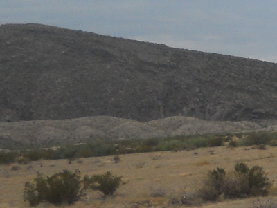
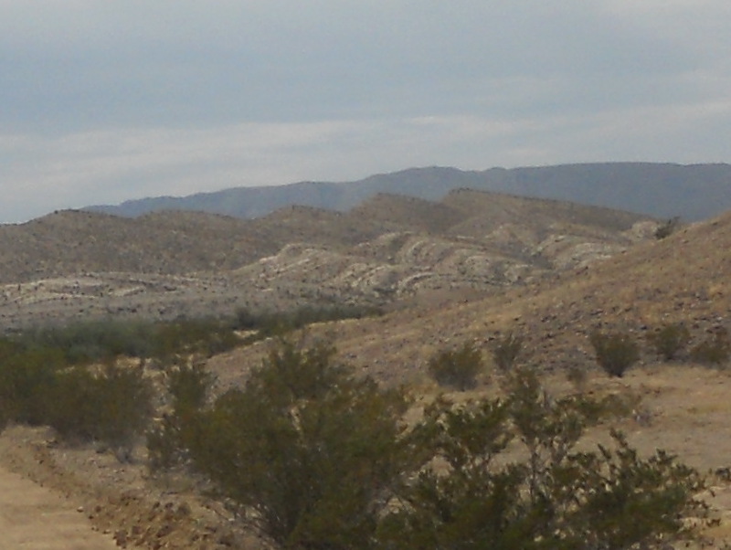
The next picture was taken looking SSW toward the northern edge of San Vicente Mountain. Since the mountain is an anticline, beds on this side (the NNE side) are dipping more or less toward the camera. The beds in the image are of the San Vicente member of the upper Cretaceous Boquillas Formation. The mountain itself mostly consists of the lower Cretaceous Santa Elena Formation. The San Vicente member of the Boquillas lies on top of the older Ernst member, which according to the USGS map does not outcrop in the area shown by this picture – at least not significantly. Both the Boquillas and the Santa Elena were deposited in a shallow sea. The Santa Elena is largely limestone whereas the Boquillas is largely a "dirty" limestone, containing clay and silt, indicating it may have formed closer to land.
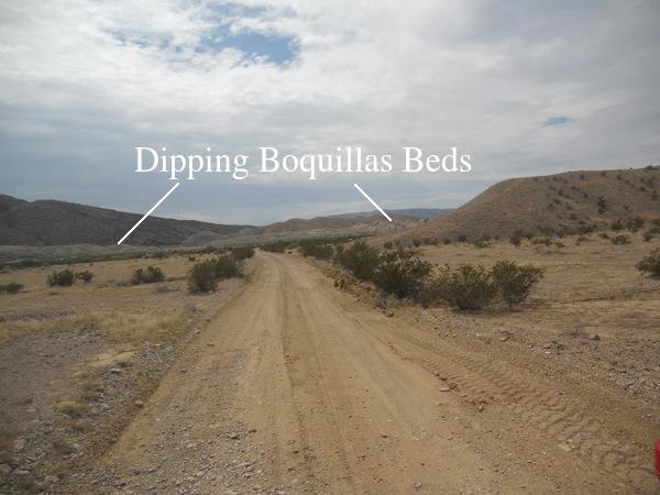
The following two images are of the dipping beds indicated by lines in the previous image. Beds of an anticline dip away from the center of the fold. The ridge in the background in the second photo is Mariscal Mountain.
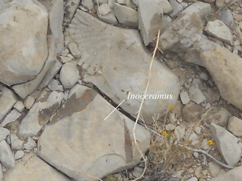
The Boquillas contains abundant marine fossils, especially of the giant clam Inoceramus. The following picture was taken after climbing up a short way into the Boquillas beds shown in the last photo. It shows a fragment of an Inoceramus shell and the shell of another clam species.
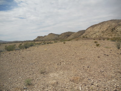
About a mile west of the junction with the road to Glenn Spring, you come across outcrops of the Pen Formation dipping in a northerly direction in this westward looking photo. On top of the Pen is a sort of "cap rock" protecting the easily eroded Pen yellow claystone. At first I thought this might again be the Aguja Formation as I had seen at the beginning of the River Road trip, but the USGS map shows it to be "Tib", Tertiary intrusive mafic rock, probably basaltic in composition. Intrusive rock is formed as magma forces its way up through the crust but solidifies underground before reaching the low pressures near the surface. The term "mafic" refers to rock that is high in iron, and often magnesium as well.
The only two radiometric ages of the Tib I know of are in the Slickrock Mountain area north of the Chisos (29 million years) and near Tortuga Mountain 15 or so miles northwest of this location (31 million years). There are no radiometric dates for the Tib here. In general the Tib is said to range from Eocene to Oligocene in age.
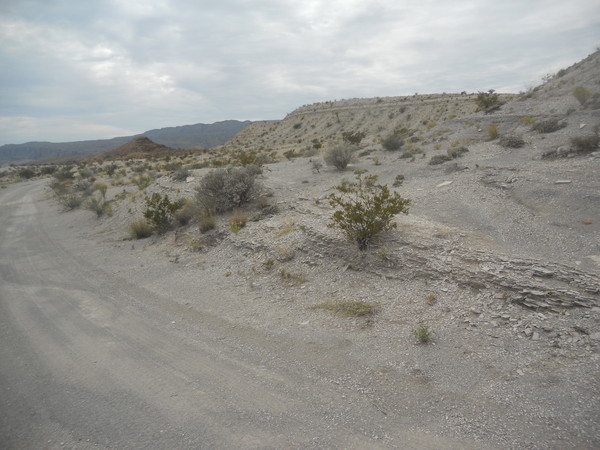
There is a major fault five or so miles down the road from where the Pen photos were taken, separating along much of its trace the Pen on the west from the Boquillas on the east. Since the Boquillas is much older than the Pen, the fault is down on the west side. Unfortunately the fault is hidden under alluvium where the road crosses it.
One complaint I have about the USGS map is the drainages, roads, and contours look alike except for width, which is often inconsistent anyway. I could have stopped and located the fault trace, except on the map it looked like the road crossed the fault where it was exposed. Actually, what I thought was the road was a drainage; the road was over-printed by a map symbol.
I finally did find the fault. Another complaint. Ahem. It is aggravating that you have to wait several seconds after taking a picture with the Nikon camera before you can turn it off. I've lost a number of photos that way over the years even though I've become much better. But not perfect. I took a photo at the location of the fault and apparently turned the camera off too soon. So it's not here.
The fault is in the distance in the following picture, looking south. It's just this side of the dark knob-ish looking hill in the distance. The light-colored beds in the photo are of the Boquillas Formation. The USGS map shows the knob to be of the Pen Formation, but it certainly looks more like it is composed of the "Tia", intrusive rock of andesitic composition. Andesite is intermediate in composition between basalt and rhyolite, where rhyolite is the volcanic equivalent of granite. Basalt is high in mafic minerals whereas rhyolite is very low. The high Chisos Mountains themselves are largely of rhyolitic composition.
The map identification of the knobby hill as Pen was confusing. The Tia outcrops in this area according to the USGS map, but much of what looks like Tia as seen from the road and on Google Earth is mapped as Pen. It could be that the dark rock is Tia debris on top of the Pen, but it doesn't seem right that the debris is high up on the knob. Once I got to view Google Earth, it does seem that there are light areas peeking out from the dark rock that could be the Pen, but still, Tia debris a half-dozen meters or so above where the Tia itself outcrops doesn't seem logical.
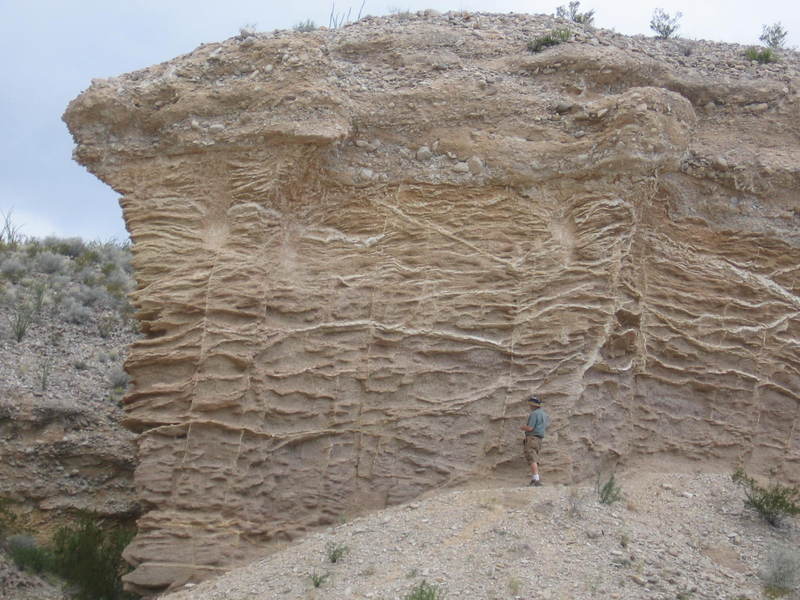
Just a short walk south down the road from the knob is an outcrop of well-consolidated Tertiary and Quaternary alluvium. (The Quaternary consists of about the last 2.6 million years and includes the so-called ice ages.) The photo below was taken some years back and shows the extensive calcite veins in the alluvium. Calcite is a common mineral and is the dominate mineral in limestone. As a form of calcium carbonate, you might crush it and swallow it with water to settle an upset tummy. Calcite veins form in "fossil" soils, the larger and more extensive the veins, the older the soil. The elaborate tapestry of these veins indicates a very old soil indeed.
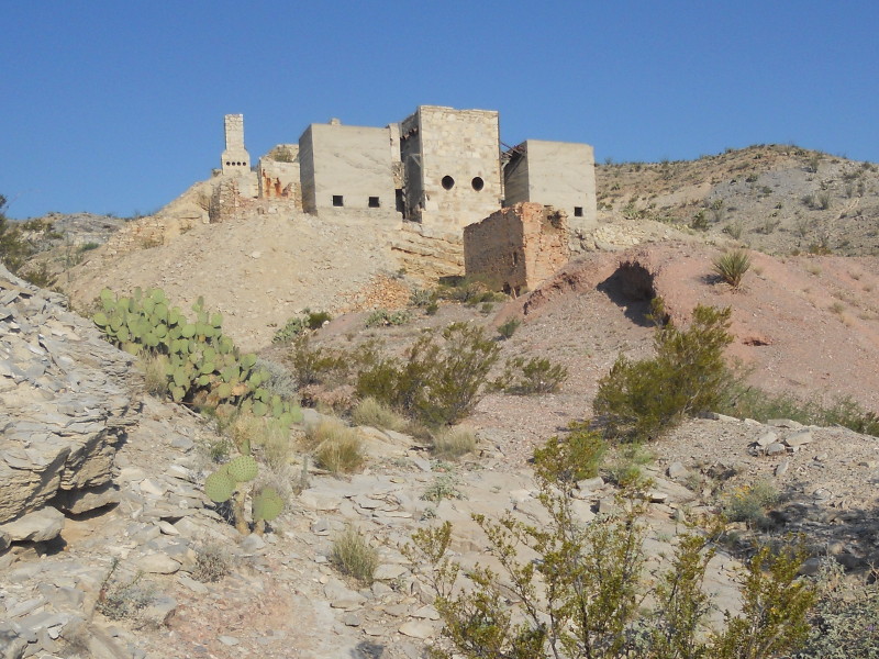
Before you reach the northern tip of Mariscal Mountain where the Mariscal Mine is located, you get a view of Talley Mountain to the north. The dipping beds on the southwest side of the mountain consist of the Aguja Formation overlain by the Tia. Beyond those rocks is a large landslide deposit on the south side of the mountain, tan in color in this photo. The dark Tia tops the mountain itself. The Mariscal Mine and its history are discussed in A Rather Miner Story
.
BACKWARD to Death Valley vs. Big Bend
FORWARD to River Road West
ALL THE WAY BACK to the Contents