"Rollin'... Rollin'... Rollin' on the River" Road West
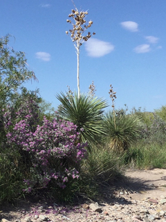
If you've read the feature on the River Road East, stand by for another tale of woe. Or perhaps, a tale of why I should just stay home from now on. After passing Mariscal Mine, I arrived and camped at Dominguez Spring campground overnight. Next morning the clouds had broken up to the extent that I got this great picture of the mountains stretching from Punta de la Sierra to Elephant Tusk with the high Chisos in the far distance. This was to be the last of the good news for that day.
My intention was to use my mountain bike to travel north on the old road that goes to Dominguez Spring and check out this strange pinnacle-shaped rock I have mentioned before. This was a last minute decision before taking off from Austin, so I wasn't entirely clear on how it would go as far as taking enough camping stuff on the bicycle to stay at the spring overnight. I tried a number of configurations but nothing would allow me to stay balanced well enough to make the trip. So it was to be a one day trip up and back like I had previously done on foot, except this time I'd be zooming along – at least between arroyos.
Not exactly. First problem: I was about to take off up the trail when I noticed my daytime running lights were still on. I had previously started off when I decided instead of cracking my windows (it was hot) I would close them and open the back window of the pickup instead. There have been break-ins in this area. You have to have the key in the ignition to close the windows, and the key was still in the ignition with the truck locked when I started for the trail.
Holy javelina hockey! I could see myself sitting in the sun on the River Road waiting fruitlessly for someone to come by. I hadn't seen one vehicle on the road after a couple had passed me shortly after getting on it. Most of my water and nearly all my food was in the truck. Plus the tent and sleeping bag. Wah! But it was my sotol walking stick to the rescue! I extracted it through the back window and then I could use it to push the window button on the passenger side. Whew!
One disaster averted, I was destined to face another. I can now see why some mountain bikes have these huge Abrams tank tires. Gravel can be almost like ice to a bicycle, but I thought the flat lying desert-pavement gravel would not be a problem. It was. I kept running into what one sports commentator described as "vegetables with knives", although mostly into one creosote bush after another. It was quite exhausting. I made it most of the way, but due to the heat and my age, I decided I had to take a rest under the largest creosote I could find and then head back. Both tires went flat. Score: Big Bend 1. Mountain Bike 0.
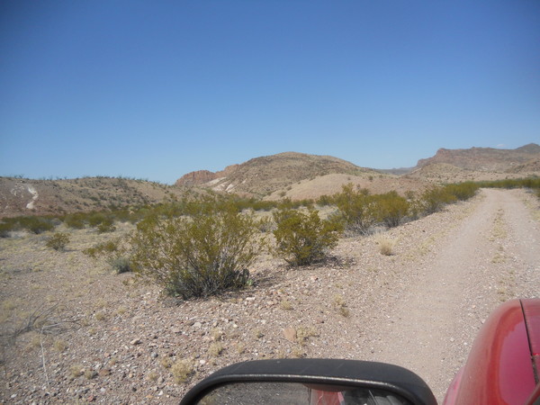
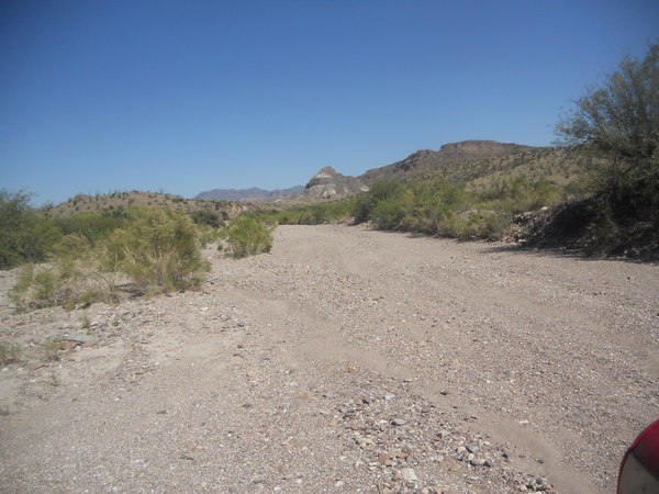
The next day I continued heading west on the River Road. Except for the stretches of deep mud I had encountered the last time I was here, the road was in worse shape due to recent rains. The road to the east of Dominguez Spring had enough washboards to equip hundreds of Zydeco bands. Fortunately, to the west it was mostly just the old familiar washed-out ruts.
(I might add a note here about an incident that occurred to me while traveling west on the eastern half of the road as a FYI. There is a juncture where it appears the road continues straight ahead, but this "road" just ends in a narrow arroyo with significantly high banks. Looks like enough people have been fooled that it is easy to follow the tracks, but then you find yourself either having to back out something like a quarter mile or painfully drive back and forth to turn around, imitating the minute hand of a clock. Another reason I like a small 4WD pickup in Big Bend.)
Back to geology. There are quite a number of outcrops of the Black Peak Formation (TKbp) visible from the River Road. This is an enigmatic formation to me because it was deposited from the late Cretaceous to the early Tertiary and includes the time when the Chicxulub asteroid impacted the Earth that is credited by most Earth scientists for killing off numerous species, including the dinosaurs. The formation contains fossils of both Cretaceous species (including dinosaurs) and Paleocene species (including mammals) according to a number of geological studies. But I know of no evidence for the asteroid impact in the formation. Mostly it just appears to be rather easily eroded black mudstone.
I checked out the outcrop in the picture above due to the interesting white "stripe". The black stuff was the usual mudstone, but the white material consisted of hard granules about the size of peas. I suspect this is just the white mudstone that is said to be found in the formation. Since the Chicxulub crater is in the Yucatan not that far from here, and since deposits interpreted to have been laid down by a tsunami resulting from the impact are found in the coastal plain of Texas, it is puzzling why no record of the impact seems to appear in the TKbp.
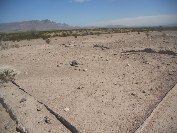
The ruins of a large ranch, the Johnson (Elmo and Ada) Ranch, can be found along the River Road. As you can see in the following picture, the ranch house was fairly large with walls, often thin, made of concrete – some of which appeared to be double. It was only a short stroll from the Rio. The ranch had a military airfield from 1929 to the early 1940s to patrol the border and prevent attacks from Mexican bandits. Bandits did attack the ranch on the fourth of April in 1929. The airfield is north of the ranch just on the other (north) side of the River Road. You can view it on Google satellite images. It appears there were two runways; one N45E and one N35W. Go to the feature posted on the national park website for more information.
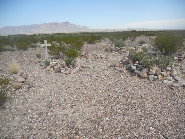
There is a cemetery just E of the turnoff to Johnson Ranch. Just one concrete cross with mostly worn off lettering. One or two other graves appeared to have had wooden markers, now deteriorated and mostly worn away.
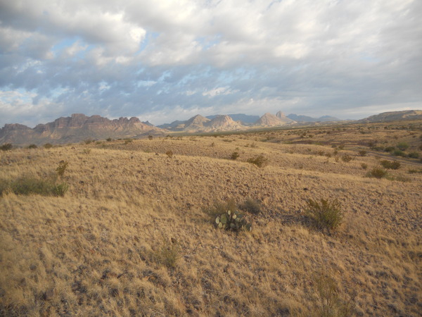
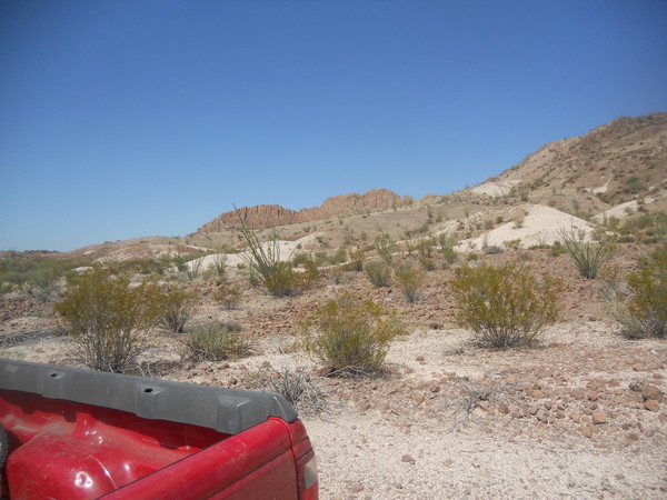
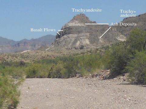
The next photo is looking north at the southeastern extent of the Sierra de Chino. I've tried to find the origin of the name of these hills but no luck so far. Anyone know? The picture was taken where the road goes up an arroyo. Gray outcrops on either side of the road are alluvial deposits of Miocene age. In some areas these deposits have served up vertebrate fossils. A basaltic lava flow (not in this area) near the base of the deposits has a radiometric age of about 24 million years. The mountains in the distance on the far right are composed of trachyandesite (Tt on the USGS map). Now that word is definitely a mouthful, but it means that the andesitic rock is high in alkali metals such as potassium. Sierra de Chino is also largely composed of these rocks. There are no radiometric dates of these rocks near here but in other parts of the park the ages range from about 33 to 45 million years.
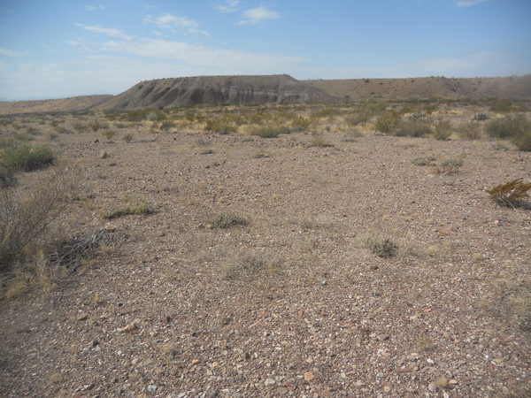
Closer now to the Sierra de Chino, having come out of the arroyo and traveling west. The "postpile" like rock in the distance is the trachyandesite (Tt) topping a ridge. The less erosion-resistant material in the foreground is mapped as the "younger" part of the Chisos Formation (Tcy on the map) of Oligocene and Eocene age. Radiometric ages for this unit range from 33 to 45 million years, with the nearest age sample found near Cerro Castellan (33 million years), several miles west of this location. The unit here is classified as "undivided", meaning it requires more detailed mapping to identify individual members. However, several distinct members of the Chisos Formation can be found in the Tcy. It contains a wide variety of volcanic and sedimentary rocks. For example, the light material in the photo is tuff, which is rock formed from volcanic ash, or possibly a tuffaceous clay.
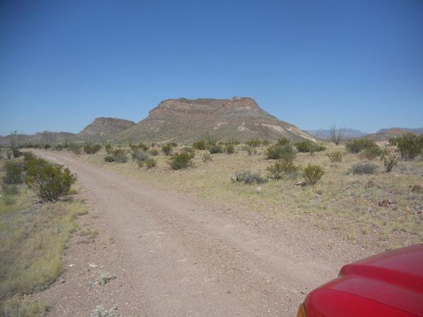
The next photo clearly shows the ridge of trachyandesite in the Sierra de Chino with the Tcy in the foreground, covered in places by trachyandesite debris. There is a dike in the area according to the USGS map, but it was hard to tell whether the dark line in the photo was rock or just a line of vegetation – or possibly vegetation was growing along the dike. There was a dark rock in line to the left that could be a remnant of the dike. I didn't have time to go see.
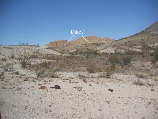
A dike is a sheet-like formation of rock that was once magma pressing upwards towards the surface but didn't make it and solidified underground. There are several dikes in this area trending away from the general direction of the extinct volcano, Dominguez Mountain, but they consist of a somewhat different type of rock and so it isn't clear there is any connection between these dikes and the volcano.
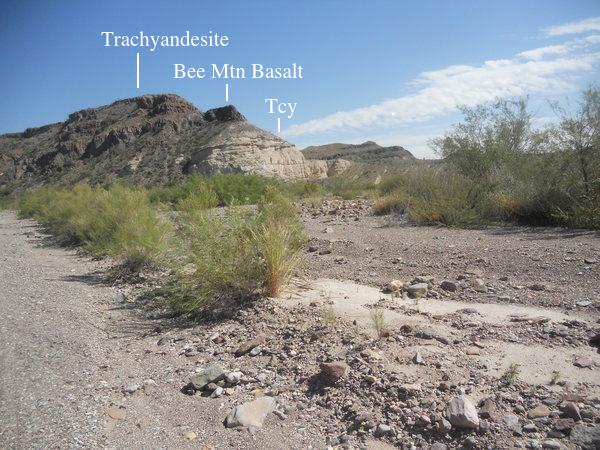
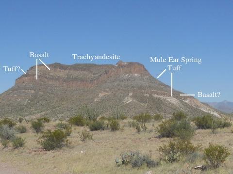
Getting closer to the west end of the road, I am now heading northeast up the Smokey Creek arroyo not far from where it drains into the Rio. The hill on the right of the arroyo exposes trachyandesite (Tt) on top of the Bee Mountain Basalt (Tcbm) on top of the Tcy. Most have heard of basalt, rather runny as a lava and iron rich, making it typically a very dark rock. Since the Tcy here is designated "undifferentiated", it could be the light rock below the basalt is the Mule Ear Spring Tuff (Tcme).
Continuing up Smokey Creek and about to turn left and head northwest. In the distance is another outcrop. I have taken a bit of license with the USGS map here due to the mapping of the undifferentiated Tcy in identifying two Bee Mountain Basalt flows and tuff beds which could be the Tcme (second picture below – a digital "telephoto" of the first picture). Note much of the lower material is covered with debris from the rocks above. The mountains are topped with trachyandesite.
"Nobody knows the troubles I've seen..." mainly because there was no one within miles of where I was. My camera, which had been acting up much of the trip, finally quit taking pictures after I accidentally dropped it. So now I had to take pictures with my wife's old iPad. As hard as it was to take pictures outdoors with the Nikon, it was ten times worse with the iPad. I was in luck, however, in the sense that I was nearing the end of the trip.
Below is the last picture taken with the Nikon, a photo of Triangulation Mountain, looking northeast. Again I have taken a bit of license with the USGS map. The map does indicate the Mule Ear Spring Tuff is here, however. The Bee Mountain Basalt consists of a number of lava flows above and below the Mule Ear Spring Tuff, so I took the liberty of identifying the outcrops in the digital "telephoto" created from this picture. Again much of the lower, less resistant, material is covered with debris from the rocks above. The Bee Mountain Basalt radiometric ages range from 33 to 34 million years. The Mule Ear Spring Tuff age is quite similar as you would expect.
One final photo, the first one taken with the iPad, shows the territory to the east and north of Triangulation Mountain, again looking northeast. Since the rocks are topographically lower to the west of the mountain, you might think there could be a fault here, but the stratigraphic level is the same. It's just that the beds are dipping more or less away from the camera. Note thick white bed which may be the Mule Ear Spring Tuff.
BACKWARD to River Road East
FORWARD to The Hoodoos
ALL THE WAY BACK to the Contents