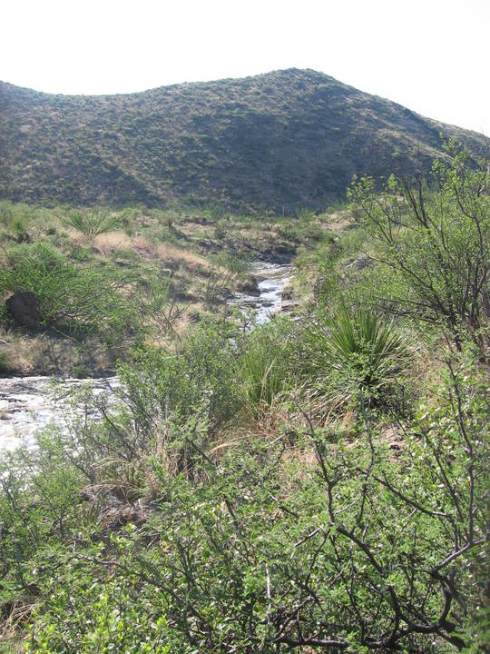
Fresno Creek in the early morning with cool water running between its banks is a sight for sore eyes (not to mention sore feet). August is monsoon season in West Texas, but the monsoon was on "pause" for the time we were in the desert. Nevertheless, enough rain had fallen for water to still be present in this desert stream, which was our halfway point between where we began on the Dodson (Twisted Shoe Camp) and where we were to end up (Blue Creek).
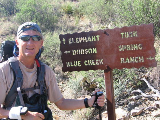
We weren't too far along the trail before we came to the conjunction with the trail to Elephant Tusk. I realize there is no geology to be discussed in this picture, but my brother, Randy, complains I don't have enough pictures of him in these field trips ;-).
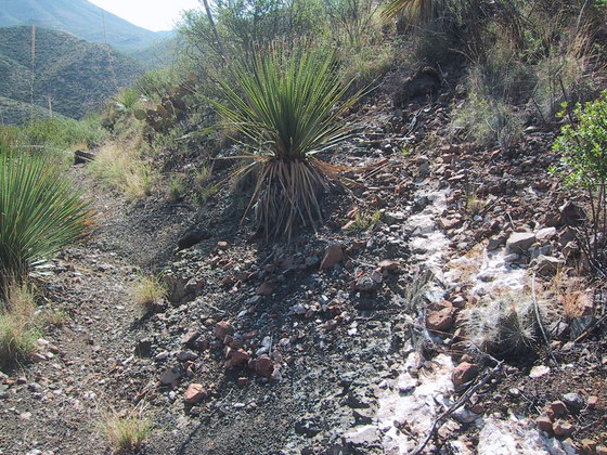
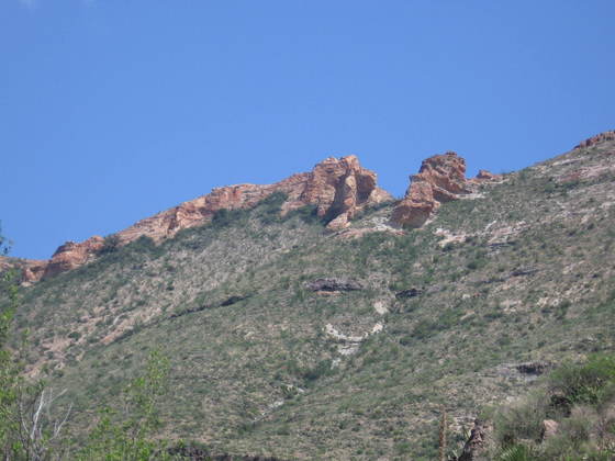
As was the case on the route from the Twisted Shoe campsite to Fresno Creek, the Chisos Formation (47 to 30 million-year-old volcanic and sedimentary rocks) is almost completely covered with soil and colluvial debris. Here you see a small outcrop of volcanic ash, rather typical of the bits and pieces of the Chisos you come across in the widespread colluvium.
Here is an update. After consulting Google Earth in conjunction with the recently published USGS map (Scientific Investigations Map 3142, 2011), I believe I have narrowed down what is in the following photo. We are entering the area of the Burned Mountains (Sierra Quemada), and the pinkish rocks are apparently part of the Sierra Quemada ring dike. The circular pattern of the rocks in the Sierra Quemada are thought to reflect the effect of a subsurface igneous intrusion. The circular pattern of these rocks, designated Tqd, is clearly seen on the USGS map. I only see one location on the map where this rock was dated, 29.9 million years old, on the opposite side of the "circle" from where this photo was taken. These rocks are of rhyolitic composition, rhyolite being the volcanic equivalent of granite. The slope – or at least the rock beneath the soil and colluvium – consists of the "crazy mixed up" sandstone, tuff, and rhyolite of the older Eocene beds of the Chisos Formation (labeled Tcstr on the map).
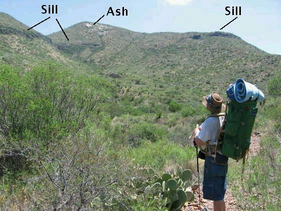
Close to where the above photo was taken, the sill we observed the first day on the trail from afar is now close by. A sill is an igneous intrusion that forms a sheet-like structure, typically between two parallel rock beds. The magma seeps between the beds and pushes them apart. The USGS map says the sill is composed of mafic rock, which is iron- and/or magnesium-rich rock such as basalt. Mafic magma is usually not as viscous as magma lower in iron and higher in silica - that is, it is relatively "runny" - and so it makes a good candidate for sill formation. According to the map the material below the sill is the Tcstr mentioned above, and that above the sill is the undivided (essentially meaning "not well studied") younger rock of the Chisos Formation (labeled "Tcy" on the map) of Eocene and Oligocene age. These rocks include volcanic and sedimentary varieties. Due to the ages of the rocks above and below the sill, you might suppose it is not really a sill but a lava flow that was covered by the Tcy rock. However, the mafic intrusions in the park are younger than the Tcy, so it is indeed a sill.
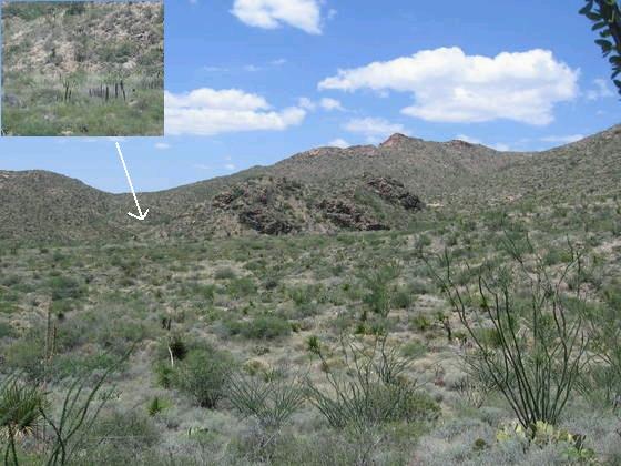
Now we are well into the Sierra Quemada ("Burned Mountains"), and up ahead in the next image is what appears to be the top of a small igneous intrusion, with an old corral at its southern base, as indicated by the inset and arrow. However, the rock here is labeled as Tcstr, so I don't know what to make of this. Of course, at the time I did not have the USGS map, otherwise I might have checked out this "intrusion" more closely. The circular rock pattern to the south of the trail is due to the Sierra Quemada igneous dome. These rocks include intrusive rocks of rhyolite, gabbro (the intrusive form of basalt), and syenite (like granite but with abundant alkali metals and little or no quartz), and volcanic breccia. Taking error bars into account, the intrusive rock dates radiometrically to between 28 and 31.5 million years. As previously mentioned, the ring dike (one date) is about 30 million years old. The current view is that the magma that formed the Sierra Quemada rocks domed up the rocks above it and was accompanied by some volcanic venting. This intrusion of magma is thought to have occurred slightly later than the volcanism that created the rocks of the South Rim Formation that cap the high Chisos mountains.
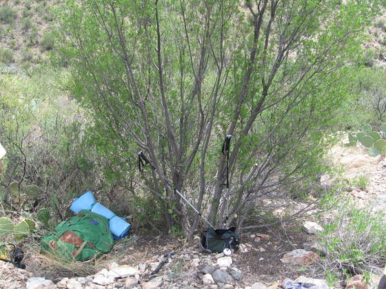
Some say there is little or no shade on the Dodson Trail. Ha! Just take a gander at this lovely resting spot.
The highest point on the Dodson Trail is a small pass in the Sierra Quemada, overlooking the Chihuhua desert to the west. From here, at about 5000 feet in elevation, you can see Goat, Kit, and Carousel Mountains in the following picture. The ranch of pioneer rancher, Homer Simpson, ..uh make that Homer Wilson, is just on the other side of Carousel Mountain along Blue Creek. All three mountains contain rocks of the Chisos Formation. However, Goat and Kit mountains are topped with the Burro Mesa Formation lying above the Chisos. The Burro Mesa Formation is volcanic and was erupted from what is now Burro Mesa to the north (off the right side of this image) around 29-30 million years in the past. The notch in the distant mesa (Mesa de Anguila), barely visible behind Goat Mountain, is Santa Elena Canyon.
Believe it or not, Randy, on a whim, decided to try his cell phone at this remote location and actually got a signal, making a call to his wife in Austin. We guess the connection was probably made through Terlingua, a re-inhabited ghost town to the west and site of the famous Terlingua Chili Cookoff. (If you haven't heard of it, you are, no offense, obviously not from Texas.)
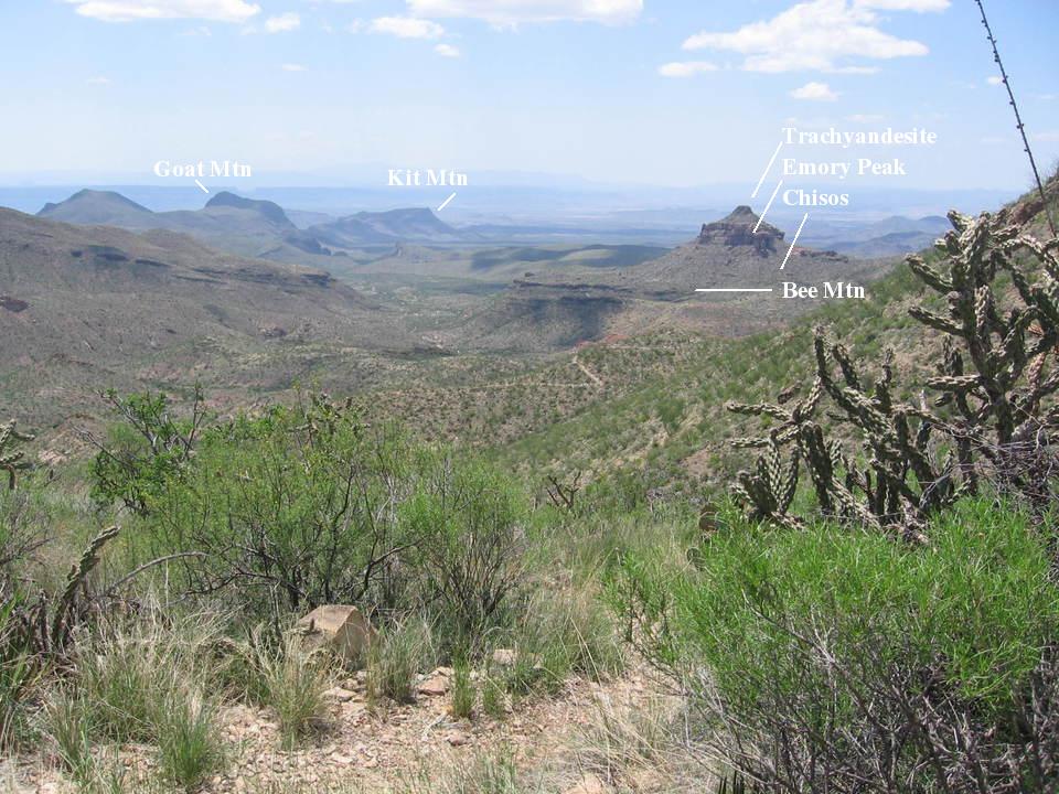
To the right in the above photo you see the well-named Carousel Mountain. The new USGS map has clarified what the rocks constituting this mountain are as some old references were apparently in error. For example, the carousel-like collar is not a conglomerate, but the 32-million-year-old Emory Peak rhyolite member of the South Rim Formation. The top-most rock had been identified as Tule Mountain Trachyandesite belonging to the Chisos Formation, but now it is considered to be younger (30 million years) trachyandesite of the Burro Mesa Formation after Daniel P. Miggins et. al. in USGS Circular 1327. Andesite is a type of volcanic rock with an intermediate content of silica and iron and gets its name from the volcanoes in the Andes Mountains. Trachyandesite is an andesite with a relatively high content of alkali metals. Stratigraphically below the Emory Peak member are the undivided rocks (Tcy) of the Chisos Formation and the 34-million-year-old Bee Mountain Basalt (dark-colored beds).
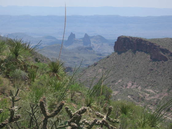
Also clearly visible from this pass are the Mule Ears, a telephoto of which appears next, peering over sotol, ocotillo, and a cholla cactus. These are eroded dikes, which are the solidified remains of sheets of magma that cut through rock beds rather than force themselves between beds like the magma that forms sills does. Magma that cuts through the pre-existing geologic structure produces igneous intrusions that are termed "discordant", whereas sills and other intrusions that follow the pre-existing structure are considered "concordant". When a discordant sheet of magma reaches the Earth's surface, it can create spectacular fissure eruptions. The rock forming the ears of Mule Ear Peaks is identified by the USGS map as the Wasp Spring member of the Burro Mesa Formation, a rock that appears to record a violent volcanic eruption on this side of the park.
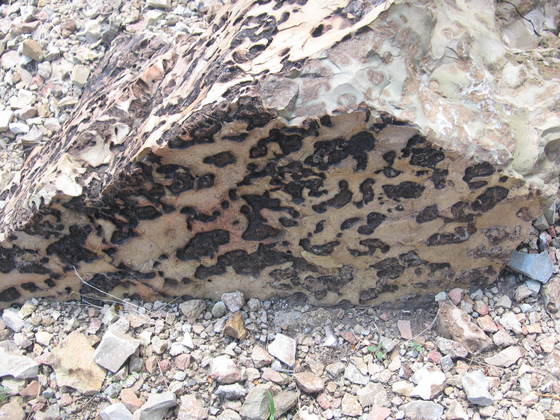
As we descended toward Blue Creek, we came across a strange but beautiful type of rock I informally called "Leopard Rock" (in honor of the mascot of my kids' high school). A photo of it appears below. It appears as if dark colored minerals, probably of iron oxide and/or iron hydroxide, collected in the spaces, called vesicles, in the volcanic rock. Vesicles are formed when gases in the magma come out of solution and form bubbles as the magma rises toward the surface and the pressure of the overlying rock on the magma decreases. This is very much like what happens when you open a carbonated beverage. When the magma cools and hardens into rock, the gases gradually escape and the former bubbles are left as voids. (It appears the volcano that produced this rock had a bad case of gas.)
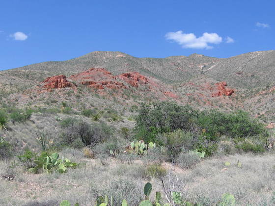
Final picture. On our way down to Blue Creek and Homer Wilson Ranch, we came across some nicely colored red rocks, with color enhancement thanks to the lowering evening sun. These may belong to the same unit as the rocks we saw the next day on the trail up Blue Creek Canyon. (The following year I studied those rocks. See Blue Creek Canyon.)
To complete our trip, we hiked up Blue Creek Canyon into the Chisos Mountains, then down Juniper Canyon back to Twisted Shoe, finishing the Mountain Loop. It was both fun and exhausting. At our age, we will probably never do anything like this again. If we need to prove our manhood, we will try something more comfortable (beer?). The Dodson in summer: No Country for Old Men.
BACKWARD to Dodson Trail I
FORWARD to Ernst Tinaja
ALL THE WAY BACK to the Contents